On September 8, the Philippine Atmospheric, Geophysical and Astronomical Services Administration said it was monitoring two new low pressure areas outside the country's forecast area (PAR), which could develop into storms.
PAGASA's storm bulletin on the afternoon of September 8 showed that at 3:00 p.m. on the same day, the center of the first low pressure was at about 24.7 degrees north latitude, 134.2 degrees east longitude, about 1,340 km east-northeast of the northernmost tip of Luzon. The second low pressure was detected east of Mindanao.
"We do not rule out the possibility of these depressions becoming storms in the coming days. However, in the next 24 hours, the possibility of the depression strengthening into a storm is low. Based on our latest analysis, the depression does not have any direct impact on the Philippines," said PAGASA's Grace Castaneda.
However, Ms. Castaneda noted that the low pressure in the northeast of Northernmost Luzon is expected to strengthen the southwest monsoon as it approaches the border or enters the Philippine forecast area.
Meanwhile, the southwest monsoon will bring rain to the west of Northern and Central Luzon.
The second low pressure in eastern Mindanao could also intensify the southwest monsoon as it approaches the PAR forecast area, possibly causing rain in western Visayas and Mindanao in the second half of next week.
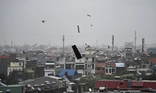
On the other hand, the southwest monsoon continues to affect most parts of Luzon, while the rest of the country is cloudy with localized thunderstorms.
Despite the above conditions, PAGASA is not currently issuing a strong gusts of wind warning for any coastal areas of the country.
Currently, the Philippines is still overcoming the consequences of Typhoon enteng (international name: Typhoon Yagi, Vietnam calls it Typhoon No. 3). Typhoon Yagi made landfall in the Philippines on the evening of September 1, causing flooding and landslides in many areas before leaving the country on September 3. Yagi became a super typhoon after leaving the Philippines.
According to a report by the National Disaster Risk Reduction and Management Council of the Philippines, as of September 7, at least 16 people have died, 15 injured, and 21 others are missing due to Typhoon Yagi in the country. Infrastructure damage is estimated at $4 million.
After Yagi left the Philippines, a super typhoon affected Hong Kong (China). Next, the strongest storm to hit Asia this year made landfall on the coast of Hainan and Guangdong provinces in China on the afternoon of September 6 with peak winds of 233 km/h. Super typhoon Yagi has killed at least 4 people, injured 95 people in Hainan, and caused infrastructure damage of more than 102 million USD.
After that, storm No. 3 continued to make landfall in the northern provinces of Vietnam on September 7, causing heavy damage. As of 10am on September 8, 14 people have died and 176 people were injured due to Typhoon Yagi. In Quang Ninh, 4 people died, Hanoi 3 people, Hai Phong 1 person, Hai Duong 1 person, Hoa Binh 4 people, Military Region 3 1 person.
176 people were injured, including 157 in Quang Ninh; 8 in Hanoi; 5 in Hai Phong; 5 in Hai Duong and 1 in Hoa Binh.