Tin bão mới nhất của Cục Quản lý Thiên văn, Địa vật lý và Khí quyển Philippines cho hay, vào hồi 4h ngày 29.9, vị trí tâm bão ở vào khoảng 18,6 độ vĩ bắc, 124,5 độ kinh đông, cách Aparri, Cagayan (Philippines) 305 km về phía đông.
Sức gió mạnh nhất gần tâm bão 95 km/h, giật lên đến 115 km/h, áp suất trung tâm 990 hPa. Bão di chuyển theo hướng tây bắc với tốc độ 10 km/h. Phạm vi gió mạnh lan ra xa tới 450 km từ tâm bão.
PAGASA cảnh báo gió mạnh cấp 8-9 (62-88 km/h) ở Luzon, phần đông bắc của đất liền Cagayan (Santa Ana) và phần phía đông của quần đảo Babuyan trong 24 giờ tới, gây ra mối đe dọa nhỏ đến trung bình đối với tính mạng và tài sản.
Luồng gió hướng về phía hoàn lưu của bão nhiệt đới dữ dội Julian cũng có thể mang theo gió giật mạnh đến cấp bão trên các khu vực ven biển và vùng cao tiếp xúc với gió.
Trong 24 giờ tới, biển động mạnh với sóng cao lên đến 8m trên bờ biển Batanes; 6m trên bờ biển Quần đảo Babuyan; 4m trên bờ biển phía bắc của đất liền Cagayan và bờ biển phía bắc của Ilocos Norte; 3,5 m trên và phần còn lại của bờ biển Cagayan và bờ biển Isabela; 3m trên bờ biển của phần phía bắc Aurora.
Về đường đi và cường độ của bão, Julian dự kiến sẽ di chuyển chủ yếu theo hướng tây bắc đến tây tây bắc từ hôm nay đến sáng thứ Ba (ngày 1.10) hướng đến khu vực quần đảo Batanes-Babuyan, trước khi tăng tốc về phía bắc đến đông đông bắc qua vùng biển phía đông Đài Loan (Trung Quốc).
Theo dự báo đường đi của bão, khả năng bão đổ bộ hoặc tiếp cận gần vào ngày mai (ngày 30.9) trên quần đảo Batanes và/hoặc Babuyan là rất cao.
Julian sẽ tiếp tục tăng cường trong suốt thời gian dự báo và đạt cấp bão cuồng phong vào tối nay hoặc sáng sớm ngày mai. Có khả năng cao bão sẽ tăng cấp nhanh chóng và không loại trừ khả năng đạt cấp siêu bão. Bão sẽ ở gần quần đảo Batanes và/hoặc Babuyan nhất ở hoặc gần cường độ cực đại.
Julian là cơn bão nhiệt đới thứ 10 của Philippines trong năm 2024 và cũng là cơn bão nhiệt đới thứ 6 chỉ tính riêng trong tháng 9.
PAGASA cũng tiếp tục theo dõi bão nhiệt đới Jebi, hiện nằm ngoài khu vực dự báo của Philippines (PAR). Vào hồi 3h ngày 29.9, vị trí tâm bão Jebi ở vào khoảng 21,9 độ vĩ bắc, 114,9 độ kinh đông, cách Cực Bắc Luzon 2.075 km về phía đông.
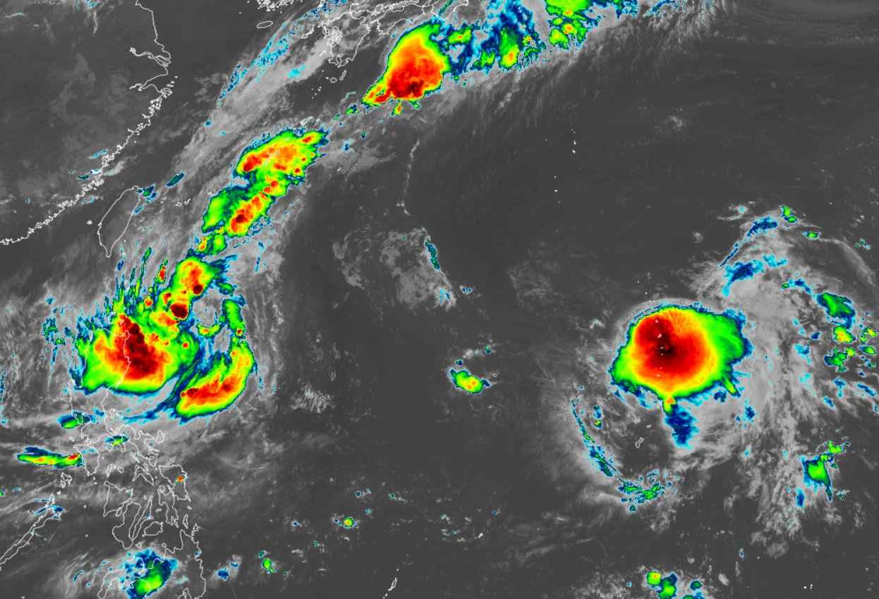
Sức gió mạnh nhất gần tâm bão đạt 65 km/h, giật 80 km/h. Bão di chuyển theo hướng tây bắc, mỗi giờ đi được 25km.
PAGASA trước đó cho biết, Jebi dự kiến sẽ không đi vào PAR. Bão có khả năng mạnh lên thành bão cuồng phong và đe dọa Đài Loan (Trung Quốc) vào tuần tới.
Jebi là cơn bão nhiệt đới thứ 17 của mùa bão 2024 ở Tây Thái Bình Dương và là cơn bão thứ 7 trong tháng 9 - tháng có số lượng bão cao nhất.


