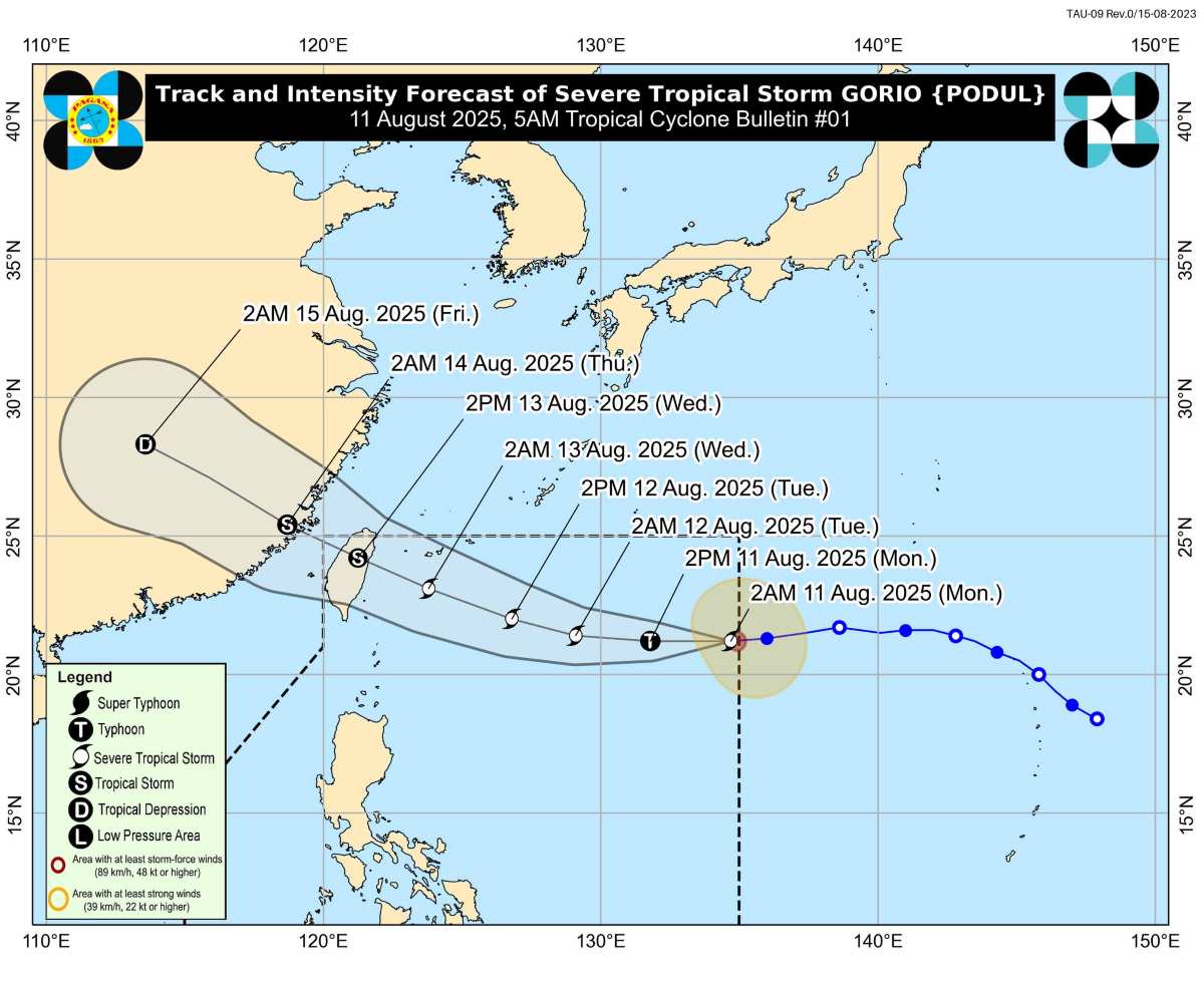
Typhoon Gorio is the seventh typhoon in the Philippines this year and the second in August.
The latest storm information from the Philippine Atmospheric, Geophysical and Astronomical Services Administration (PAGASA) said that at 4:00 a.m. on August 11, the center of typhoon Gorio was located about 1,305 km east of Luzon Island, at 21.1 degrees North latitude, 134.4 degrees East longitude.
The storm has sustained winds of 110 km/h, gusts of up to 135 km/h, central pressure of 985 hPa. The range of strong storm-level winds extends up to 280 km from the center.
The storm is moving west at a speed of 25 km/h and has not directly affected the Philippine mainland in the next 3 days. However, PAGASA warned that if the epidemic trajectory southwards, the northernmost provinces of Luzon may issue storm No. 1 warnings.
The sea area around the northernmost tip of Luzon is expected to have waves 1-1.1m high, posing a potential danger to small ships, especially wooden boats and ships that are not equipped enough to be safe. The authorities recommend that fishermen and boat owners limit or temporarily stop going to sea under this condition.
It is forecasted that in the next 24 hours, Typhoon Gorio will continue to move west, then turn west-northwest from the afternoon of August 12.
The typhoon is expected to make landfall on the northeastern coast of Taiwan (China) on August 13, then leave PAR in the evening of the same day or early morning of August 14.
The storm is likely to strengthen into a typhoon within the next 12 hours before gradually weakening as it approaches land.
Natural disaster prevention agencies and people in high-risk areas are called to closely monitor storm forecasts, prepare response plans, protect property and life. Areas that are frequently affected by flash floods, landslides or strong winds should be ready to evacuate when ordered.

According to the Vietnam National Center for Hydro-Meteorological Forecasting, the southern East Sea (including Truong Sa archipelago), the sea area from Lam Dong to An Giang and the Gulf of Thailand are currently experiencing scattered showers and thunderstorms.
Weather forecast for the day and night of August 11: Areas that may have scattered showers and thunderstorms include the northern East Sea (including Hoang Sa archipelago), the southern East Sea (including Truong Sa archipelago), the northern part of the Gulf of Tonkin, the sea area from Lam Dong to Ca Mau, Ca Mau to An Giang, the Gulf of Thailand.
During thunderstorms, there is a possibility of tornadoes, strong gusts of wind, and waves 2-3m high.
Ship operating in the above areas are at risk of being affected by tornadoes, strong gusts of wind and high waves.


