According to the latest storm information from the Philippine Atmospheric, Geophysical and Astronomical Services Administration (PAGASA), the severe tropical storm Podul is expected to enter the Philippine Forecast Area (PAR) on the night of August 10 or the morning of August 11.
At 2:00 a.m. on August 10, the center of Typhoon Podul was at about 21.5 degrees north latitude, 137.4 degrees east longitude, 1,615 km east of the northernmost tip of Luzon. Maximum winds near the center of the storm are 110 km/h, gusting to 135 km/h. The storm is moving westward at 20 km/h. When entering PAR, the storm will be locally named Gorio.
PAGASA forecasts that Typhoon Podul will move mainly westward today and tomorrow (11.), then move northwestward from August 12. Typhoon Podul may enter PAR between tonight and early tomorrow morning.
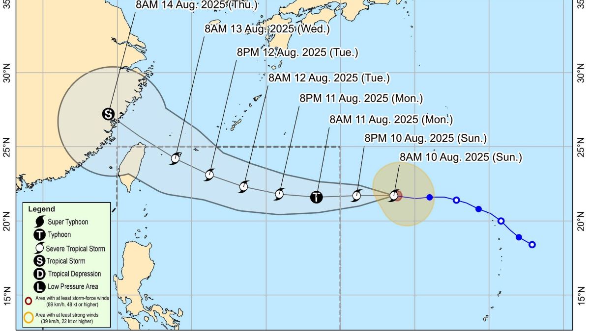
Currently, Podul's storm wind range extends out to 280km from the center of the storm.
Overall, PAGASA said Typhoon Podul is unlikely to directly affect the weather and sea conditions of the Philippines in the next 5 days.
Typhoon Podul is forecast to pass near or south of the Ryukyu Islands (Japan) on the morning of August 13. Furthermore, the scenario of making landfall in Taiwan (China) in the afternoon or evening of August 13 is also not ruled out - PAGASA warned.
PAGASA said, "Given these developments, people and agencies managing and mitigating related natural disasters are advised to continue monitoring updated weather forecasts related to this tropical storm."
Regarding the forecast for typhoons/low pressure for the week of August 15-21, 2025, PAGASA said that while Typhoon Podul continues to move westward towards southern China, a new low pressure is expected to appear outside the PAR, in the East Sea.
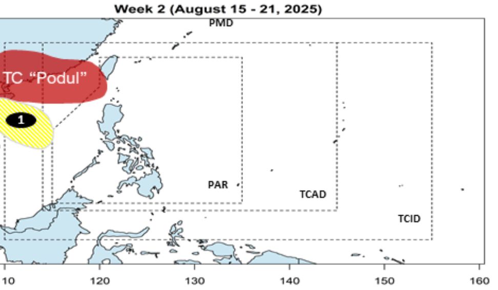
This low pressure in the East Sea is unlikely to strengthen into a storm.