According to the latest weather news, a high-pressure cold air mass from the Arctic is colliding with the humid current from the Gulf Coast, creating a widespread winter storm.
On January 21, the US Weather Forecast Center warned that thick snow, ice and ice will stretch from the Southern Rockies to the East Coast of the United States from January 23 - 25.
The storm is expected to begin to strengthen in the delta on January 23. The area affected stretches more than 1,600km from Oklahoma, North Texas to North Carolina and Virginia.
Currently, the US National Weather Service has ordered storm monitoring in most of Oklahoma, North Texas, Arkansas and northwestern Louisiana.
The biggest concern of experts is the ice rain phenomenon. A layer of ice from 0.6 to 1.2cm thick is strong enough to knock down trees and pull down power lines. The area from North Texas, the Mississippi Valley to North Georgia and Carolinas is facing the most serious risk of freezing.
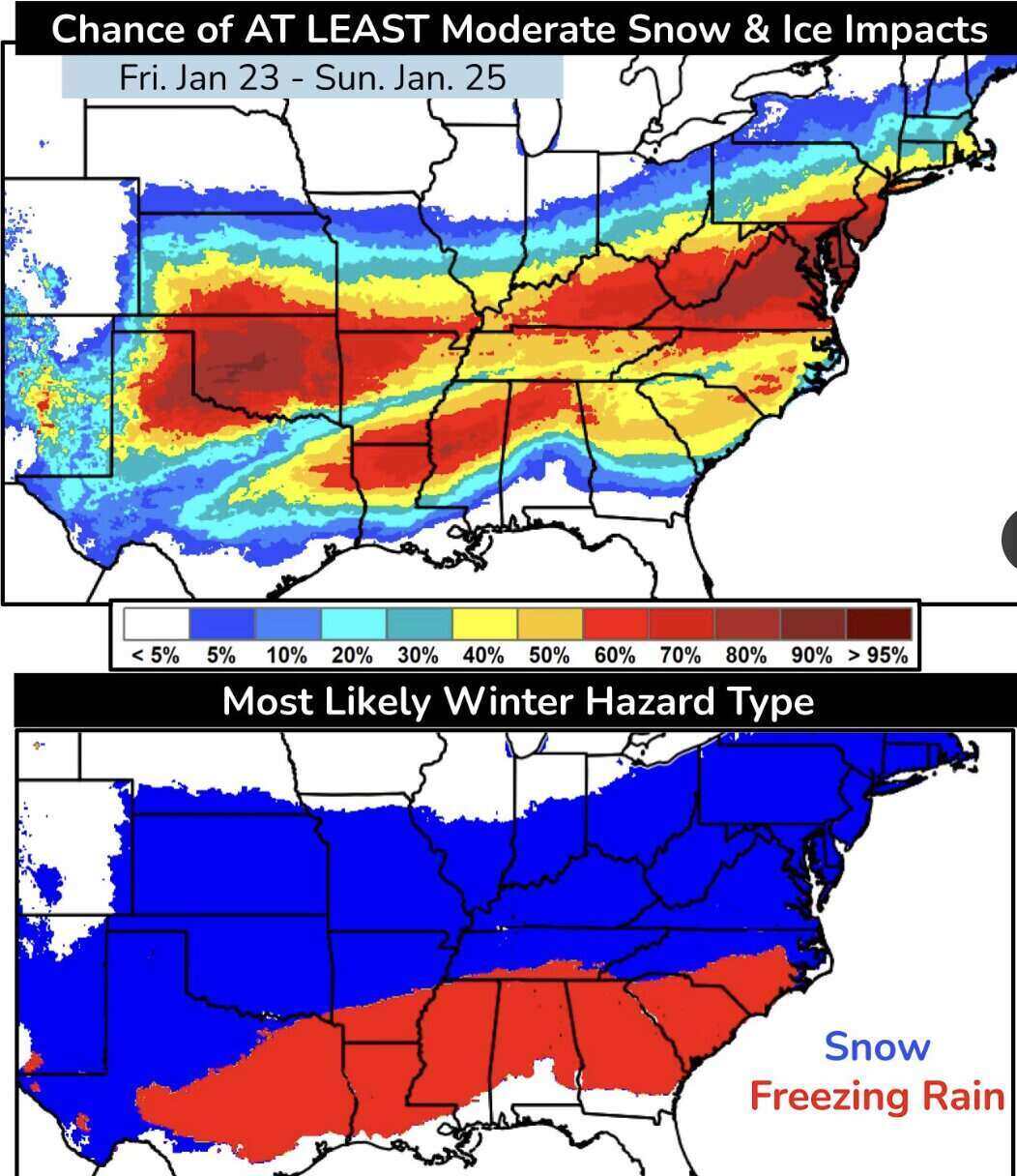
Even a small amount of ice can completely paralyze traffic in major cities. The north of the icy region will suffer heavy snowfall, covering from Oklahoma, Kansas to the Central Atlantic region. Depending on the speed of the storm's movement, snow may last until January 26 in the East Coast.
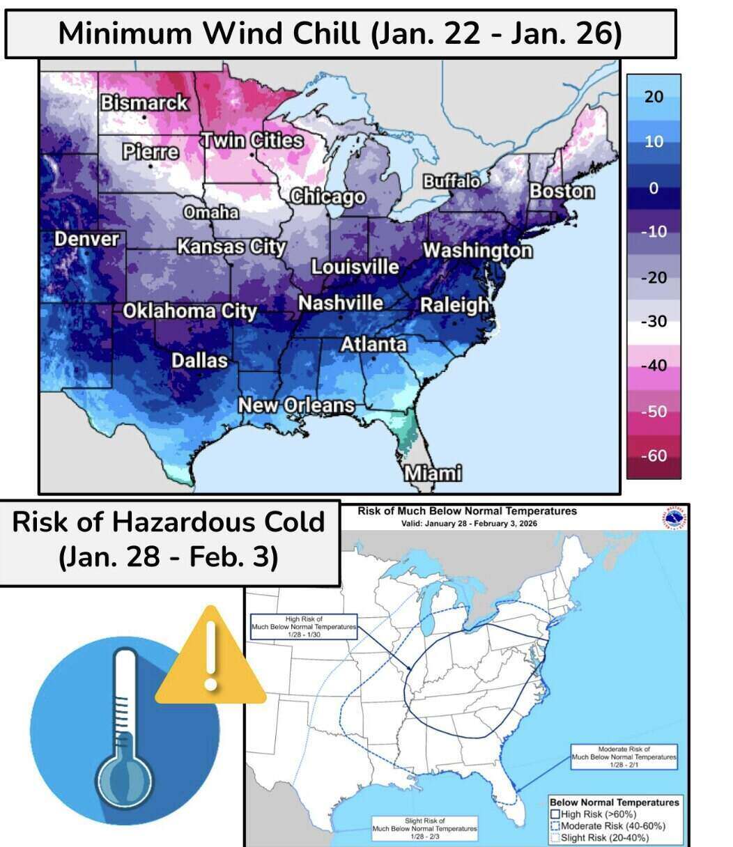
Parallel to the storm is the Arctic cold air wave. Temperatures in the Midwest and Delta regions are expected to be lower than the average level by about 16 degrees Celsius.
In areas such as Twin Cities (Minnesota) or Chicago, the actual temperature may remain at a deep level for many consecutive days. Alarmingly, the cold wind index in the upper-middle-west region is expected to fall to levels from -34 to -45 degrees C.
Health authorities warn that in these extreme weather conditions, frostbite on bare skin can occur within just 10 minutes of contact.
This cold air mass will continue to spill into the south and spread to the northeast region on January 24, causing temperatures in Boston and New York to drop to record lows.


