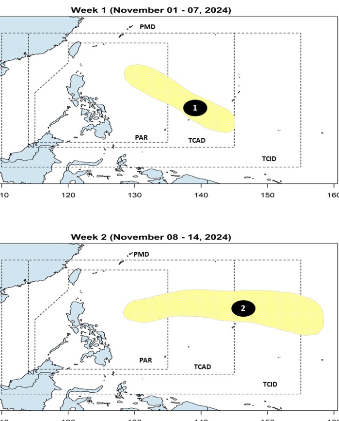
PAGASA's storm and depression forecast released on November 1 said that it is expected that during the week from November 1 to 7, there will be no tropical depressions within the Philippines' PAR forecast area.
However, forecast models note that a low pressure area is likely to form east of the boundary between PAR and PAGASA's TCID forecast area. This newly formed low pressure area has little chance of strengthening into a tropical storm.
According to the forecast, the week of November 8-14 will record another tropical depression east of PAGASA’s PMD forecast area. Similarly, this depression is unlikely to strengthen into a storm.
Thus, PAGASA believes that in the next 2 weeks, there is little possibility of a strong storm forming near the Philippines.

The two most recent storms in the 2024 storm season that occurred in the Philippines were Typhoon Kristine (international name Tra Mi) and Typhoon Leon (international name Kong-rey).
The next storm of the season expected to hit the Philippine forecast area will be named Marce.
The latest typhoon Kong-rey to pass through the northern Philippines earlier this week has prompted fresh evacuations just days after Typhoon Tra Mi claimed at least 145 lives last week.
Typhoon Kong-rey has weakened after making landfall in Taiwan on the afternoon of October 31, killing two people and injuring more than 500. After hitting the island, Typhoon Kong-rey will bring heavy rain and strong winds to Shanghai and other areas on China's east coast on November 1.
From July to December, between two and eight tropical storms are forecast to enter the Philippine PAR forecast area. After Typhoon Tra Mi and Typhoon Kong-rey in October, PAGASA forecasters expect up to six more storms to form near the Philippines before the end of the season.
Typhoons in the last quarter of the year are typically stronger and more likely to hit the Philippines.


