Shocking forecast of future storm developments

Thanh Hà |

The number of storms is forecast to double, becoming stronger in intensity and frequency over the next decade in the Atlantic.

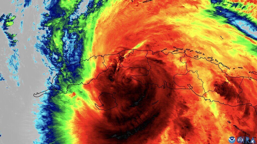
Storms are likely to appear more frequently and more intense in both the Atlantic and eastern Pacific over the next decade, increasing the danger to coastal communities across North and Central America, according to a new study.

A research team at the University of Reading used the British Meteorological Agency's storm forecasting software ( Met Office) to predict a typhoon pattern for up to 10 years.

The forecast model shows that in the next decade, the number of tropical cyclones in the Atlantic could double compared to the levels of the 1970s, while storms in the eastern Pacific could increase by more than a third.

The total energy of these storms - including frequency, intensity and duration - is also forecast to increase significantly. In the north Atlantic, hurricane energy could double the levels of the 1970s.

The study, published in the journal NPJ Climate and Atmospheric Science, used Met Office's DePreSys4 climate prediction software and a dedicated tracking algorithm to predict future typhoon patterns.

This study marks a major step forward in storm prediction by tracking each storm in the model's simulation, rather than relying on indirect metrics such as sea level pressure or sea surface temperature models.

This is the first time direct storm monitoring has been used to predict hurricane patterns over the next decade. This technique has been used to predict short-term storms for a few days or months.

The forecast of a sharp increase in the number of storms is related to two important environmental factors: Sea surface temperature and changes in winds in the atmosphere. The forecast system sees Atlantic temperatures likely to increase in the coming years, providing more energy for the storm to form and strengthen.

Along with that, changes in wind patterns - especially how winds change at different altitudes in the atmosphere - are predicted to create more favorable weather conditions for storms to develop. These changes are the result of a combination of natural climate change and long-term climate trends.

Thanh Hà
RELATED NEWS

Storm and low pressure forecast near the East Sea in the second half of February

|

According to the latest storm news, there are currently no storms in the East Sea, but strong northeast winds cause natural disaster risks.

New storm after super typhoon Zelia was renamed

|

The new storm after super typhoon Zelia will be renamed to avoid confusion with the current Australian Prime Minister.

The strongest super typhoon on the planet made landfall, winds reached 290 km/h

|

Super Typhoon Zelia, the strongest storm currently active on Earth, made landfall in northwestern Australia on February 14.

A ward in Hanoi resolves land procedures overdue for 134 days, must apologize to citizens

|

Hanoi - Long Bien Ward is assessed as still having shortcomings and limitations when resolving administrative procedures on land, including dossiers that are overdue for 134 days.

Prenn Pass road closed in Da Lat for 6 days to repair landslide site

|

Lam Dong - Functional agencies decided to close Prenn Pass road for 6 days to repair and fix damaged points caused by previous landslides.

Forecast of the time to end widespread severe cold in the North

|

According to a representative of the meteorological agency, it is forecast that widespread severe cold and frost in the North will last until about January 10, to prevent frost and frost in mountainous areas.

Ho Chi Minh City launches campaign to handle sidewalk and roadway encroachment throughout the area

|

Ho Chi Minh City is deploying a peak period of inspection and handling of sidewalk and roadway encroachment throughout the area to restore urban order.

A restaurant yacht catches fire on the Saigon River

|

Ho Chi Minh City - Restaurant yacht on Saigon River suddenly catches fire, functional forces are controlling the fire.

Storm and low pressure forecast near the East Sea in the second half of February

Khánh Minh |

According to the latest storm news, there are currently no storms in the East Sea, but strong northeast winds cause natural disaster risks.

New storm after super typhoon Zelia was renamed

Thanh Hà |

The new storm after super typhoon Zelia will be renamed to avoid confusion with the current Australian Prime Minister.

The strongest super typhoon on the planet made landfall, winds reached 290 km/h

Thanh Hà |

Super Typhoon Zelia, the strongest storm currently active on Earth, made landfall in northwestern Australia on February 14.