As Humberto strengthens outside the Atlantic, Americans face a closer threat, potential storm Imelda. Experts warn that the "double storm" scenario could cause widespread flooding in the coming days.
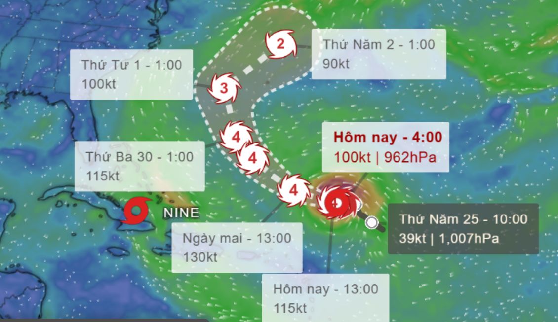
On September 26, Hurricane Humberto reached Category 3 on the Safir-Simpson hurricane scale with sustained winds of 185 km/h in the mid- Atlantic and continuing to strengthen. However, this is not the most worrying storm for the United States.
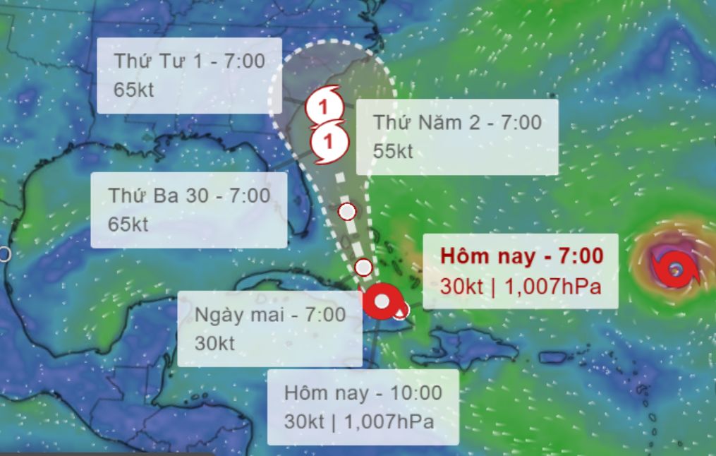
The US National Hurricane Center (NHC) said the tropical depression - temporarily called "Active No. 9" - just 55km northeast of Cuba, is showing signs of formation and is likely to become Hurricane Imelda within 24 hours.
Imelda could strengthen into a hurricane as it passes the Bahamas and approaches Florida, before weakening into a tropical depression when it makes landfall in the area from northern Florida to southeastern North Carolina on October 1.
The NHC warned that heavy rains will extend from Georgia to the mid-Pacific, causing the risk of urban and riverbank flash flooding.
In Cuba, rainfall is expected to reach 300mm, locally 400mm, threatening to cause flash floods and landslides. Hispaniola, Jamaica and the Bahamas are also in the affected area, with common rainfall of 100-200mm.
More dangerously, North Carolina, South Carolina and Virginia could see precessor rain a phenomenon of heavy rain before it actually arrives due to moist winds extending from the ocean combined with a cold trough in the Appalachians. Last year, a similar phenomenon caused flooding in North Carolina and Tennessee before Helene made landfall.
Scott Kleebauer, an expert with the US Weather Forecast Center, said that from September 28, thunderstorms in North and South Carolina could absorb more tropical moisture from Imelda, causing rainfall to spike.
Although Humberto is not expected to make landfall in the US, it could affect the trajectory of Imelda through the Fujiwhara effect - when two tropical cyclones interact, suck and rotate around each other. This makes Imelda's path unpredictable - with the potential to hit the Carolina directly, and the possibility of being pushed back into the Atlantic.
The impact on the US East Coast from Florida to North Carolina is clearly increasing, said Michael Brennan, NHC Director. People need to closely monitor the situation".
However, experts say Imelda is unlikely to cause flooding disasters like Hurricane Helene in late September last year. Current forecasts show that the heaviest rain areas will be located east, less overlapping with areas previously damaged by Hurricane Helene. However, 150-250mm of rain in some places in North and South Carolina was still enough to cause widespread flooding.
This could be a terrible storm for North Carolina, said weather forecaster Matt Lanza. Although not to the Helene level, people need to prepare mentally for flooding for many days.