Bualoi is the 20th storm in the Northwest Pacific in 2025 and will become storm No. 10 Bualoi in the East Sea when it enters our country's waters around the night of September 26 and early morning of September 27.
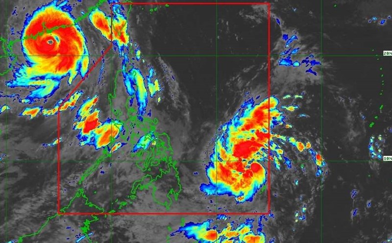
The latest storm information from the Philippine Atmospheric, Geophysical and Astronomical Services Administration (PAGASA) said that on the morning of September 25, typhoon Bualoi (local name is Opong) continued to strengthen as it moved in the sea east of the Philippines.
At 4:00 a.m. on September 25, the center of the storm was at 10.9 degrees North latitude, 129.8 degrees East longitude, about 440km east of Guiuan city (Eastern Samar province), with the strongest wind near the center reaching 110 km/h, gusting to 135 km/h, central pressure 980 hPa. The storm is moving west-northwest at a speed of 20 km/h.
The storm's wind radius is very wide, and can affect the area up to 450km from the center of the storm. As it approaches Eastern Visayas and Bicol, the storm is likely to bring widespread heavy rain, accompanied by the risk of rising water. Rough seas, high waves reach 6m in some places in the northern Catanduanes, Northern Samar, Albay and Sorsogon.
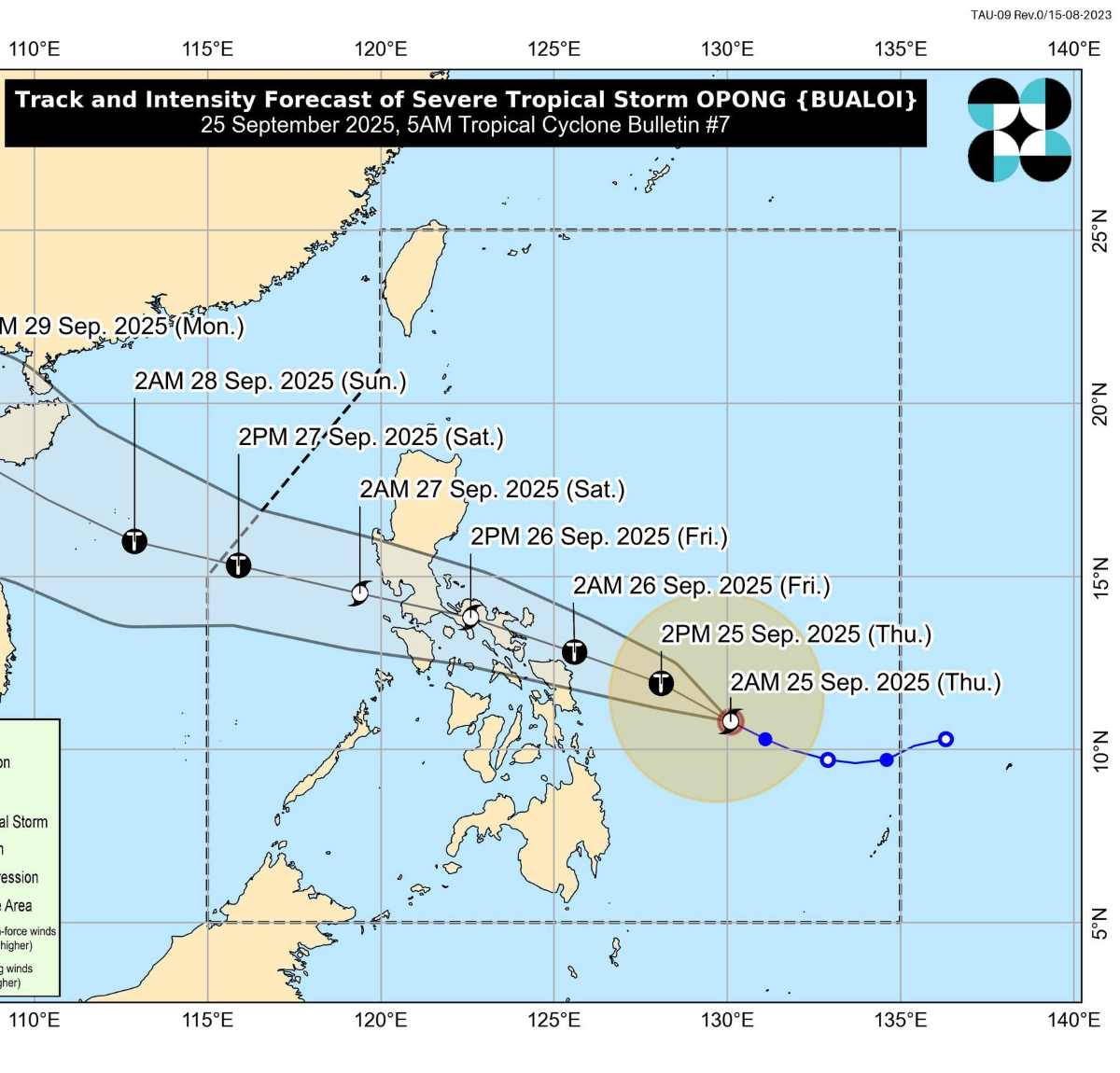
PAGASA stressed that Bualoi has strengthened into a severe tropical storm (level 12 or higher), before making landfall in the Bicol region on September 26.
PAGASA's storm forecast shows that after crossing the central Philippines, the storm will enter the East Sea around the night of September 26 and early morning of September 27, officially becoming the 10th storm to operate in the East Sea this year, affecting Vietnam.
Forecast of the directly affected area from Quang Ngai to Da Nang on September 28, then expand to Thua Thien Hue, Quang Tri, then continue to affect the North - North Central regions in the last days of September.
The maximum intensity can reach level 12-13, gust level 14-16, posing a great risk of strong storms, heavy rain, flash floods and landslides.
The particularly worrying thing is that when Typhoon No. 9 Ragasa has just ended, Typhoon No. 10 Bualoi will immediately follow. This is a continuous natural disaster situation, which can easily cause overlapping floods, prolonged flooding and widespread landslides.
Regarding storm No. 9 Ragasa, according to the Vietnam National Center for Hydro-Meteorological Forecasting, at 4:00 a.m. on September 25, the center of the storm was at about 21.5 degrees North latitude; 109.5 degrees East longitude, about 170km east of Mong Cai (Quang Ninh).
The strongest wind near the storm center is level 9 (75-88km/h), gusting to level 11. The storm is moving westward at a speed of about 20km/h.
The coastal area from Quang Ninh to Hai Phong will have winds gradually increasing to level 6-7, near the storm center level 8, gusting to level 9-10; The deep inland area in the Northeast will have strong winds of level 5, some places level 6, gusting to level 7-8.
Regarding rain forecast, from early morning of September 25 to the end of the night of September 26, in the Northern region, Thanh Hoa and Nghe An, there will be heavy to very heavy rain with common rainfall of 150-300mm, locally over 450mm. Beware of heavy rain causing urban flooding.
Flood warning: From September 25 to September 27, there is a possibility of a flood on rivers in the Northern region, Thanh Hoa, Nghe An.