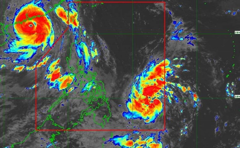
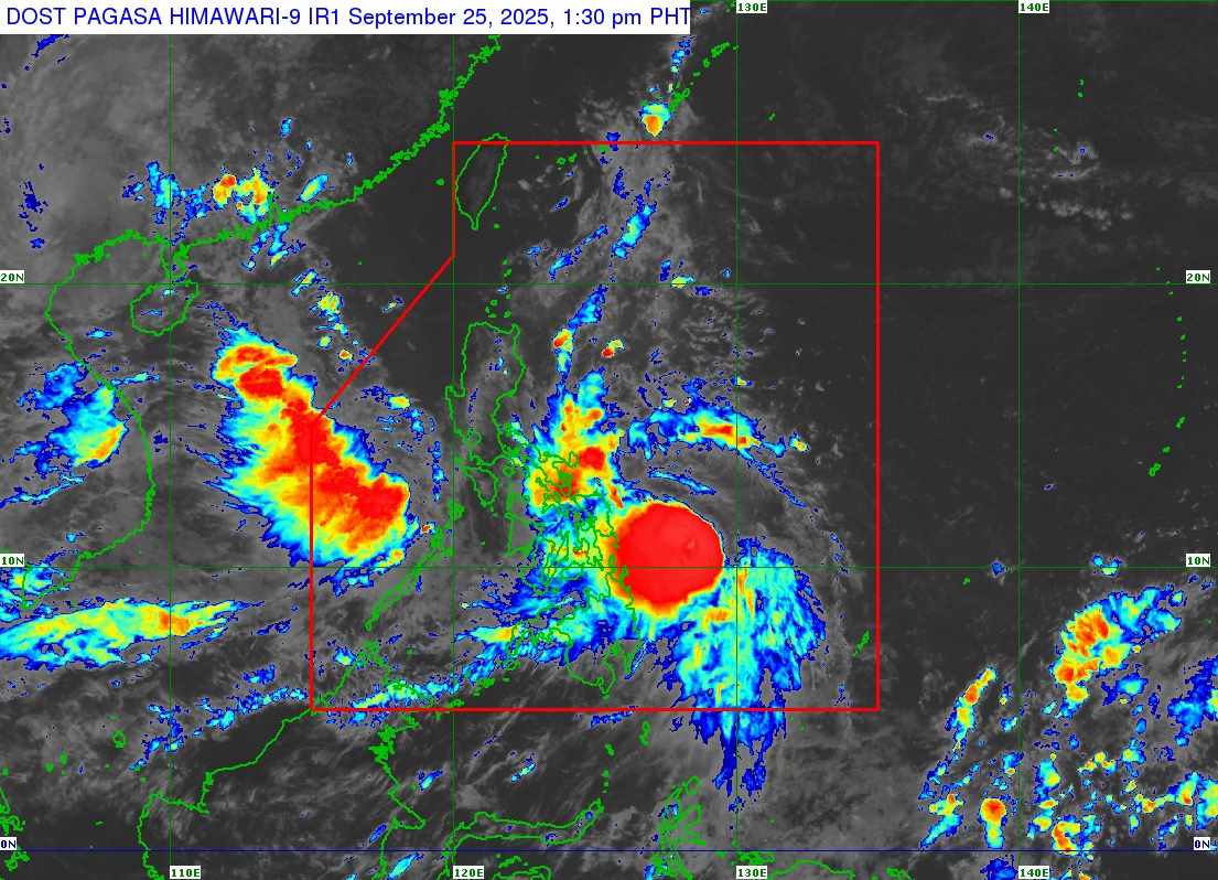
According to the latest storm information from the Philippine Atmospheric, Geophysical and Astronomical Services Administration (PAGASA), at 3:00 p.m. on September 25, the center of the severe tropical storm Bualoi (local name is Opong) was at 11.2 degrees North latitude, 128.0 degrees East longitude, 245km east of Guiuan, Eastern Samar.
Maximum sustained winds near the center of the storm are 110 km/h, gusting up to 135 km/h. The storm is moving west at a speed of 15 km/h. The affected area is 430km from the center of the storm.
Sea conditions forecast for the next 24 hours: Waves up to 11m in the coastal areas of Catanduanes; coastal areas east of Albay and Sorsogon; coastal areas north and northeast of Samar and Eastern Samar.
Waves up to 6 m high in the northern and eastern coastal areas of Camarines Norte and Camarines Sur.
Waves up to 5 m in the coastal areas of Quezon, Marinduque and Romblon; the remaining seas of the Bicol Region, Northern Samar and Eastern Samar.
There is a high risk of life-threatening high tides with peak tides exceeding 3m within 36 hours in low-lying or uninhabited coastal areas of Metro Manila, Central Luzon, CALABARZON, Western Mindoro including Lubang Island, Oriental Mindoro, Marinduque, Romblon, Bicol Region, Northern Samar, Eastern Samar, Samar, Biliran, Leyte and Philippines.
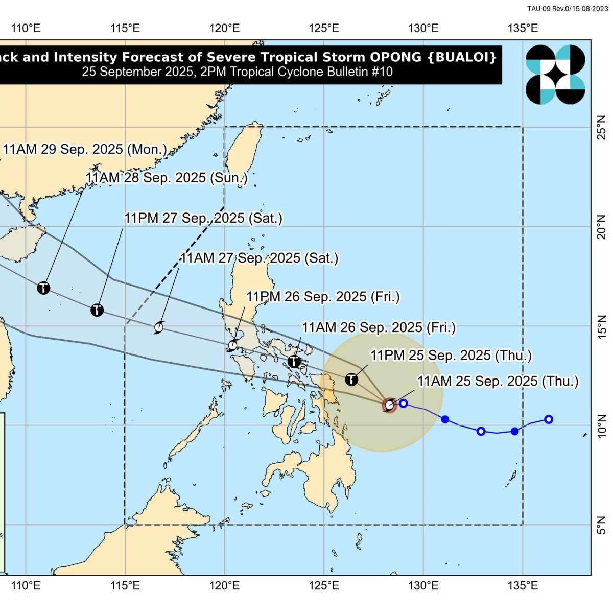
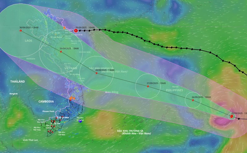
Typhoon Bualoi is forecast to continue moving mainly in the West-Northwest direction when approaching the Eastern Visayas - Southern Luzon area.
The storm could pass near or make landfall in the North Samar early tomorrow morning (26,), then enter the Bicol region in the morning of 26 September or early afternoon.
The storm will pass through Southern Luzon throughout September 26. The storm will then enter the South China Sea, becoming the 10th storm and leaving the Philippine Forecast Area (PAR) in the afternoon or evening of Saturday (September 27).
PAGASA forecasts that Bualoi may reach typhoon level before making landfall in the Bicol region on September 26. The storm will weaken as it passes through the archipelago, although throughout its movement, the storm may still be a typhoon or a severe tropical storm. The possibility of strengthening again is very high when the storm enters the East Sea.
After entering the East Sea, storm No. 10 is forecast to move rapidly in the Northwest direction, towards the Hoang Sa special zone around September 28, with continued intensity, likely reaching level 12-13.
The forecast of the next movement and final destination of storm No. 10 depends on the operation of the subtropical high-altitude systems. Storm No. 10 may go straight into the Hue - Da Nang area or move along the coast towards the North Central and Northeast regions.
Regardless of the final destination, the risk of a large-scale heavy rain is very high due to the strong interaction of the storm's circulation with the terrain.
It is forecasted that from September 27 to 29, ships operating in the North and Central East Sea are at risk of being affected by very strong winds and large waves.