Few people thought that behind the name "Bualoi" - often associated with the sweet sweet bowl of sweet soup in Thai life - was the name of a storm that could sow a fierce typhoon in the East Sea.
This name does not appear by chance. It was proposed by Thailand itself and included in the international list of storm names by the World Meteorological Organization (WMO) Hurricane Committee. Previously, the name Rammasun was permanently suspended after the 2014 super typhoon caused terrible damage, forcing member countries to find a replacement name. And since 2016, "Bualoi" was officially chosen.
In Thai, Bualoi (or Bua Loi) means "floating lotus flower" - a beautiful image, associated with a traditional sweet soup made with colorful sticky rice floating in a layer of sweet, warm coconut milk. It is that contrast that attracts international public attention: A name with a sweet, gentle taste is associated with severe natural disasters.
The first time "Bualoi" was used to name a storm was in 2019. Since then, the name has become a part of a chain of typhoon names in the Northwest Pacific Ocean - the world's most affected area of super typhoons.
Naming storms on a common list is not only for easy identification, but also reflects the cultural imprint of each member country. Thanks to that, among the powerful names such as Hagibis (the name proposed by the Philippines means fierce speed), Mangkhut (used by Macau, China, means goosebump) or Haiyan (used by China, means bird of sea bird), people still see the image of a Thai rustic sweet soup in a low air.
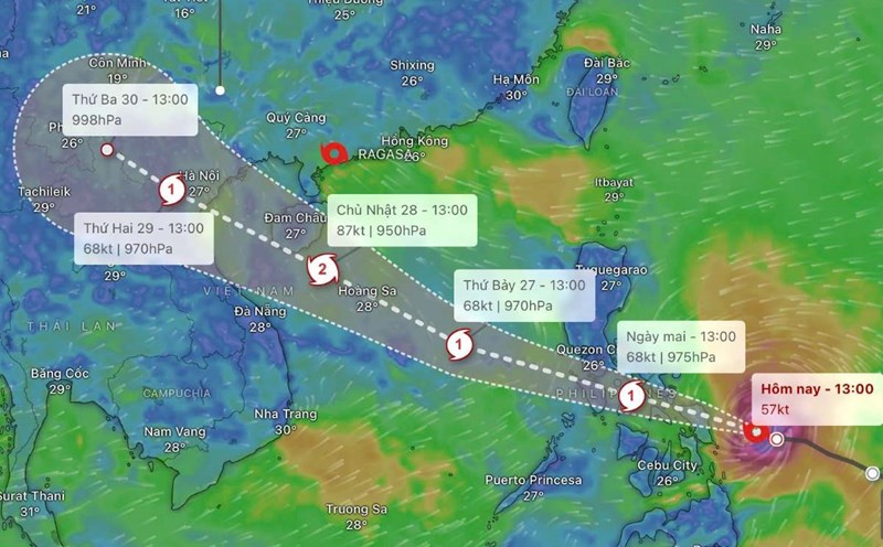
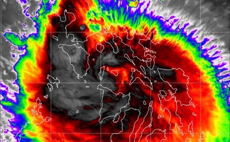
According to the latest storm information from the Vietnam National Center for Hydro-Meteorological Forecasting, at 1:00 p.m. on September 26, the center of storm Bualoi was at about 12.5 degrees North latitude - 121.3 degrees East longitude, in the central Philippines.
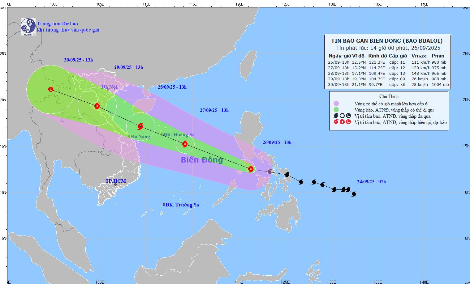
The strongest wind is level 11 (103-117 km/h), gusting to level 14.
Moving in the West Northwest direction, speed 35-40 km/h.
Forecast of developments in the next 24-72 hours
13:00 on September 27: West Northwest, 35 km/h, enters the East Sea, becomes storm No. 10, tends to strengthen.
Location: 15.2 degrees North latitude - 114.2 degrees East longitude, wind speed level 11-12, gusts level 15.
Dangerous area: 11.5-17.0 degrees North; East longitude 112.0 Kinh Dong.
Natural disaster risk: Level 3 (North and Central East Sea, including Hoang Sa special zone).
1:00 p.m. on September 28: West Northwest 25-30 km/h, continuing to strengthen.
Location: 17.1 degrees North - 109.4 degrees East, wind speed level 13, gust level 16.
Dangerous area: 13.0-20,0 degrees North; 108.0-116.5 degrees East.
Natural disaster risk: Level 3 (North and Central East Sea, Hoang Sa, sea off Thanh Hoa - Quang Ngai).
1:00 p.m. on September 29: West Northwest 25-30 km/h.
Location: 19.3 degrees North latitude - 104.7 degrees East longitude, wind speed level 8-9, gust level 11.
Dangerous area: North latitude 15.0 degrees North; West longitude 112.0 Kinh Dong.
Natural disaster risk: Level 3 (Northwest and Central East Sea, Hoang Sa, Thanh Hoa - Quang Ngai sea area, North of the Gulf of Tonkin including Bach Long Vy, Van Don, Co To, Cat Hai, Hon Dau).