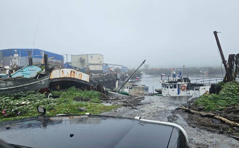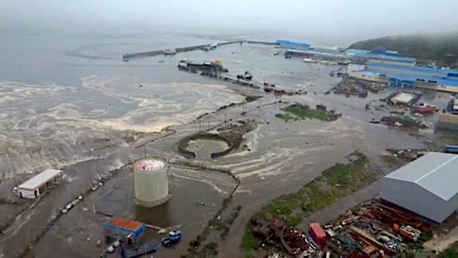
The strong earthquake of 8.8 degrees Richter that occurred on the morning of July 30 off the Kamchatka peninsula (Russia) caused a 3-5m high tunnel, forcing all residents of the town of Severo- Kurilsk to evacuate urgently. The sea water has flooded deep into the mainland, causing flooding, damaging the fish processing facility and sweeping away ships at the port. This was one of the strongest earthquakes ever recorded in the Russian Far East.
Although not located in the directly affected area, Vietnam is still being monitored by the Pacific Ocean Surge Warning Center (PTWC). Waves can spread to our country's sea with a forecast height of less than 0.3m - a level that is not dangerous but needs to be closely monitored.
According to Dr. Nguyen Xuan Anh - Director of the Institute of Geophysics, the earthquake in Kamchatka is a clear warning for Vietnam in strengthening the system of forecasting and responding to natural disasters.
"Vietnam needs to have appropriate research solutions to accurately assess and forecast natural disasters in the context of climate change, thereby building more effective and proactive risk mitigation measures..." - Mr. Xuan Anh emphasized.
On the morning of July 31, speaking with Lao Dong Newspaper about this issue, Associate Professor, Dr. Cao Dinh Trieu - Director of the Institute of Applied Geophysics said that in order to be proactive in the face of earthquake phenomena that can cause sunscreens, Vietnam needs to deploy 4 key working groups.
"First, it is necessary to conduct research on ancient sunsones through historical documents, especially documents related to major storms that have occurred in Vietnam. This will help identify the possibility of previous sunny incidents and determine the scale of the phenomenon, thereby creating a basis for future calculations and forecast models.
Second, it is necessary to clearly identify areas that are likely to experience dangerous earthquakes in the East Sea. On that basis, assess the threshold of the intensity of the earthquake that can cause songams, serving the work of warning and responding.
Third, wave propagation models must be calculated with high detail, especially simulation of the seabed. Because the Vietnamese seabed has many islands and complex terrain characteristics, currently the seabed depth data is still limited, which can easily lead to errors in calculation models.
Fourth, the warning system needs to be improved so that it can not only predict the wave height when it reaches the shore, but also estimate the level of flooding deep inland - a factor that directly determines the damage" - Mr. Trieu commented.
From Kamchatka's lesson, experts also recommend that Vietnam should invest more heavily in early warning systems, build a detailed sea bottom database, organize Tsunami drills in coastal localities and disseminate knowledge of natural disaster prevention to people.
In the context of climate change increasing the extreme and unpredictable nature, proactiveness is not only a choice, but a requirement for survival.