As of this morning, August 25, according to the report of the Border Guard, the units have notified, counted, and instructed 59,617 vehicles/248,843 people who know the developments and direction of the storm to proactively avoid it. By 8:00 p.m. on August 24, all fishing vessels from Quang Ninh to Hue had returned to shore and anchored, with no more vehicles operating at sea. There is no information about the damage to ships due to storm No. 5.
According to the Report of the Ministry of Construction, as of 3:00 p.m. on August 24, the area at high risk of incidents due to the impact of storm No. 5 has 131 river phaces with VR-SB registration (including Thanh Hoa; 50; Nghe An 27, Ha Tinh - Quang Binh 37; Quang Tri - Hue 35).
The total area of coastal aquaculture from Ninh Binh to Hue is 91,285 hectares, about 13,159 cages and 1,648 aquaculture cages.
Regarding the sea ban, 8 provinces from Ninh Binh - Quang Ngai have carried out this work.
According to the report this morning, August 25, of the Ministry of Agriculture and Environment on the synthesis of response work to storm No. 5, as of 6:00 a.m., provinces from Ninh Binh - Hue have evacuated 9,820 households/29,753 people (Ninh Binh 894 people; Thanh Hoa 1,083 households/4,003 people; Nghe An 2,006 households/6,954 people; Ha Tinh 5,211 households/13,311 people, Quang Tri 1,362 households/4,139 people; Hue 158 households/452 people). Currently, localities are continuing to organize the evacuation of households in dangerous areas.
Regarding the work that needs to be implemented further, it is necessary to complete the anchoring of boats at shelters, avoid damaged and sunken damages at anchorage areas, including transport boats; do not let people stay on fishing boats, cages, rafts, and aquaculture hutes.
Complete the evacuation of people in unsafe houses in coastal areas, at risk of deep flooding, flash floods, landslides; ensure logistics, food, drinking water, hygiene... for people in evacuation areas, not allowing people to return home before the storm has dissipated.
Prohibit people in affected areas from going out until no more storms affect them.
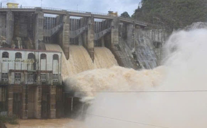
Check and prepare plans to ensure the safety of reservoirs and downstream areas, especially small hydropower reservoirs, vulnerable reservoirs that are full of water; arrange standing forces to be ready to operate, regulate and handle situations.
At 7:00 a.m. on August 25, the center of the storm was at about 18.4 degrees north latitude; 107.2 degrees east longitude, about 160 km east-southeast of Nghe An, about 145 km east of Ha Tinh, about 155 km east-northeast of Quang Tri. The strongest wind near the storm center is level 14 (150-166 km/h), gusting to level 17; moving west-northwest at a speed of about 20 km/h.
According to Mr. Mai Van Khiem, Director of the National Center for Hydro-Meteorological Forecasting, in the next 6 hours, the storm is forecast to move west-northwest, about 20 km/h and the intensity will tend to decrease.
"At 1:00 p.m. on August 25, the center of the storm was at about 18.6 degrees north latitude; 106.3 degrees east longitude, in the waters of Thanh Hoa - Ha Tinh provinces. Strong winds of level 13-14, gusting to level 16" - Mr. Khiem said.
The danger zone is latitude 16.5 to 20.5 degrees north latitude, west of longitude 109.5 degrees east longitude. Level 3 natural disaster risk in the northern Gulf of Tonkin and the sea area from Thanh Hoa to Quang Tri (including Hon Ngu island, Con Co island); level 4 in coastal areas and mainland provinces from southern Thanh Hoa to northern Ha Tinh.
"The time the storm makes landfall is about 15 - 18 hours" - Mr. Khiem added.