Weather forecast for the next 24-48 hours, establish a low pressure trough with an axis at about 25-28 degrees North latitude connecting to the hot low pressure area in the West.
The southwest monsoon will operate at weak to moderate intensity. Above, the subtropical high pressure tends to lift its axis to the North through the North Central region.
The low pressure area in the sea east of Luzon Island (Philippines) will gradually move into the East Sea.
Weather forecast for the next 3-10 days, the low pressure trough with an axis at about 25-28 degrees North latitude connecting with the hot low pressure area in the West will remain, then gradually move to the South, from around August 10, the low pressure trough will have an axis through the Central region and will gradually become stronger.
The southwest monsoon will operate at weak to moderate intensity, from August 10, and will gradually strengthen. Above, the subtropical high pressure will continue to gradually lift its axis to the North over the North, then gradually weaken, from August 12, the subtropical high pressure with an axis over southern China will become active again and tend to encroach on the west.
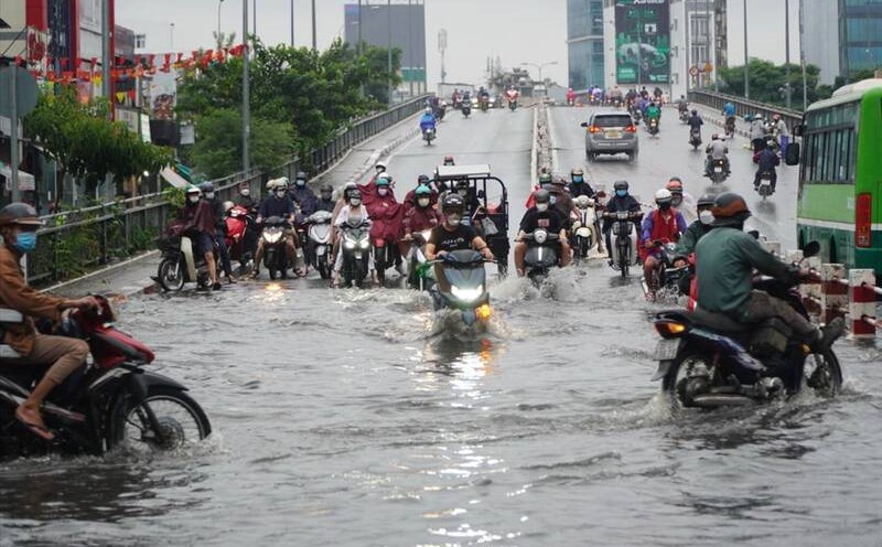
Therefore, Ho Chi Minh City and the South from August 9 to August 11 will have moderate to heavy rain. Total rainfall is generally 50-100 mm, in some places over 100 mm.
Beware of the possibility of heavy rain causing flooding in low-lying areas, urban areas, industrial parks, riverside areas and canals.