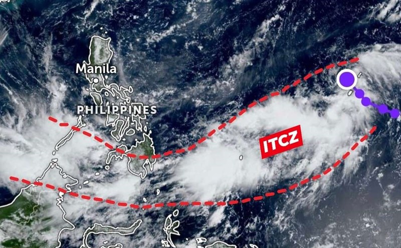
Weather forecast for the next 24-48 hours, the low pressure trough with an axis over the South Central region connecting with the low pressure area over the South China Sea tends to move to the West, towards the Southern provinces.
Above, the subtropical high pressure will encroach on the West and lift its axis to the North through the North. The southwest wind in the Southern region is weak.
Weather forecast for the next 3-10 days, the low pressure trough with an axis through the South - South Central region will remain, the low pressure area in the South China Sea will continue to move to the West and then gradually weaken.
Above, the subtropical high pressure will lift its axis to the North through the North of the North and be active, weakly withdrawing to the East from October 12, and weakly affecting the East wind in the area from October 12-14. The southwest wind in the Southern region is weak.
Therefore, from around October 8-11, the Southern region may experience widespread thunderstorms.
The water level at most stations on the Saigon River will continue to rise rapidly during the high tide period, in the next 2-3 days, then fall again. The highest daily tide peak in this period is likely to appear on October 8-9.
At Phu An and Nha Be stations, it is likely to reach a level of 1.60-1.65 m (about or 0.05 m above alert level 3 for high tides from 5-7am or 5-7pm. At Thu Dau Mot station, it will reach 1.75-1.80 m (above alert level 3 from 0.15-0.20 m).
This is a high tide period, it is necessary to be on guard against heavy rain combined with high tides causing flooding in low-lying areas, along rivers affecting traffic and socio-economic activities in the Ho Chi Minh City area.


