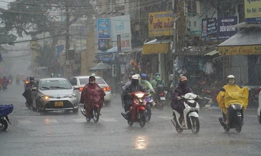
On the afternoon of October 14, combined with monitoring on satellite cloud images, lightning location data and weather radar images, it was shown that convective clouds are existing in the areas of Dong Nai, Ba Ria-Vung Tau, Ho Chi Minh City, Long An, Tien Giang, Ben Tre, Ca Mau provinces... In addition, the coastal cloud area of Ca Mau continues to expand.
From now until the next 4 hours, these convective clouds will cause showers and thunderstorms in the above mentioned area, then continue to develop and expand, causing rain in neighboring provinces such as Tra Vinh, Binh Phuoc... During thunderstorms, there is a possibility of tornadoes, lightning, hail and strong gusts of wind.
Regarding high tides, in the past 24 hours, water levels at most downstream stations on rivers in the Southwest region rose rapidly following the high tide on September 15 of the lunar calendar and are currently at high levels.
Water levels at downstream stations on rivers in the Southwest region will continue to rise rapidly in the coming days. By October 18, the highest tide of the day may reach above alert level III.
According to the Southern Hydrometeorological Station, the continental cold high pressure has weakened in intensity and will strengthen again around October 18-19. The equatorial low pressure trough around October 15-16 tends to become active, slowly lifting its axis to the North and is located at about 7-10 degrees North latitude. The high-altitude easterly wind disturbance is active and maintained in the Southern region.
Therefore, the Southern region will have increased rain in the coming days. Thunderstorms may cause tornadoes, lightning and strong gusts of wind. Beware of the possibility of heavy rain causing localized flooding in low-lying areas and areas with poor drainage capacity.


