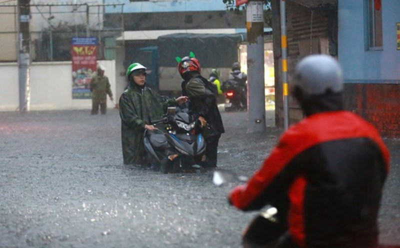
On the afternoon of October 16, combined with monitoring on satellite cloud images, lightning location data and weather radar images, it was shown that convective clouds still existed in the areas of Binh Phuoc, Dong Nai, Binh Duong, Ba Ria Vung Tau, Ho Chi Minh City...
In the next 4 hours, these convective clouds will cause showers and thunderstorms in the above mentioned area, then continue to expand and cause rain in neighboring provinces. During the thunderstorms, there is a possibility of tornadoes, lightning, hail and strong gusts of wind.
The thunderstorms are caused by stable continental cold high pressure. The equatorial low pressure trough has an axis through the Southern region. The high-altitude easterly wind disturbance has a positive impact on the weather in the Southern region.
Weather forecast for the next 24-48 hours: continental cold high pressure will weaken slowly. Equatorial low pressure trough has little change in location and intensity. Subtropical high pressure has an axis through North Central Vietnam. East wind disturbances above the South will remain.
The continental cold high pressure from October 19-20 will strengthen again in the North of our country. The equatorial low pressure trough tends to function well again, slowly lifting its axis to the North and is located at about 7-10 degrees North latitude. The high-altitude easterly wind disturbance will function well and remain in the Southern region. The subtropical high pressure has an axis through the North - North Central region.
Therefore, the probability of rain in the South is still high, locally there will be heavy to very heavy rain with rainfall from 20-40mm, locally over 80mm; warning of the risk of local heavy rain (over 80mm/6 hours).