
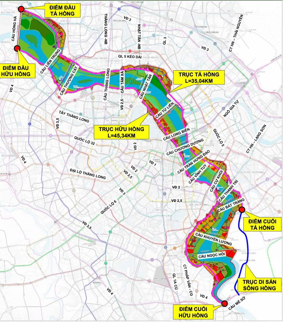
Hanoi is seeking people's opinions on the overall adjustment project of the Red River urban sub-area zoning plan at a scale of 1/5,000 (section from Hong Ha bridge to Me So bridge).
According to the project content, the section through the planning research area has 11 urban railway lines including 1, 2, 4, 5, 6, 7, 8, 10, 14, 15 and 2A.
In the research area, there is a national/interregional railway line (running along Ring Road 4 through Hong Ha and Me So bridges) and a high-speed railway line (running along Ring Road 4 through Me So bridge).
The Hong River Landscape Avenue axis includes landscape roads on the left and right banks of the Red River with a scale of 8-10 lanes.
The dyke sections passing through the inner city area (Au Co, Nghi Tam, Yen Phu, Tran Nhat Duat, Tran Quang Khai, Tran Khanh Du, Nguyen Khoai streets) are identified as inter-regional roads with a scale of 4-6 lanes. Other main urban and inter-regional roads have a width of 40-50m (6-8 lanes).
The main roads in the area have a width of 17-30m (2-4 lanes).
The main roads in the area are built on the basis of upgrading existing dyke sections such as Ta Hong dyke, Huu Hong dyke section Lien Mac - Thuong Cat, the section south of Thanh Tri bridge is determined to have a scale of 4-6 lanes including the dyke foot gathering road.
Along with that, the city completes the connectivity system across the Red River with 17 road bridges (including existing bridges, currently being deployed and newly planned) and 1 bridge over the Duong River, strengthening the connection between the two banks of the river and connecting the Capital region.
The current status of the river bridge system on the Avenue Axis has 12 bridges. Among them, there are 6 existing bridges (Thang Long, Nhat Tan, Long Bien, Chuong Duong, Vinh Tuy, Thanh Tri); 6 bridges under construction (Hong Ha, Thuong Cat, Tu Lien, Tran Hung Dao, Ngoc Hoi, Me So).
The city plans to plan 5 more bridges over the Red River on the Avenue Axis, including Lien Trung, Tam Xa, Cu Khoi, Bat Trang and Khuyen Luong.
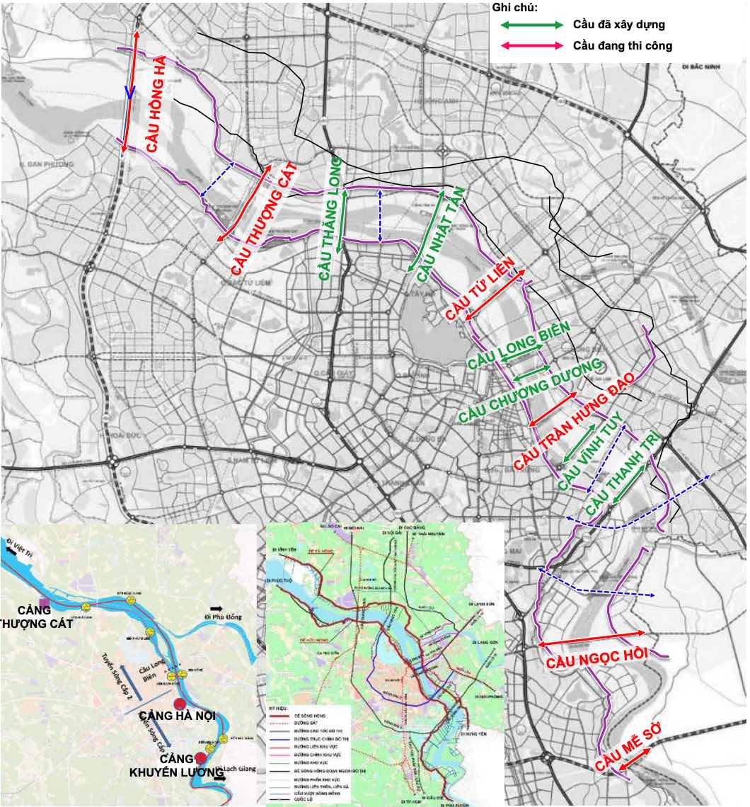
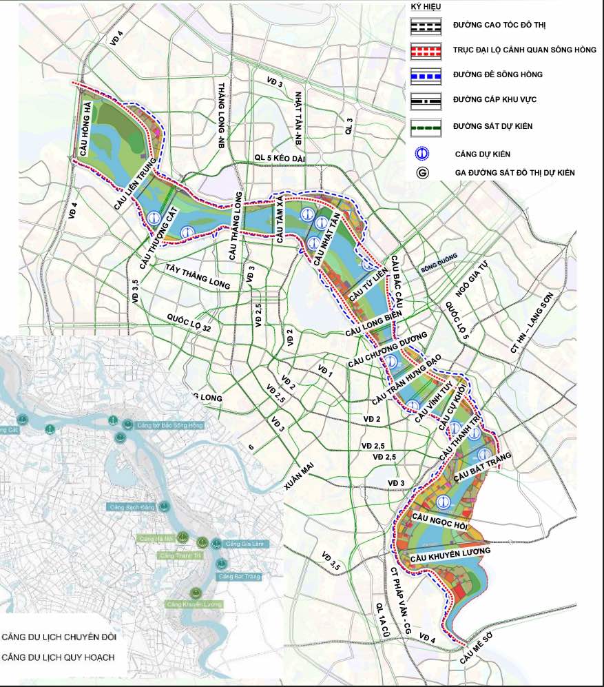
Regarding port system planning, gradually convert the functions of cargo ports into tourist ports - combined with forming service points on both sides of the Red River to serve traffic combined with tourism, meeting the requirements of planning in the future.
Regarding public transport, continue to operate existing bus routes in the area. Organize a bus network synchronously with urban railways, conveniently connecting with stations; arrange stops on regional roads or higher, at a distance of 300-500m, maximum 800m.


