As reported by Lao Dong Newspaper, 1 year ago, around November 2024, the water level of the Red River through Phu Tho province began to drop, giant alluvial plains and sand dunes appeared in the middle of the river, many sections of the flow were narrow.
In November 2024, the actual water level of the Red River measured at Phu Tho station usually fluctuates between 11 - 12m. At some locations, the reporter also recorded people sitting on sandbanks in the middle of the river to fish, posing a potential risk of subsidence and drowning...
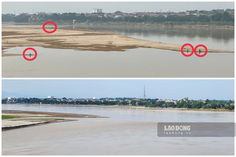
However, in November 2025, the image of the Red River that the reporter recorded has many differences. The easiest thing to see is that the number of alluvial plains and sand dunes on the river is less than in November 2024, so the river flow has not narrowed.
In the Ngoc Thap bridge area (connecting Phong Chau ward and Hien Quan commune, Phu Tho province), the image of the riverbed cracked after the water receded or the alluvial plains overgrown with reed grass, flowers blooming... a year ago, it was no longer there.
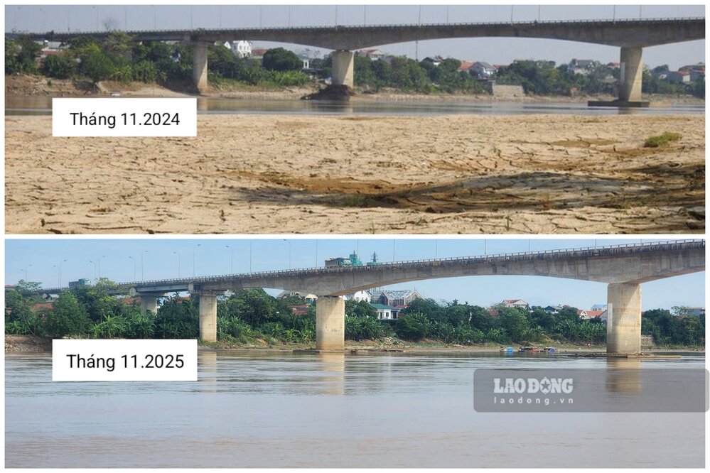
Mr. Vu Quang Dao - a resident of Ngoc Thap bridge resettlement area, Phong Chau ward - shared: "It can be clearly seen that this year the river water does not dry up as quickly as last year. In my opinion, it is good, because if the river water is low, the alluvial plains along the river this season will grow reed, attracting many young people to come and play, take photos, fish... it will be very dangerous".
According to the National Center for Hydro-Meteorological Forecasting's Short-term Hydro-Meteorological Forecast and Warning bulletin on November 21, 2025, the water level of the Thao River at Yen Bai station (in the upstream, now Lao Cai), Phu Tho station is decreasing.
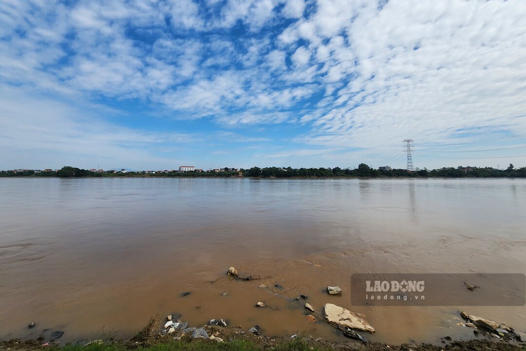
The actual water level measured on the Thao River at Phu Tho station showed that at 1:00 a.m. on November 21, it was at 13.26m, at 7:00 a.m. the same day, it was forecasted that by 7:00 p.m. the same day, the water level would drop to 12.90m.


