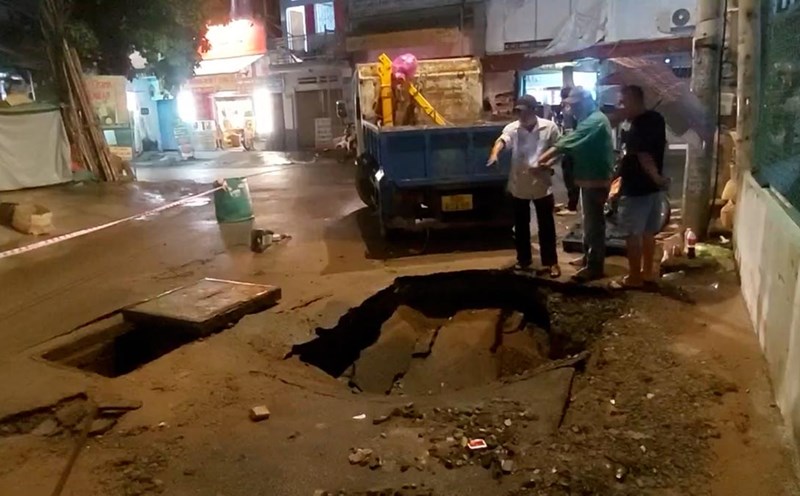
As reported by Lao Dong Newspaper, in the early morning of March 29, on National Highway 3B, through Hiep Luc village, Kim Lu commune, a serious sinking death hole appeared.
Initially, the sinkhole was about 7m long and 5m deep, located in the middle of the median strip. However, the hole gradually enlarged, 8.6m long, 8.5m wide, and 8m deep on average. At the bottom of the sinkhole, there is an underground water mach and a 5.3m deep frog's jaw.
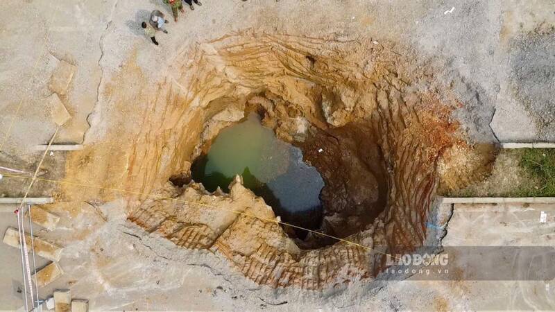
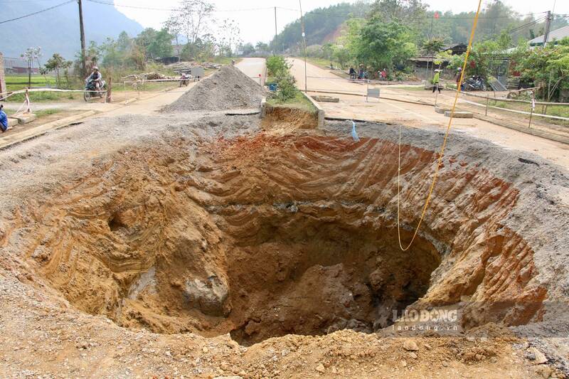
According to preliminary assessments, the location of the subsidence is in the form of Karst Cave (a phenomenon of evaporation characteristic of limestone mountains due to eroded water), below which there is a water flowing underground that often pulls up soil and rocks, causing subsidence of the roadbed.
More than 10 days since the sinkhole appeared, in addition to temporary traffic congestion, the lives of many households in the surrounding area have been affected.
Mr. Chu Thanh Tu (Hiep Luc village) said that on the night of March 29, after a loud noise, a sinkhole was discovered tomorrow. A few days later, the family's farm not far away also cracked and collapsed slightly. The family's offshore well nearly 10 meters deep suddenly had all the water drained.
"The sinkhole drained all the water in the well, making it difficult for my family to do daily activities. But I am most worried that my family's house and property could be affected if the subsidence becomes stronger. Hopefully, the cause will be found soon and there will be a plan to handle it completely," Mr. Tu worried.
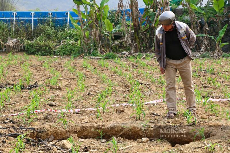
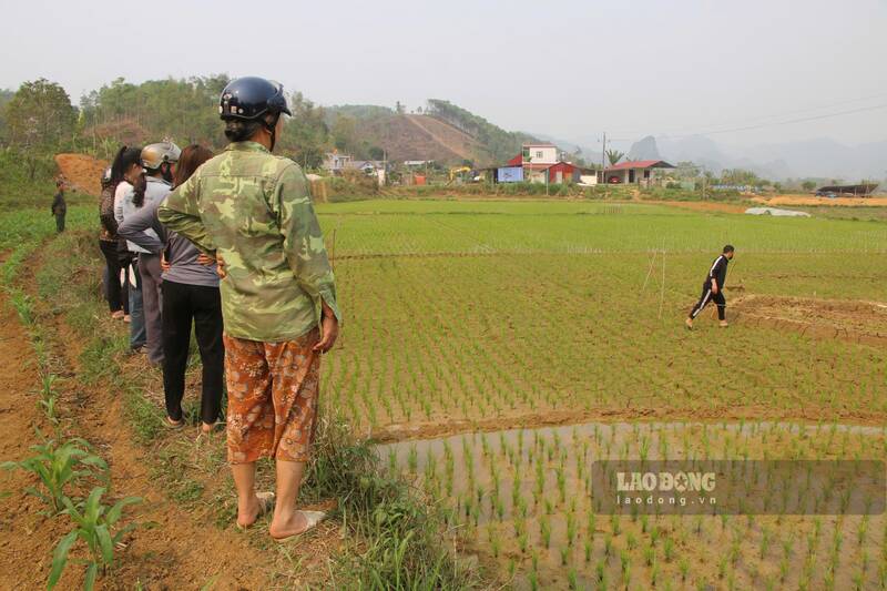
About 100m from the death hole, Mr. Dam Van Viet's family's rice field has 2 adjacent small sinkholes. To keep the rice plants hydrated, the family was forced to build fences around the pits and regularly check the fields.
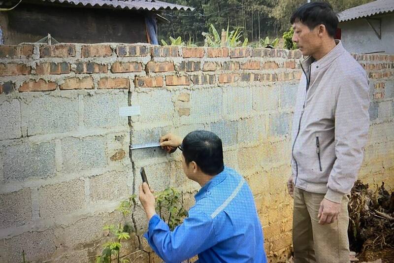
"Before there was a sinkhole in the middle of the median strip, the fields had a sinkhole about 1 meter wide, causing the entire water to be lost, then there was another hole right next to it. Subsidence holes appeared, affecting people's underground water supply and fields. At the same time, some surrounding locations have cracked walls, causing people to worry," said Mr. Viet.
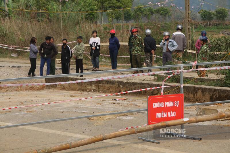
According to Mr. Luong Thanh Loc - Vice Chairman of Na Ri District People's Committee, currently about 200m from the original subsidence location, the road surface shows unusual signs and is slightly subsided. The authorities have cordoned off the area and warned of the danger. Preliminary statistics show that 21 households are at risk of being affected. The district has planned to evacuate people to a safe place in case of emergency.
Previously, the Department of Construction assigned officers to the scene to coordinate with the locality to conduct the localization and place warning signs. At the same time, people and vehicles are prohibited from passing through to ensure safety.
The Road Management Unit poured nearly 200m3 of boulders and gravel. However, the amount of rock that fell was swept away by the underground water system under the sinkhole.
The Department of Construction of Bac Kan has also reported the incident and requested the Vietnam Road Administration to inspect the actual scene and propose solutions.