
At noon on August 8, Lao Cai Provincial Hydrometeorological Station informed that due to the impact of prolonged rain in recent days, soil moisture in many areas in the area has reached a state of saturation or near saturation, increasing the risk of landslides and subsidence in the coming hours.
In the past 24 hours, many places in Lao Cai province recorded rainfall from moderate to heavy. Some notable points have rainfall such as An Phu (Muong Lai commune) 42.8mm; Pa Hu (Tram Tau commune) 55.4mm; Phinh Ho 43.4mm and Phuc Son (Cau Thia ward) 51.4mm.
According to monitoring results, the soil moisture model shows that many areas have reached or exceeded the 85% threshold, approaching saturation. This is a disadvantageous condition, reducing the bonding capacity of the soil and increasing the risk of landslides in hilly areas, positive slopes, negative slopes and along traffic routes.
Forecast for the next 6 hours, many places in the province will continue to have rain with common rainfall from 5-10mm, locally over 20mm.
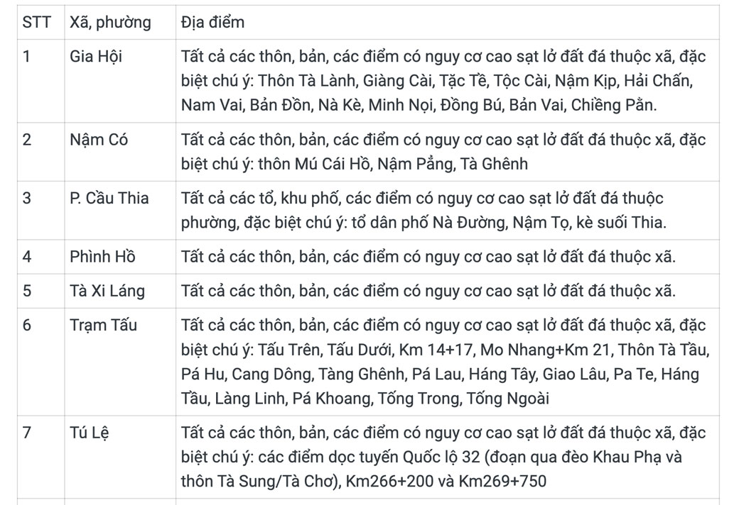
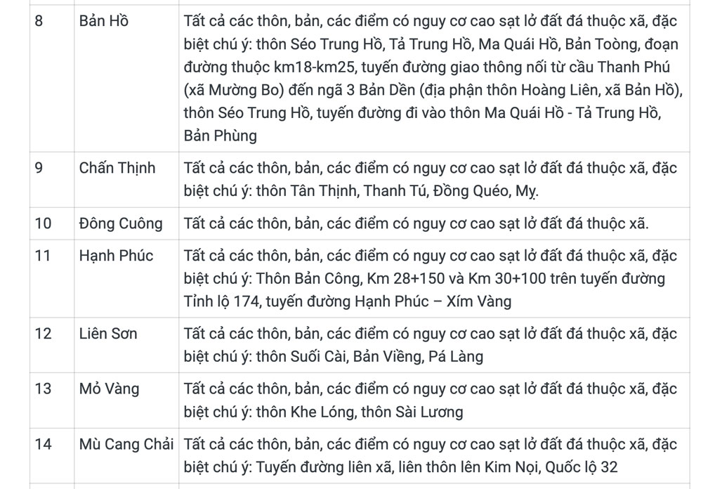
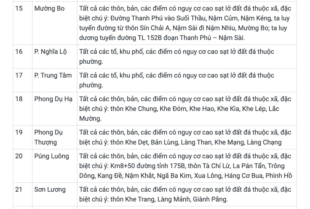

Lao Cai Provincial Hydrometeorological Station warns that in the next 6-12 hours, there is a high risk of landslides on hillsides, traffic road slopes and land subsidence in many areas, especially in villages, hamlets, residential groups and points that have experienced landslides or have been identified as at high risk.
The meteorological agency believes that landslides and subsidence can seriously affect the environment, threaten people's lives, disrupt traffic, damage infrastructure works, and cause damage to production activities and socio-economic development.
Lao Cai Provincial Hydrometeorological Station recommends that local authorities and people closely monitor weather forecasts and warnings; proactively review high-risk areas to promptly deploy response plans, relocate people and property when necessary to minimize damage.
Currently, the level of natural disaster risk due to landslides, subsidence due to heavy rain or currents in Lao Cai province is determined to be level 1.


