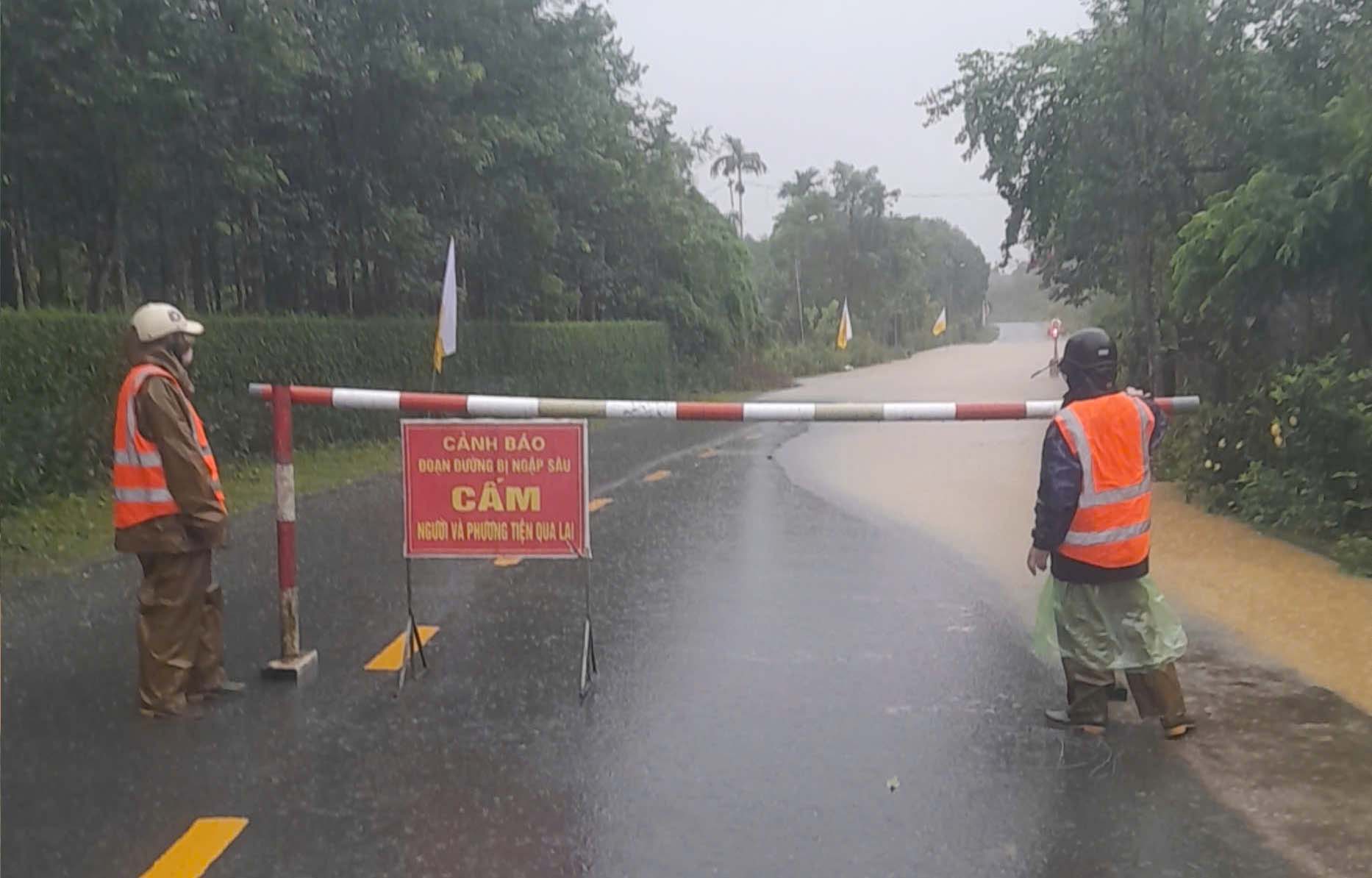
On the morning of August 30, Mr. Phan The Chuong - Deputy Director of Ha Tinh Traffic Construction Management and Construction Joint Stock Company - said that due to prolonged heavy rain, at Km434+590 - Km434+650 National Highway 15, the section passing through Phuc Trach commune was flooded from 30 - 50cm deep.
The authorities have regulated, guided, diverted traffic and erected barriers and warning signs, prohibiting all types of vehicles from passing at flooded areas.
According to weather forecasts, by 7:00 a.m. on August 30, the tropical depression had strengthened into storm No. 6. The center of the storm at 7:00 a.m. was at about 17.8 degrees North latitude; 108.6 degrees East longitude, about 240km east of northern Quang Tri, about 190km northeast of Hue City.
Maximum wind speed: level 8 (62-74km/h), gust level 10. It is forecasted that in the next 3 hours, the storm will move in a West-Northwest direction, at a speed of about 20km/h.

In general, in the past 24 hours (from 6am on August 29 to 6am on August 30), Ha Tinh province has had heavy rain, some places have had very heavy rain such as: Huong Quang: 222mm, Huong Tho: 181mm, Huong Lam: 179mm, Ha Tinh: 149mm, Huong Giang: 147mm, Thach Xuan: 147mm, Do Diem: 140mm, Dai Loc: 134mm, Cuong Gian: 130mm, My Loc: 126mm, Dau Lieu: 121mm, P. Tran Phu 120mm...
It is forecasted that in the next 3 - 6 hours, Ha Tinh area will continue to have rain with accumulated rainfall from 50 - 100mm, some places over 150mm.
In the next 6 hours, there is a risk of local flooding, flash floods on small rivers and streams, landslides on steep slopes, and subsidence in Ha Tinh province.
From the morning of August 30 to the end of August 31, Ha Tinh will have heavy to very heavy rain and thunderstorms. The total rainfall of the forecast locations of Nghi Xuan, Bac Hong Linh, Can Loc, Thanh Sen, Thach Ha, Huong Khe, Cam Xuyen, Ky Anh, Hoanh Son, Huong Son, Vu Quang, Duc Tho is generally 150-300mm, locally over 500mm.


