
According to Flood Warning Order No. 19/L-BCH on the evening of August 24 of the Hanoi City Civil Defense Command, at 6:40 pm on the same day, the water level of the Tich River at Kim Quan reached 8.42m, exceeding 0.02m compared to alarm level III. The city issued alarm level III on the Tich River, requesting localities and functional forces to deploy response plans.
In Trung Gia commune, the water level of the Cau River at Luong Phuc station reached 8m at 1:40 pm on August 24, equivalent to alarm level III. Rising floodwaters caused flooding in many residential areas.
According to statistics, the whole commune has 338 households with 1,489 people isolated. Among them, Hoa Binh hamlet, An Lac village has 1,309 people; An Lac hamlet has 100 people and Trai hamlet, Do Tan village has 80 people.
About 50ha of rice and crops are flooded, including 30ha in Do Tan and 20ha in Bac Son. Many other production areas are at risk of continuing to be affected if the rain lasts.
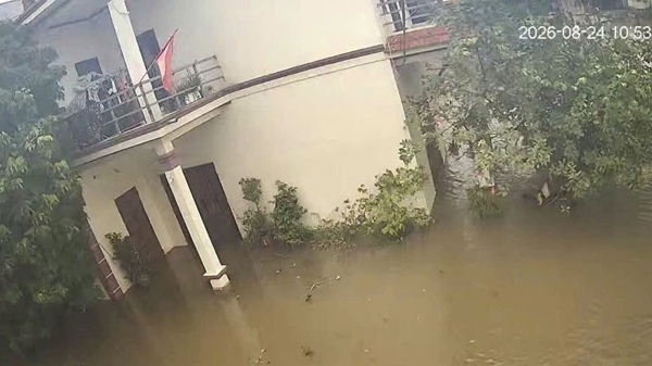
In Hoa Binh hamlet, floodwaters in some riverside locations rose from 2-4m deep, submerging many people's roads. Road travel was paralyzed, boats and canoes became the main means of access to the flooded area.
Many households have proactively moved livestock, poultry, motorbikes and valuable assets to higher ground. The Trung Gia commune government has reviewed key locations, arranged standing forces, prepared means of transporting food, clean water, medicine and organized rescue when necessary.
The Commune People's Committee coordinates with the irrigation unit, Dyke Management Unit No. 7 and the electricity sector to operate drainage pumping stations, proactively drain water, and protect the dyke system. Patrol and guard forces are mobilized on the Huu Cau dyke line, especially in the Go Sanh area.
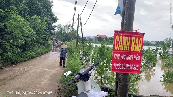
The government recommends that people not arbitrarily pass through deep water and fast currents; proactively move property, livestock, and poultry to a high and dry place and cut off power in deeply flooded areas.
In Xuan Mai commune, in the afternoon of August 24, the Bui River water began to overflow through some low sections on the Bui 2 dyke, threatening residential areas and production areas inside the dyke.
The commune has mobilized more than 150 people to participate in flood control, and at the same time gathered more than 500m3 of sand, 10,000 sacks and many supplies to the scene.
At the water overflow locations, functional forces pack sand into bags, arrange along the dyke edge and cover with tarpaulins to limit the water flow causing erosion. Cars and excavators are mobilized to transport sand, sacks and supplies.
Bui 2 dyke is about 2.8km long, with a common elevation of 6.7-7m, with the task of preventing and slowing floods into residential areas of Tien Tien, Nam Phuong and Viet An villages. The dyke line once had 3 landslide locations with a total length of about 50m due to the impact of floods in 2025.
On the Tich River, at 6 pm on August 24, the water level at Kim Quan station reached 8.40m, equal to alarm level III. At Vinh Phuc station, the water level reached 7.93m, about 0.07m lower than alarm level III.
The Northern Hydrometeorological Station predicts that in the next 12-24 hours, the water level of the Tich River will continue to rise. Many communes and wards along the river are at risk of flooding, especially in low-lying areas and riverside residential areas.
Faced with flood developments on many rivers, Hanoi's suburban localities continue to maintain on-duty forces, monitor water levels, check dykes and be ready to support people in flooded areas at risk of being cut off.


