Red River water level fluctuates through Lao Cai after prolonged heavy rain

Đinh Đại |

Lao Cai - The water level of the Red River has clearly increased after heavy rain days, while many areas are warned of the risk of flash floods, landslides and flooding.

Lao Cai has continuously experienced moderate to heavy rain in recent days, with very heavy rain in some places, causing the water level on many rivers and streams to rise.

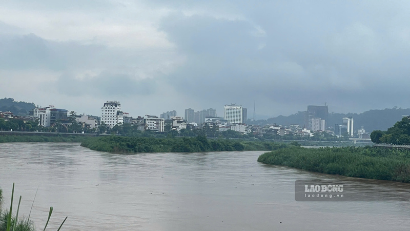
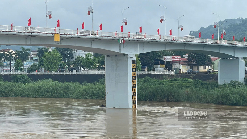
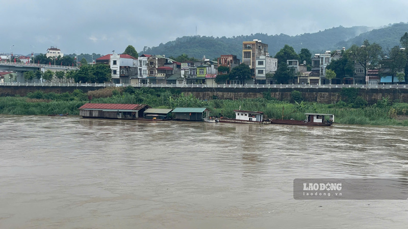
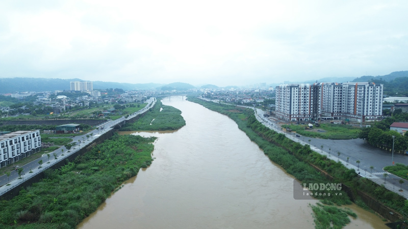
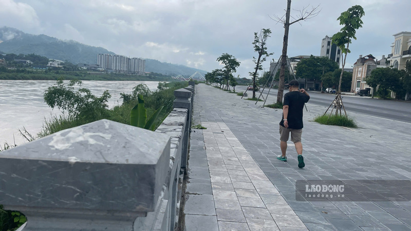
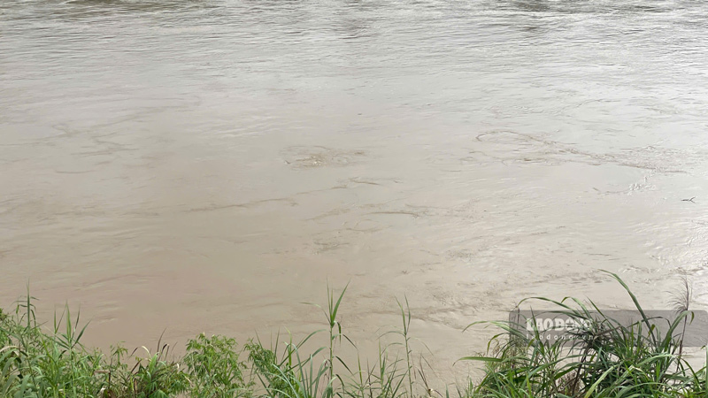
Recorded by reporters on the morning of July 2nd, the old Lao Cai city area had rain, on the Red River through Lao Cai ward, the water level has increased significantly compared to the dry season, the water flow is cloudy and fast.

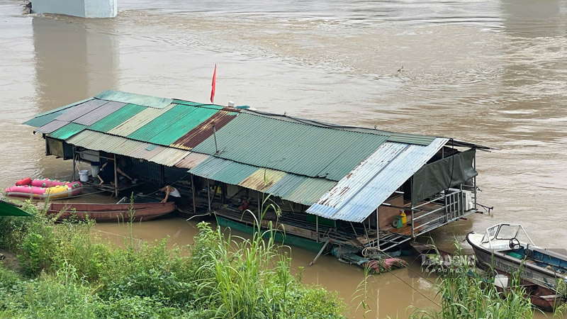
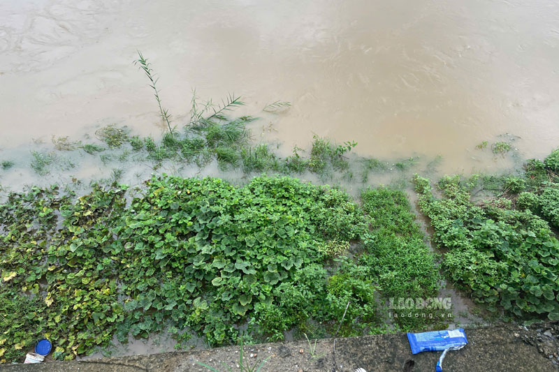
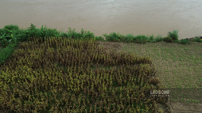
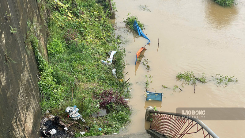
In some areas along the river, water has flooded into people's crops. Local authorities are strengthening monitoring the development of water levels, and at the same time warning people not to approach riverbanks and wharves to ensure safety.

Mực nước sông Hồng qua phường Lào Cai bắt đầu dâng sau nhiều ngày mưa lớn liên tiếp. Ảnh: Đinh Đại
The water level of the Red River through Lao Cai ward began to rise after many days of rain. Photo: Dinh Dai

According to the Lao Cai Provincial Hydrometeorological Station, heavy rain continues to be maintained, causing soil moisture in many areas to be close to or reaching saturation. In the coming hours, the locality will still have showers and thunderstorms, with common rainfall from 10-30 mm, in some places over 50 mm.

The meteorological agency warns of the risk of flash floods on small rivers and streams, landslides in hilly areas, traffic road slopes and flooding in low-lying areas.

Mr. Nguyen Van Hung, a resident living near the Red River bank in Lao Cai ward, shared that in recent days it has been raining continuously, so the water level has risen quite quickly.

After only a few days of rain, the Red River water passing through Lao Cai has risen and flowed faster. Due to the strong current, we live around the area and regularly monitor the developments of rain and floods, and at the same time remind young children not to go to the riverbank area to play to ensure safety," Mr. Hung said.

Người dân theo dõi diễn biến mực nước sông Hồng để kịp thời ứng phó. Ảnh: Đinh Đại
People need to monitor the developments of the Red River water level to promptly respond. Photo: Dinh Dai

The Standing Office of the Steering Committee for Natural Disaster Prevention and Control and Search and Rescue of Lao Cai province said that by the end of July 2, the water level on rivers and streams continued to fluctuate upwards.

This flood may cause the water level on the Thao River at Lao Cai station to reach alarm level 1, while many small rivers and streams are likely to exceed alarm level 1 to alarm level 2.

Functional sectors recommend that localities proactively review areas at risk of flooding, flash floods, and landslides to promptly evacuate people when necessary.

Localities with suspension bridges and underground spillways across rivers and streams need to arrange guard forces, not allowing people and vehicles to pass when the water rises.

Dòng nước đục ngầu, chảy xiết từ thượng nguồn đổ về. Ảnh: Đinh Đại
Fast-flowing water flowing from upstream. Photo: Dinh Dai

Previously, on the afternoon of June 29, in Ngu Chi Son commune, a truck was swept away by floodwaters and trapped in the middle of a stream while moving into a construction site. Police and people deployed rescue and removed the vehicle from the dangerous area after more than an hour.

According to forecasts, thunderstorms in Lao Cai will continue in the coming days. In addition to the risk of flash floods and landslides, people also need to be wary of tornadoes, lightning, hail and strong gusts of wind during thunderstorms.

Lao Cai Provincial People's Committee on July 2nd informed that from June 26th to July 1st, moderate rain, heavy rain to very heavy rain accompanied by thunderstorms occurred in Lao Cai province, causing damage to housing, agricultural production, transportation and people's infrastructure in many communes and wards.

Heavy rain affected 44 houses, nearly 46 hectares of crops were flooded and damaged, 619 poultry died or were swept away, nearly 1.8 hectares of aquaculture were damaged, many traffic routes and infrastructure works were landslides and damaged. Initial estimated total damage is over 1.3 billion VND.

Some images recorded on the morning of July 2:

Nhiều bãi bồi ven sông bị ngập khi nước sông Hồng dâng cao. Ảnh: Đinh Đại
Many alluvial grounds along the river are flooded as the Red River water rises. Photo: Dinh Dai
Người dân sinh sống ven sông Hồng. Ảnh: Đinh Đại
People living along the Red River. Photo: Dinh Dai
Một số diện tích hoa màu ven sông bị ảnh hưởng do nước dâng. Ảnh: Đinh Đại
Some areas of riverside crops are affected by rising water. Photo: Dinh Dai
Cảnh quan sông Hồng thay đổi rõ rệt khi lượng nước từ thượng nguồn liên tục đổ về. Ảnh: Đinh Đại
The landscape of the Red River changes significantly as water from upstream continuously flows in. Photo: Dinh Dai
Mưa lớn kéo dài làm gia tăng nguy cơ lũ quét, sạt lở đất tại khu vực miền núi Lào Cai. Ảnh: Đinh Đại
Prolonged heavy rain increases the risk of flash floods and landslides in the mountainous area of Lao Cai. Photo: Dinh Dai
Đinh Đại
RELATED NEWS

Warning of floods on Thuong River, Lang Son and Bac Ninh to prevent landslides

|

The flood peak at Phu Lang Thuong station is forecast to exceed alarm level 1 in the next few days, threatening to cause flooding in riverside areas.

Thao River water level in Phu Tho is the lowest in history

|

Phu Tho - In mid-April 2026, on the Thao River (main stream of the Red River), the water level at Phu Tho station showed the lowest value in history.

Red River water level forecast for the first month of 2026

|

In January 2026, the water level of the Thao River/Red River section passing through Lao Cai, Phu Tho, and Hanoi provinces will have changes.

Live broadcast of Vietnam U18 women's volleyball team vs South Korea U18 at the AFC U18 Championship

|

Live match between Vietnam U18 women's volleyball team and Korea U18 at the AFC U18 Championship, taking place at 1:00 PM today (July 2).

Russia's latest unmanned weapon revealed, only 10 minutes to launch

|

According to the Russian Ministry of Defense, the BM-70 UAV can attack targets at a distance of up to 100km and deploy quickly in just a few minutes.

Red Trade Union - the core uniting the worker force in the early years of the revolution

|

On February 3, 1930, the Communist Party of Vietnam was established. Under the leadership of the Party, the Red General Confederation of Labor gathered the force of workers and boatmen, the main force of the Vietnamese revolution, creating the Xo Viet Nghe Tinh rise 1930-1931.

Ho Chi Minh City starts construction of 8 projects to lay the foundation for a new growth era

|

On July 1, Ho Chi Minh City simultaneously started construction of 8 projects with a total investment of more than 252,000 billion VND, expected to create breakthroughs in transport infrastructure, logistics, urban embellishment and expand development space for the city in the new phase.

Warning of floods on Thuong River, Lang Son and Bac Ninh to prevent landslides

Khánh Linh |

The flood peak at Phu Lang Thuong station is forecast to exceed alarm level 1 in the next few days, threatening to cause flooding in riverside areas.

Thao River water level in Phu Tho is the lowest in history

Tô Công |

Phu Tho - In mid-April 2026, on the Thao River (main stream of the Red River), the water level at Phu Tho station showed the lowest value in history.

Red River water level forecast for the first month of 2026

Tô Công |

In January 2026, the water level of the Thao River/Red River section passing through Lao Cai, Phu Tho, and Hanoi provinces will have changes.