According to the Forecast and Hydrological Warning for the season (from November 2025 to April 2026) of the National Center for Hydro-Meteorological Forecasting, in August, from August 25 to 28, on rivers in the Northern region, there was a peak flood on the Thao River (the Thao River is the main river of the Red River) exceeding Alert 3.
From September 27 to October 2, major floods appeared on many rivers in the Northern region. During this flood, the peak water level on small rivers will rise to alert level 2 - alert level 3, in some places above alert level 3; the flood peak on Thao River (Lao Cai), on Lo River (Tuyen Quang) will exceed alert level 3.

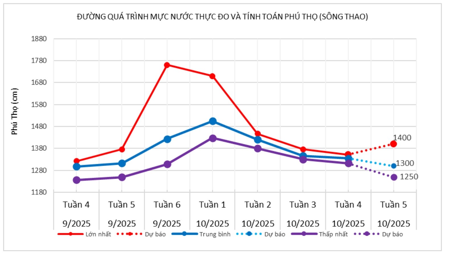
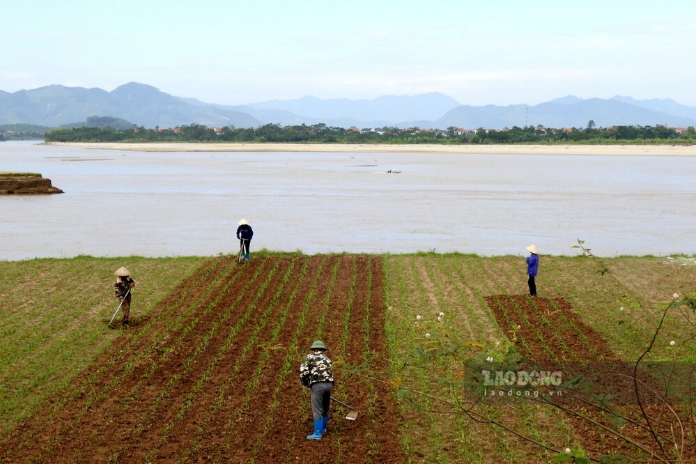
According to the reporter of Lao Dong Newspaper in late October, on the Thao River passing through Phu Tho province, the water level has receded a lot compared to the time of the big flood more than half a month ago and is changing slowly.
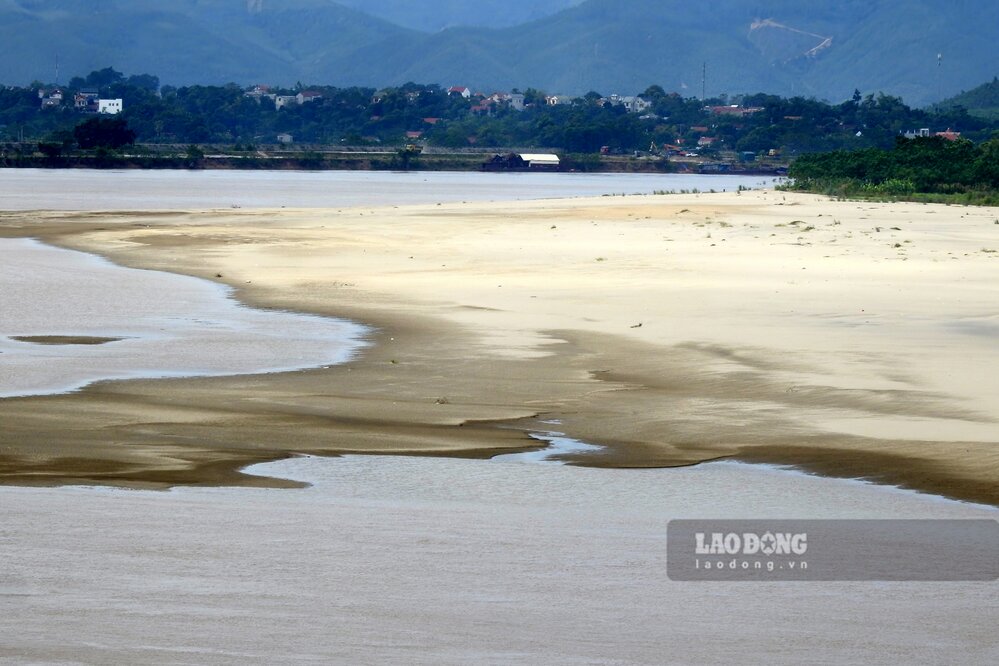
When the water recedes, giant sand dunes and alluvial plains appear in the middle of the river. In the alluvial plains along the river, people have cleared, improved the land and planted short-term crops. ferry terminals and ferries across the river also operate more stably and safely.
The National Center for Hydro-Meteorological Forecasting's short-term hydrological forecast and warning bulletin on October 22 showed that at 7:00 a.m. on October 22, the water level on the Thao River at Yen Bai station (now in Lao Cai province) was at 26.19 m (34.39 m at 11:00 a.m. on September 30); at Phu Tho station, at 7:00 a.m. on October 22, it was 13.57 m (13.58 m at 1:00 p.m. on September 30).
In the 5 days from October 21 to 25, the water level of the Thao River at Yen Bai station and Phu Tho station is forecast to continue to change slowly.

In the long term, from November 2025 to January 2026, the season bulletin forecasts that the water level on the main rivers in the North will change with a downward trend, the downstream of the Red River - Thai Binh will fluctuate and be affected by tides. The flow on the Thao River, the Lo River and the downstream of the Red River, on the Cau River is generally approximately equal to and is 5-10% higher than the average of many years.
From February 2026 to April 2026, the flow on Thao and Lo rivers is forecast to be 5-10% lower than the average of many years.