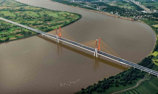
According to the General Planning orientation of the Capital (adjusted), Hanoi City will build 7 more bridges over the Red River including: Lien Trung, Tam Xa, An Duong, Ngoc Thuy, Cu Khoi, Bat Trang and Khuyen Luong. Along with existing bridges and 4 bridges that have started construction in 2025 (Tran Hung Dao, Tu Lien, Ngoc Hoi, Thuong Cat), the total number of Red River overpasses through the central urban area will be increased to 21 bridges.
A representative of the Hanoi Department of Planning and Architecture said that the capital - the national political and administrative center, and also the locomotive of culture, economy and international integration - is entering a new stage of development, aiming to become a "Cultural City - Civilized - Modern". To realize this goal, Hanoi is implementing many breakthroughs in urban planning and infrastructure development, using a new planning map as a tool to create development momentum.
Accordingly, the planning of the new capital period inherits the strategic orientation from the General Planning in 2011, and is adjusted to suit the current context and overcome existing shortcomings. Key strategies are set out to promote green growth, digital transformation, climate change response and smart urban development.
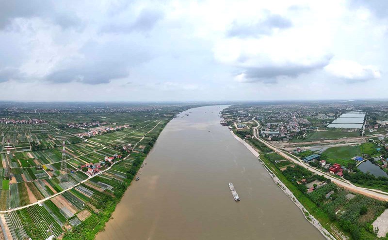
Hanoi will develop according to a multi-center model, using traffic as a framework infrastructure, prioritizing the beltway system, highways and especially the Red River and Duong River overpasses to strengthen regional connectivity.
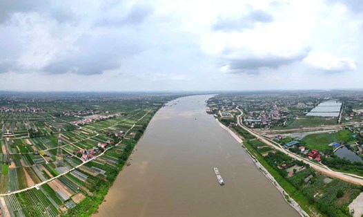
According to Mr. Dao Minh Tam - Deputy Director of the Hanoi Department of Planning and Architecture, the biggest breakthrough in the new planning is the location of the Red River as a green axis, a central landscape axis and a development symbol of the capital.
The Red River is not only a landscape axis but also a space for the development of modern services, culture, science and technology and urban architecture.
The space on both sides of the river is divided into three main sections: Central area (from Thang Long bridge to Thanh Tri bridge): Forming a cultural, entertainment, and service space; creating a landscape highlight. Western area (from Thang Long bridge and above): Development of ecological space, theme parks, urban agriculture and eco-tourism. Southern area (from Thanh Tri bridge down): Developing agricultural areas, traditional craft villages, aquaculture combined with trade - services.
A representative of the Department of Planning and Architecture said that the exploitation and development of the Red River space has been planned for a long time, but lacks resources for implementation. This adjustment of the planning is concretized by synchronous works and projects on both sides of the river, in which the strengthening of the bridge system is a key solution to ensure connection and balanced development between the two banks.
Hanoi also prioritizes investment in bridges located on beltways (2.5 and 4) to close the traffic system, reducing the load on the inner city. At the same time, areas on both sides of the river such as Long Bien, Gia Lam, Dong Anh will be planned to become new compact urban areas and service administrative areas of the capital.
Along with developing technical infrastructure, Hanoi focuses on urban beautification, heritage conservation and improving the living environment, towards a "green - clean - beautiful - safe" capital. The capital is changing strongly, making the Red River a central symbol, harmoniously connecting the thousand-year tradition of culture and the stature of a modern global city, said a representative of the Hanoi Department of Planning and Architecture.