On the afternoon of December 3, thunderstorms appeared widely in Ho Chi Minh City such as Xuan Hoa ward, Ban Co ward, Saigon ward, Ben Thanh ward...
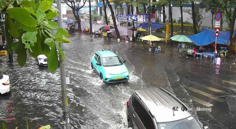
Some roads such as Quoc Huong, Nguyen Duy Trinh... were flooded due to heavy rain.
In the next 3-4 hours, these convective cloud pockets will continue to cause showers and thunderstorms in the above area, then may expand to neighboring areas. During thunderstorms, there is a possibility of tornadoes, lightning, hail and strong gusts of wind, flash floods on small rivers and streams, landslides on steep slopes.
Weather forecast for the next 24-48 hours, the continental cold high pressure will continue to strengthen in the North and North Central regions. The tropical depression weakened into a low pressure area and entered the sea area of Dak Lak - Khanh Hoa province.
The subtropical high pressure has an axis through the North Central region and tends to encroach on the West, weakly disturbing the East wind in the Southern region. In the southern seas, the Northeast wind will gradually strengthen.
Weather forecast for the next 3-10 days, the continental cold high pressure will continue to strengthen, then stabilize and gradually weaken; from around December 7-8, the continental cold high pressure is likely to strengthen and shift to the east again.
The subtropical high pressure will encroach on the West after stable activity. In addition, from around December 7-9, the tropical depression in the eastern sea of the Central Phiplippin is likely to enter the East Sea and strengthen into a storm.
Therefore, the Southern region should be on guard against thunderstorms accompanied by dangerous weather phenomena such as tornadoes and strong gusts of wind affecting agricultural production, breaking trees, damaging houses, traffic works, and infrastructure.


