These projects are identified in the Political Report of the 1st Ho Chi Minh City Party Congress, term 2025 - 2030, to create a breakthrough in transport infrastructure, reduce congestion and enhance inter-regional connectivity.
Nguyen Khoi Bridge and Road
Nguyen Khoi Bridge and Road is expected to start construction in November 2025 and be completed in the fourth quarter of 2027, with a total investment of more than VND 3,724 billion.
The project includes a concrete overpass system, over 2.5 km long, 6.5 - 25.5 m wide, crossing Te Canal and Ben Nghe Canal, connecting District 7 (formerly) through District 1 (formerly).
The project also includes a 1.1 km long bridgehead, Nguyen Khoi and Hoang Trong Mau service routes and the expansion of Vo Van Kiet Street towards Ben Nghe Canal.
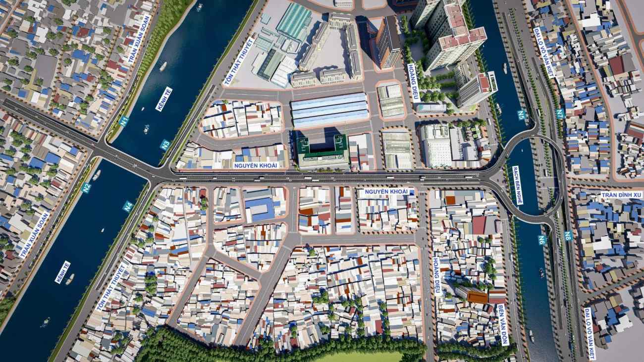
When put into operation, Nguyen Khoi Bridge and Road will allow vehicles to move from the South to the center via overpass, reducing the load on Nguyen Huu Tho - Kenh Te Bridge, Duong Ba Trac, Nguyen Tat Thanh routes.
Binh Tien Bridge and Road
Long 3.66 km, of which the elevated overpass is 3.1 km long, 4 - 6 lanes wide, the Binh Tien bridge starts from Pham Van Chi street (formerly District 6), crosses Tau Hu canal, Doi canal, connects to Nguyen Van Linh Avenue.
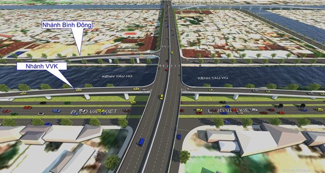
The total investment capital is nearly 6,300 billion VND. Ho Chi Minh City will approve the compensation and resettlement plan in December 2025, start construction in 2026 and complete in 2028.
Binh Tien Bridge and Road will create a new traffic axis connecting the city center with the South.
Thu Thiem 4 Bridge
Thu Thiem 4 Bridge has a total length of 2.16 km (the main bridge section is more than 1.6 km), with a scale of 6 lanes. The route starts from the Tan Thuan 2 - Nguyen Van Linh bridge intersection, crosses the Saigon River to the Thu Thiem New Urban Area.
This project has been delayed many times to submit to the Ho Chi Minh City People's Council for approval of the investment policy due to the lack of consensus on the bridge clearance plan.
Previously, 5 options were proposed, including clearance of 10 m, 15 m, 45 m, raising - decreasing the span from 15 to 45 m and a tunnel across the Saigon River, with a total investment of 4,365 to 8,953 billion VND.
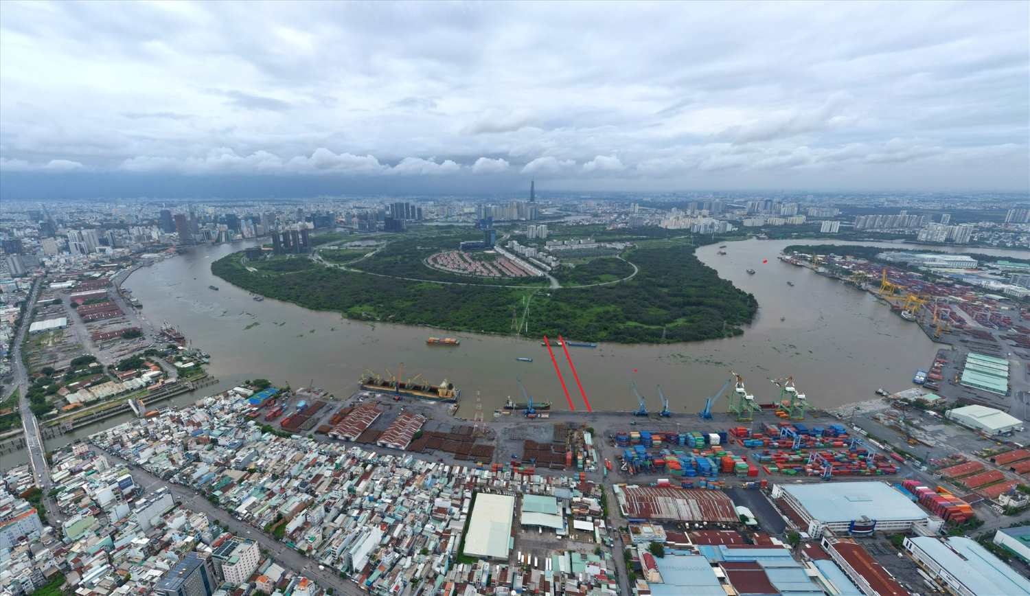
Recently, the Ho Chi Minh City People's Committee has issued a document recommending the Ministry of Construction to give opinions on the clearance design. The city aims to submit for approval this year and complete the project by 2028.
The project will shorten travel time between the East and the South, reducing congestion on the routes Ton Duc Thang, Nguyen Tat Thanh, Huynh Tan Phat, Nguyen Van Linh and Khanh Hoi Bridge.
Can Gio Bridge
Can Gio Bridge is 7.3 km long, of which the main bridge is nearly 3 km long, the approach road is 4.3 km long, designed with 6 lanes (4 car lanes, 2 mixed lanes), designed speed of 60 km/h, clearance for boat cruising 55 m.
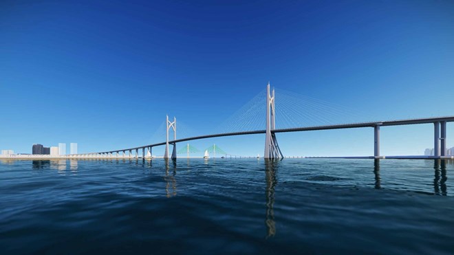
The total investment capital of the project is about 10,569 billion VND, expected to be approved in 2025, started in 2026 and completed in 2028.
The project will replace Binh Khanh ferry, shortening travel time between the center of Ho Chi Minh City and Can Gio district.
Cat Lai Bridge
Currently, the connection between Ho Chi Minh City and Nhon Trach (Dong Nai) mainly depends on Cat Lai ferry. Every day, tens of thousands of people and vehicles have to wait for the ferry if they do not want to go around National Highway 51 or the Ho Chi Minh City - Long Thanh - Dau Giay Expressway (which is only for cars).
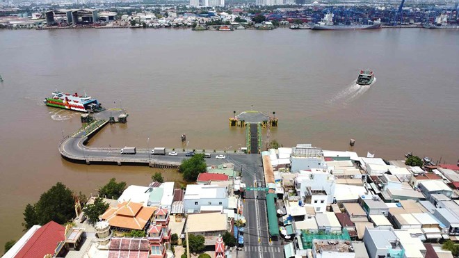
This situation affects the transportation of goods between Nhon Trach industrial parks and seaport systems such as Cat Lai, Cai Mep - Thi Vai.
Cat Lai Bridge will be built to replace it, with a scale of 8 lanes, a total length of 11.4 km (including the bridge and approach road), and a total investment of nearly 20,000 billion VND.
The project aims to start construction in 2026 and be completed in 2028.
Phu My 2 Bridge
With a total preliminary investment of VND 21,484 billion, of which the cost of site clearance is about VND 6,250 billion, Phu My 2 bridge has a total length of 16.7 km, with a scale of 8 lanes.
The route starts from Nguyen Huu Tho Street, goes east, connects with Hoang Quoc Viet - Dao Tri, crosses the Dong Nai River and connects to Lien Cang - 25C Street (Dong Nai).
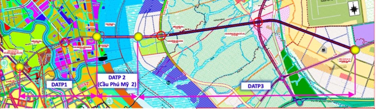
Phu My 2 Bridge helps connect the South Saigon urban area with Long Thanh airport, forming a modern inter-regional transport network.