According to the bulletin of the Dong Thap Hydrometeorological Station, the water level in the Thap Muoi inland area of the province has reached its peak and has begun to decrease slowly, but is still at a high level.
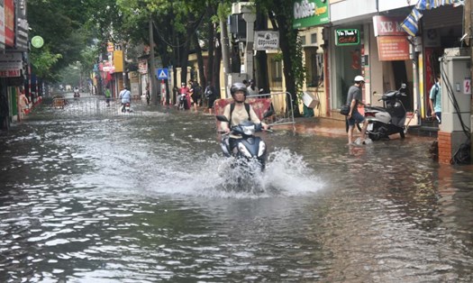
As of 7:00 a.m. on October 28, the highest water level measured at Truong Xuan station was 263 cm, 13 cm above alert level III, and 183 cm above alert level III at Hau My Bac station.
It is forecasted that the water level in the Thap Muoi inland area will decrease slowly and fluctuate at the level of alert level III in the next few days. Floods in this area continue to be at a dangerous level because in the next few days, there is still a possibility of moderate to heavy rain in the late afternoon, increasing the level of flooding
The flooding scope will occur in low-lying areas, riverside areas, areas outside the dike, and in the Thap Muoi fields, causing widespread flooding such as: Truong Xuan commune, Thap Muoi commune, Phuong Thinh commune, Hau My commune etc. The flooding period will last until mid-November 2025. The maximum flooding depth is from 1.0 - 1.6 m. Flooding and landslides in low-lying areas, vulnerable areas, along rivers, outside dykes threaten areas with low and weak dykes, negatively affecting production, transportation, daily life, property damage and socio-economic activities in the area.
The Southern Institute of Water Resources Research stated that it is forecasted that the water level in the upstream of the Mekong Delta in November 2025 will tend to increase and decrease gradually. The water level in the Cai Lon - Cai Be irrigation system is mainly affected by high tides and inland rain along with upstream floodwater, slowing down drainage, high risk of flooding. The largest water level of the month is forecast at the stations at 0.70 - 1.2m, the water level tends to be high in the area along the main river, gradually decreasing towards the area far from the main river and in the fields. The largest water level in the downstream of Cai Lon culvert is forecast to be from 1.25 - 1.29m, in the downstream of Cai Be culvert from 1.21 - 1.25m, appearing during the high tide in early November 2025 from November 7-10, 2025.
The Southern Institute of Water Resources Research forecasts that flooding may occur in coastal areas of the West and along the Cai Lon River in Tay Yen, An Bien, Binh An communes of An Giang province due to unsecured infrastructure. If there is heavy rain, the southwest monsoon will be active and coincide with the high tide from November 7-10, 2025. Inner-field areas affected by upstream flood water and in-field rain such as Binh Hoa, Go Quao, Long Thanh, Vinh Hoa Hung communes in An Giang province, Hong Dan commune, Vinh Loc in Ca Mau province, Vinh Yen commune, Vinh Thuan Dong in Can Tho city have high water levels and can cause local flooding.
The Southern Institute of Water Resources Science also recommends that the operation of Cai Lon, Cai Be, and Xeo Ro sluices must be flexible in terms of time and number of valves for the above 3 sluices to control the tide, supporting drainage for the system during the high tide period from November 7-10, 2025.
Specifically, Cai Lon culvert will operate with a maximum of 7.9/11 valve gates closed, 11/11 valve gates open from November 7 to 10, 2025.
For Cai Be culvert, it will be closed and 2/2 of the valve gates will be opened from November 7 to 10, 2025. As for Xeo Ro culvert, it will be closed/opened according to local requirements.
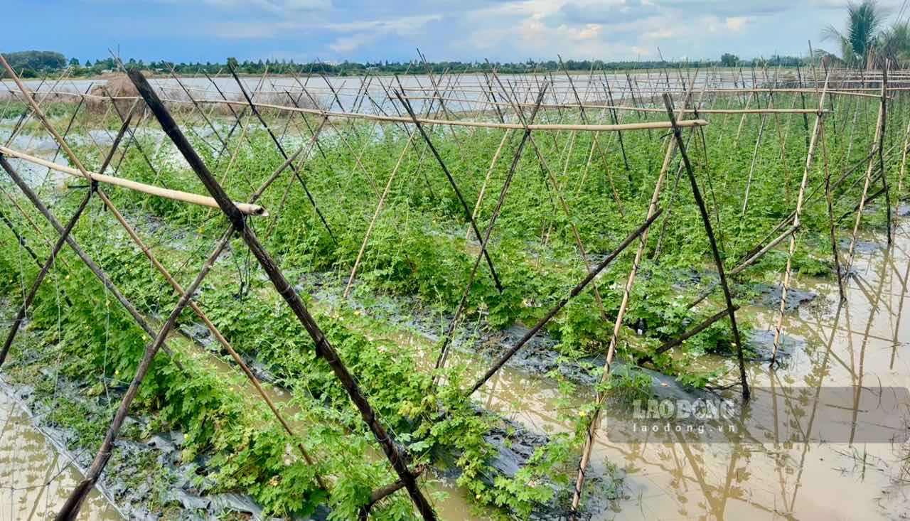
According to the report of the Department of Agriculture and Environment of Dong Thap province, the flood peak combined with the high tide peak in 2025 has affected the lives and production of people in the province. According to preliminary statistics, the whole province of Dong Thap has 25/102 communes and wards directly affected. Specifically, the water overflowed many embankments, breaking a section of the dike in Thanh Loi 6 Pumping Station (Truong Xuan Commune); the embankment on the East bank of Canal 5 Phuoc in Hamlet 2A (Phuong Thinh Commune) broke for a section of about 12m and broke a total of 296m of many embankments in Tan Bung B, Tan An, Tan Bung A, Tan Luong B and Tan Thien Hamlets of Hiep Duc Commune... rain, floods and high tides have flooded many houses and infrastructure, completely damaged 11 hectares of crops and 361 hectares of rice fields that have just been planted; damaged (30 70%) 570.5 hectares of fruit trees, 7,960 hectares of fish ponds with total preliminary damage of about 21.83 billion VND. In addition, floods also caused 3 landslides on the Tien River with a total landslide length of 63 m, a total landslide area of 682 m2, collapsing 1 house, affecting 16 households and some crops.