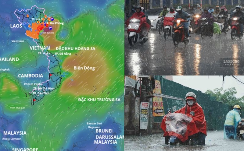
The 8:30 a.m. bulletin on July 22 of the Thanh Hoa Hydrometeorological Station said that due to the impact of storm No. 3, in Thanh Hoa, there were strong winds of level 5, level 6, gusting to level 6, level 7. The whole province will have heavy to very heavy rain; total rainfall from 07:00 on July 21 to 07:00 on July 22 at KTTV stations in mountainous areas is generally from 50 - 120mm, coastal plain areas from 100 - 190mm, some places are higher such as: Nga Son Economic Zone 336.9mm, Sam Son Economic Zone 229mm.
At 07:00 on July 22, the center of the storm was at about 20.2 degrees North latitude; 106.7 degrees East longitude, in the coastal waters of Hai Phong - Ninh Binh. The strongest wind near the storm center is level 9 (75-88km/h), gusting to level 12; moving in the West Southwest direction at a speed of about 15km/h.
The warning level of natural disaster risk due to storms in Thanh Hoa area is assessed at level 3; the risk due to heavy rain is level 1. The risk of flash floods, landslides in mountainous areas and flooding in low-lying areas and urban areas is very high.
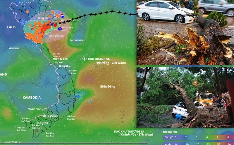
It is forecasted that by the morning of July 23, the storm will weaken into a low pressure area when moving to the Upper Laos area, but the circulation after the storm will continue to cause heavy rain in Thanh Hoa in the next 1-2 days.

According to the Thanh Hoa Hydrometeorological Station, coastal mainland areas during storms are extremely dangerous and unsafe for any vehicles or works operating in dangerous areas such as: Tourist boats, passenger ships, transport ships, cages, rafts, aquaculture areas, dykes, embankments, coastal roads. Vehicles are likely to overturn, be destroyed, and be flooded due to strong winds, thunderstorms, whirlwinds, large waves, and rising sea levels. On land, strong winds can cause trees, electric poles to fall, and roofs to be blown off.
Due to the influence of the tropical convergence zone with an axis passing through the Northern region with the activity of storm 3 (WIPHA), Thanh Hoa area will have heavy to very heavy rain and thunderstorms from July 22 to July 24. with total rainfall in the mountainous areas of the North and Northwest: 100 - 200mm, some places over 200mm, the mountainous areas of the West, Southwest and coastal plains from 150 - 250mm, some places over 250mm.
Heavy rain can be accompanied by thunderstorms, tornadoes, lightning, hail and strong gusts of wind that break trees, damage houses, traffic works and infrastructure, cause flooding of crops, make the soil saturated with water, or cause trees to fall, causing damage to the crop.
Heavy rain will also overload the urban drainage system, causing flooding in residential areas, traffic congestion due to flooding and reducing visibility when driving, causing slippery traffic and traffic accidents.