On September 9, one day after super typhoon No. 3 ended its devastation of many northern localities, there were too many hot, heartbreaking events related to people's safety.
The first was the sudden collapse of Phong Chau bridge in Phung Nguyen commune, Lam Thao district, Phu Tho province, causing many moving vehicles to fall into the river (1 truck, 2 tractor-trailers, 6 motorbikes, 1 electric motorbike); 8 people were missing; 3 injured people were rescued and taken to the emergency room at a medical facility.
This can be considered a rare incident in the Vietnamese road and bridge industry over the past several decades.
According to the report of the People's Committee of Phu Tho province, the cause of the bridge collapse was due to the impact of storm No. 3, the flood water on Thao River (Red River) rose very high, flowing rapidly...
Next, a landslide in Cao Bang swept a passenger bus carrying 20 people (including the driver) into the river. Search and rescue teams found 4 bodies.
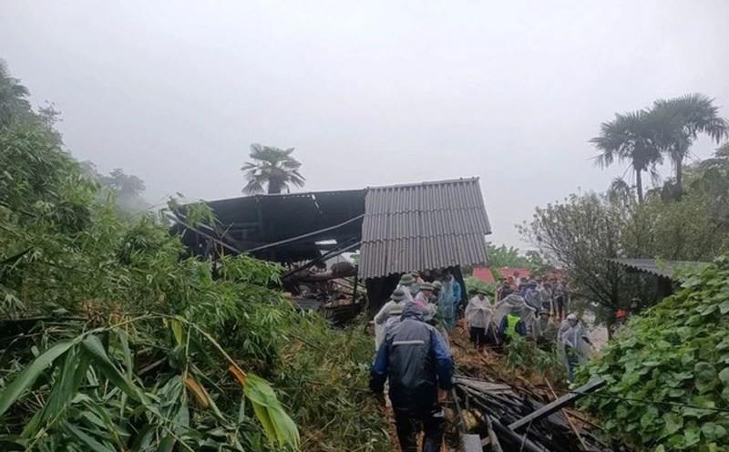
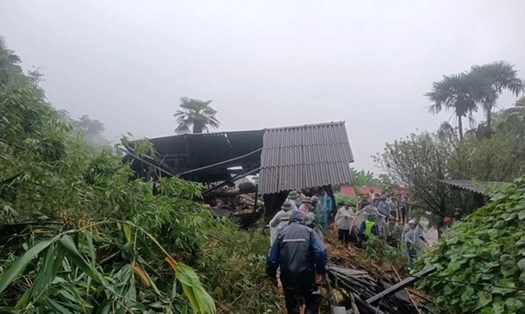
In Lao Cai, there were 3 consecutive landslides in 3 different localities in one day, causing many deaths and missing people...
After storms, there are often prolonged heavy rains that cause widespread flooding, whether in the plains or in the mountains, and this is the most dangerous time, causing heavy damage to people and property.
Now, whenever there is heavy rain, flooding and landslides occur from the mountains to the plains. The causes such as extreme weather, deforestation, and unreasonable planning have been mentioned many times, so there is no need to discuss them further.
What is worth mentioning now is that there is still a subjective mentality and a "relaxed" state of the people as well as local leaders after days and nights of straining to mobilize all resources to fight the storm.
In addition, storm prevention work can be conducted by command, requiring people to "self-manage on the spot". But to prevent floods, especially landslides, there needs to be flood warning maps, landslide maps, along with barriers, signs... so that people can proactively take precautions.
These maps need to be published, publicized and preventive measures taken before each storm season, instead of waiting until an incident or loss occurs. Unfortunately, not all "at risk" localities currently have these maps.
“There is a great need for a system to analyze hazards and risks based on natural disaster mapping and planning of dangerous areas. From there, this map will be brought to each locality to promptly warn people,” Professor Ta Hoa Phuong, Chairman of the Vietnam Paleontology and Stratigraphy Association, said in Lao Dong Newspaper in July 2024, when the most serious landslide occurred in Yen Dinh commune (Bac Me district, Ha Giang province), killing 11 people and injuring 4 others.
Up to this point, that proposal is still just a "very necessary" thing for many localities, and has not yet become a reality.
The danger from natural disasters is unpredictable. However, the damage from natural disasters can be reduced and avoided if there is proper preparation and a non-subjective mentality in any situation!