According to new storm news from the National Center for Hydro-Meteorological Forecasting, by 10:00 a.m. on November 6, storm No. 13 Kalmaegi was only more than 330km east-southeast of Quy Nhon (Gia Lai).
The strongest wind near the storm center is level 14 (150-166km/h), gusting to level 17.
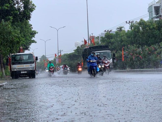
Today, the storm began to directly affect the weather in provinces and cities from Hue to Khanh Hoa, causing thunderstorms and strong gusts of wind on the mainland.
It is forecasted that in the next 3 hours, the storm will move in a West-Northwest direction, at a speed of about 30km/h.
It is forecasted that by 10:00 p.m. today, November 6, storm No. 13 Kalmaegi will enter the sea area of Quang Ngai - Dak Lak, maintaining speed and intensity.
The storm is forecast to make landfall in the Central region of Vietnam around the night of November 6 and the early morning of November 7.
Due to the impact of storm No. 13, on November 5, the Central and Southern regions will have some places with heavy rain. Rainfall from 7am to 8pm on November 5 was over 50mm in some places such as: Thuan An station (Hue city) 81.6mm, Gia Huynh station (Lam Dong) 102.8mm, Ho Nui Nhan station (Ho Chi Minh city) 62mm...
It is forecasted that from November 6 to the end of November 7, the area from Da Nang to Dak Lak will have very heavy rain with common rainfall of 200-400mm, locally over 600mm. The area from South Quang Tri to Hue City, Khanh Hoa and Lam Dong will have heavy to very heavy rain with common rainfall of 150-300mm, locally over 450mm.
On November 7, the area from Nghe An to North Quang Tri will have moderate rain, heavy rain, locally very heavy rain with common rainfall of 20-50mm, locally over 80mm.
In addition, in the late afternoon and evening of November 6, in the southern part of the Central and Southern Plateau, there will be scattered showers and thunderstorms with rainfall of 15-30mm, locally heavy rain over 70mm.
People and tourists should be on guard during thunderstorms with the possibility of tornadoes, lightning, hail and strong gusts of wind. Localized heavy rains are likely to cause flash floods on small rivers and streams, landslides on steep slopes and flooding in low-lying areas.
From the night of November 7-8, the area from Thanh Hoa to North Quang Tri will have moderate rain, heavy rain with common rainfall of 50-100mm, locally very heavy rain over 200mm.
From November 8, heavy rain in the above areas will gradually decrease.
Warning level of natural disaster risk due to heavy rain: level 1, especially in the area from Da Nang to Dak Lak level 2.
Heavy rain can cause flooding in low-lying areas, urban areas, industrial parks, flash floods on small rivers and streams, and landslides on steep slopes.
On November 6, floods on the Huong River continued to decrease and remained below alert level 2 (BD2), the Bo River flood continued to decrease and remain above level 2.
Warning from November 6-9, on rivers from Quang Tri to Lam Dong, there is a possibility of a flood. During this flood, the flood peak on the Bo River, Huong River (Hue City); Vu Gia - Thu Bon River (Da Nang City); Tra Khuc River, Ve River, Se San River (Quang Ngai); Kon River (Gia Lai); Ba River, Ky Lo River, crepok River (Dak Lak) will increase to level BD2-BD3 and above level 3; Kien Giang River (Quang Tri); An Lao River, Lai Giang River (Gia Lai); Dinh Ninh Hoa River (Khanh Hoa), rivers in Lam Dong will increase above level 2; Gianh River, Thach Han River (Quang Tri), Cai Nha Trang River (Khanh Hoa) will increase above level 1.
Flooding risk in low-lying areas along rivers, urban areas, and residential areas in provinces/cities from Quang Tri to Lam Dong. There is a high risk of flash floods on rivers and streams and landslides on steep slopes of provinces/cities from Quang Tri to Lam Dong.
People and tourists should pay attention to weather forecasts and proactively respond to situations that may arise when storms and floods occur. Avoid going out when not necessary and follow local instructions to ensure safety.


