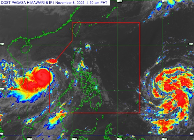
According to the latest storm information from the Joint Typhoon Warning Center (JTWC), the tropical depression has officially strengthened into a tropical storm - the predecessor of Typhoon No. 14 Fung-wong (Japan's Typhoon No. 26, Typhoon Uwan in the Philippines) currently located about 307 km east of Yap Island, moving west-northwest at a speed of 22 km/h. The highest waves were recorded at about 4.6 m.
Typhoon Fung-wong is forecast to quickly enter a stable development stage as it continues to move west-northwest.
Notably, the storm does not follow the trajectory of Typhoon No. 13 Kalmaegi through the central Philippines but tends to head towards Aurora, northeast of Luzon Island.
In the next 30 hours, the tropical depression is expected to strengthen into a storm and cross the line of 130 degrees East with very strong winds.
However, about 12 hours before making landfall in the Philippines for the first time, the strong northeast wind will cause the storm to ease slightly, falling below the threshold of 185 km/h.
In further forecasts, after passing Luzon and moving into the western Taiwan Strait, Typhoon Fung-wong is expected to change direction to the northeast and begin to weaken as it approaches Taiwan (China).
In the short term, strong winds along the southern edge of the storm's eye are dangerously approaching Yap Island. The atmospheric environment ahead is very favorable for storms to continue to strengthen at a stable rate, and may even intensify rapidly.
According to the storm forecast from the Philippine Meteorological Agency (PAGASA), tropical storm Fung-wong has the strongest winds of 65 km/h, gusting to 80 km/h.
Although the forecast for the coming days is still uncertain, the likelihood of the storm making landfall in Northern or Central Luzon of the Philippines on Monday, November 10 is increasing.
The storm is likely to strengthen very quickly, reaching strong typhoon level tomorrow and even super typhoon level on Saturday. The possibility of the storm making landfall when it is approaching its peak intensity is entirely possible.
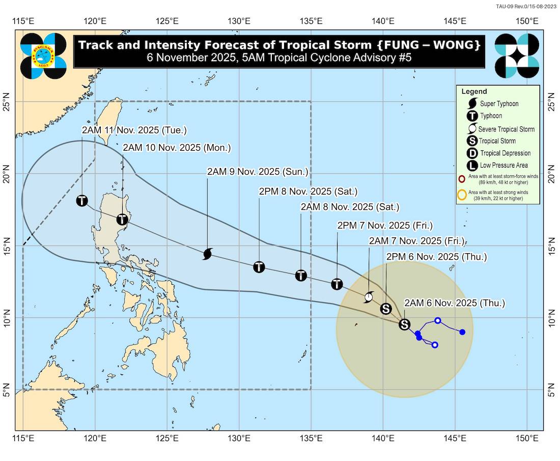
In general, international forecast models still maintain the view that the storm will maintain high intensity for the first 3 days. All models predict the storm will peak in the next 72 to 96 hours.
PAGASA recommends that people and tourists continuously update information as the storm is likely to rapidly strengthen and change trajectory.
Limit travel to Luzon (especially Aurora province) in the coming days, as the storm is forecast to reach very strong intensity as it approaches the shore.
Closely monitor announcements from airports and airlines. Some flights to or from Manila, Clark or airports north of Luzon may be delayed or canceled during the intensification period and before landfall.
Be careful when going to sea or participating in outdoor activities in the Yap and the sea area east of the Philippines, as waves 4-5 m high and strong winds can be dangerous.
If you plan to travel to Taiwan (China) in the coming days, it is important to note that the storm may change direction and affect the weather on this island when it approaches the Taiwan Strait.


