Typhoon Fung-wong, the storm that preceded Typhoon No. 14, is becoming a threat to the Philippines. The Philippine Atmospheric, Geophysical and Astronomical Services Administration (PAGASA) updated the path of Typhoon Fung-wong in detail from the range of influence, wind power to issuing warnings.
In addition, according to the AEM Group's weather forecast team in the US, La Nina is also expected to increase the number of storms and tropical depressions in the East Sea, in which the Philippines may experience 3-5 more storms from now until the end of the year, some of which are likely to affect Vietnam.
Every rainy and stormy season, weather reports become the focus of the audience's attention. Not only conveying forecast information, the way the news is presented on television also reflects the technological level, the level of visual experience and the leadership ability of the editors.
How to report storm news in Vietnam
In recent years, weather reports from VTV, VTC or HTV... have changed significantly, shifting from static expressing, many dry data to a more modern form, combining 3D simulation maps, multi-layered information charts and satellite images updated by the hour.
In the storm bulletins in Vietnam, the storm situation is simulated with 3D graphics, clear colors, illustrating strong winds, storm center, and heavy rain areas.
The editor stands in front of a large LED screen, interacting with the hand, directly on a real-time map, similar to the style of foreign contributors.
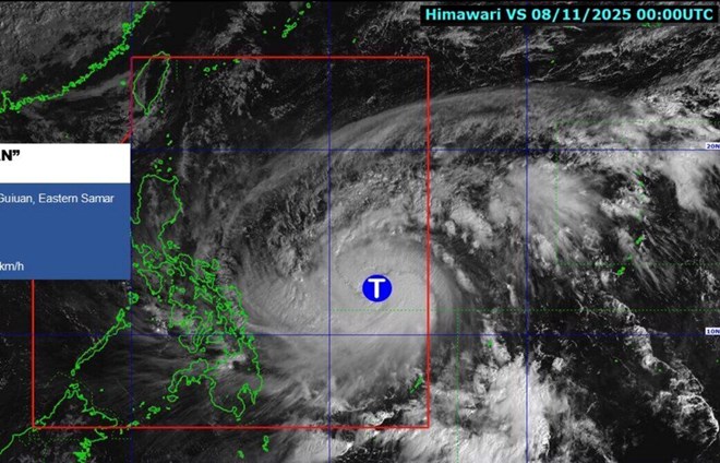
The bulletin also uses satellite images of Himawari right, updating convective clouds and storm circulation at each time frame.
Some newsletters have included models of the forecast path of 3 - 4 international models (ECMWF, GFS...) to help the audience have a multi-dimensional view.
The Vietnam Typhoon Newsletter still focuses heavily on safety warnings, possible damage, response instructions, and closely following community information tasks.
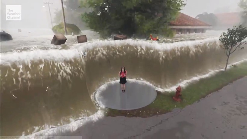
TV series Tung Thu of the Center for Weather and Natural Disaster Warning - Vietnam Television shared with Lao Dong reporter: "We created scenes of flooding, thunderstorms, fires, lightning right in the studio... Along with that, there was also visual noise. All of these settings are created using 3D technology - virtual studio.
The National Center for Hydro-Meteorological Forecasting also continuously updates radar maps, forecasting heavy rain every hour.
How to report storms in Japan and South Korea
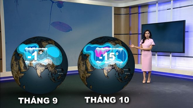
Meanwhile, Japanese stations are considered the regional standard for weather graphics. The strength is simulating storms in real 3D space, recreating cloud height, circulation structure, and eye circles of storms. AR - enhanced reality technology helps TVs stand in the middle of a "storm model", viewers see the wind, rain, and the rising water level virtual as real.
A detailed scientific chart explaining why storms are strong and how the atmosphere and ocean interact show that the Japan Weather bulletin focuses on meteorological education and helps people deeply understand the mechanism for natural disasters to form.
In addition, Japanese people can participate in natural disaster prevention simulation at the Ikebukuro Life Safety Learning Center and Yokohama Disaster Risk Reduction Learning Center.
KBS, SBS, MBC (Korea) are famous for their way of making newsletters that combine maps and strong effects.
The characteristic of the Korean typhoon bulletin is the graphics simulating the path of the typhoon, the effect of the wind and rain as real. Simulating the project, the city was affected in miniature 3D. The editor interacts with graphics such as touching virtual screens, pulling or enlarging real-time maps.


