According to the National Center for Hydro-Meteorological Forecasting, in the past 24 hours (from 9:00 a.m. on November 18 to 9:00 a.m. on November 19), the areas of Ha Tinh province/city and from Hue city to Khanh Hoa have had moderate rain, heavy rain to very heavy rain. Some points monitoring heavy rainfall such as Cau Treo 122mm (Ha Tinh); Rao Trang 4 Hydropower Dam 118.8mm (Hue City); Tra Kot 238.8mm (Da Nang City); Ba Dien 383.6mm (Quang Ngai); Van Canh 474mm (Gia Lai); Song Hinh 4 589.1mm (Dak Lak); Khanh Binh 285.5mm (Khanh Hoa)...
Soil moisture models show that some areas in the above provinces are nearly saturated (over 85%) or have reached a saturated state.
In the next 3 - 6 hours (from 9:40 a.m. on November 19), the above provinces/cities will continue to have rain with common accumulated rainfall as follows: Ha Tinh, Hue City 10 - 30mm, some places over 50mm; Da Nang City and Quang Ngai 20 - 40mm, some places over 80mm; Gia Lai and Khanh Hoa 50 - 100mm, some places over 180mm; Dak Lak 80 - 180mm, some places over 300mm.
In the next 6 hours (from 9:40 a.m. on November 19), there is a risk of flash floods on small rivers and streams, landslides on steep slopes in many communes/wards.
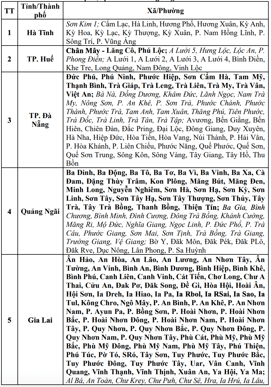
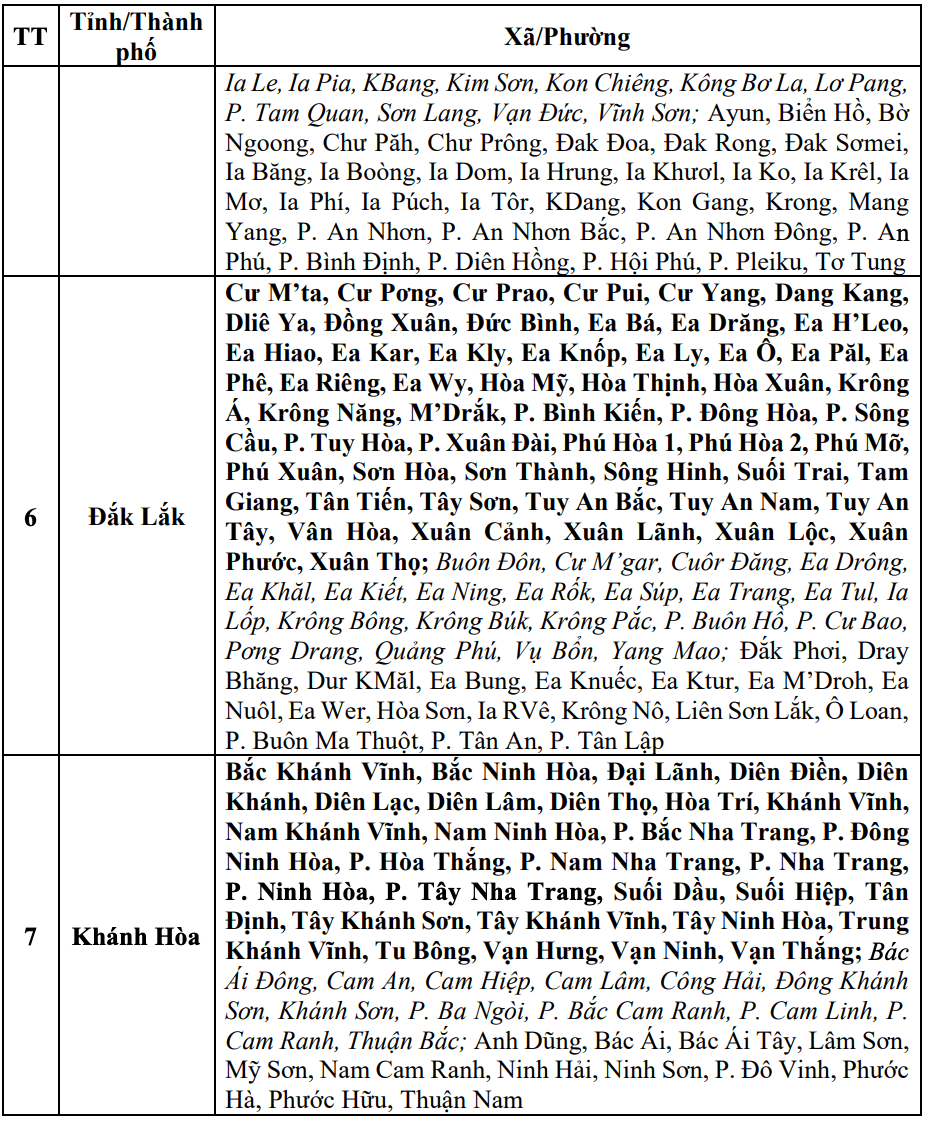
The meteorological agency warns that the risk of natural disasters due to flash floods, landslides, and land subsidence due to heavy rain or water flow is level 1; Da Nang City level 2; Dak Lak level 3.
Flash floods and landslides can have a very negative impact on the environment, threatening people's lives; causing local traffic congestion, affecting the movement of vehicles; destroying civil and economic works, causing damage to production activities and socio-economic activities.
The meteorological agency recommends that local authorities pay attention to reviewing bottlenecks and vulnerable locations in the area to take preventive and response measures.


