According to the National Center for Hydro-Meteorological Forecasting, due to the influence of the tropical depression, Quang Ha station has strong winds of level 6, gusting to level 9; Bach Long Vi station has strong winds of level 7, gusting to level 8; Co To station has strong winds of level 6, gusting to level 8, Cua Ong station has strong winds of level 6.
Early this morning (August 19), the tropical depression entered the mainland areas of Quang Ninh - Hai Phong provinces.
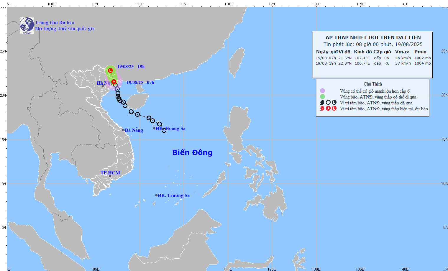
At 7:00 a.m. on August 19, the center of the tropical depression was at about 21.5 degrees north latitude; 107.1 degrees east longitude, in the mainland area of Quang Ninh - Hai Phong provinces. The strongest wind near the center of the tropical depression is level 6 (39 - 49km/h), gusting to level 8; moving north-northeast at a speed of about 15km/h.
It is forecasted that in the next 12 hours, the tropical depression will move north-northeast at a speed of about 15km/h and gradually weaken. At 7:00 p.m. on August 19, the center of the low pressure area was at about 22.8 degrees north latitude - 106.7 degrees east longitude; in the Vietnam - China border area; wind power below level 6.
The dangerous area is north of 20 degrees north latitude; west of 108.5 degrees east longitude. The natural disaster risk level is level 3 for the northern area of the Gulf of Tonkin (including the special zones of Bach Long Vi, Cat Hai, Co To and Van Don).
Regarding the impact of the tropical depression at sea, the northern area of the Gulf of Tonkin (including the special areas of Bach Long Vi, Cat Hai, Co To and Van Don) on August 19 will have thunderstorms and strong winds of level 6, gusts of level 8, waves 2 - 3.5m high, rough seas. Ship operating in the above-mentioned dangerous areas are likely to be affected by thunderstorms, whirlwinds, strong winds, and large waves.
On land, coastal areas of Quang Ninh and Hai Phong have strong winds of level 6, gusting to level 8.
On the day and night of August 19, the Northeast and Thanh Hoa will have moderate rain, heavy rain and thunderstorms with common rainfall of 40 - 70mm, locally very heavy rain over 150mm.