Storm No. 3 Wipha is about to cause heavy rain and strong winds in Hanoi, forecast for key communes and wards

NHÓM PV |

On the evening of July 21, the Northern Hydrometeorological Station issued detailed forecasts on the impact of storm No. 3 on communes and wards in Hanoi.

Regarding strong winds, according to the Northern Hydrometeorological Station, tomorrow and night (July 22), the northern and western areas of Hanoi city (including the forecast points: Bat Bat, Ba Vi, Son Tay, Xuan Mai, Hoa Lac, Quoc Oai, Hoai Duc, Soc Son) will gradually increase to level 4 - 5, gusting to level 6;

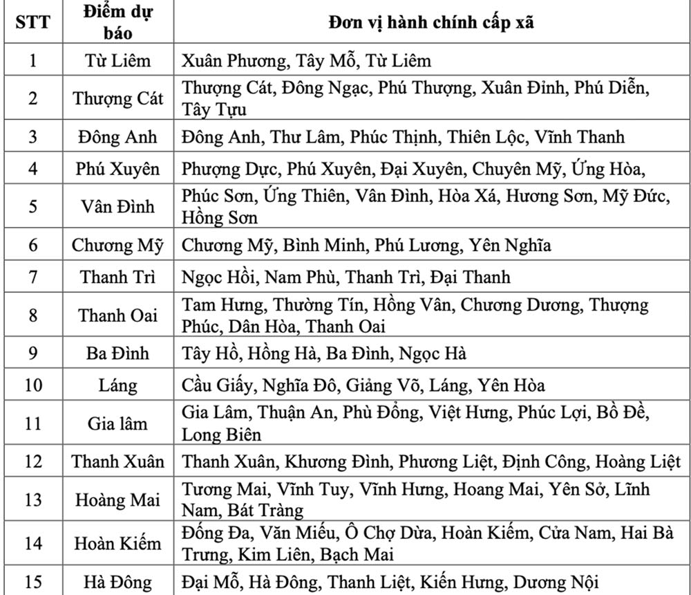
The southern and central areas of the city (including the forecast points: Tu Liem, Thuong Cat, Dong Anh, Phu Xuyen, Van Dinh, Chuong My, Thanh Tri, Thanh Oai, Ba Dinh, Lang, Gia Lam, Thanh Xuan, Hoang Mai, Hoan Kiem, Ha Dong) will gradually increase in winds to level 5, sometimes level 6, gusting to level 7 - 8.

Cac diem du bao gio manh (tu cap 6 tro len) tuong ung voi don vi hanh chinh cap xa. Anh: Chup man hinh
Strong wind forecast points (from level 6 and above) correspond to commune-level administrative units. Photo: Northern Hydrometeorological Station

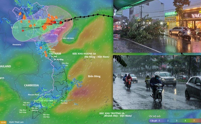
The meteorological agency of the North warned that strong winds will cause trees to fall, damage houses, traffic works and infrastructure, endangering human life.

The risk level of natural disasters due to storms for the southern and central areas of the city is level 3.

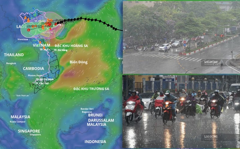
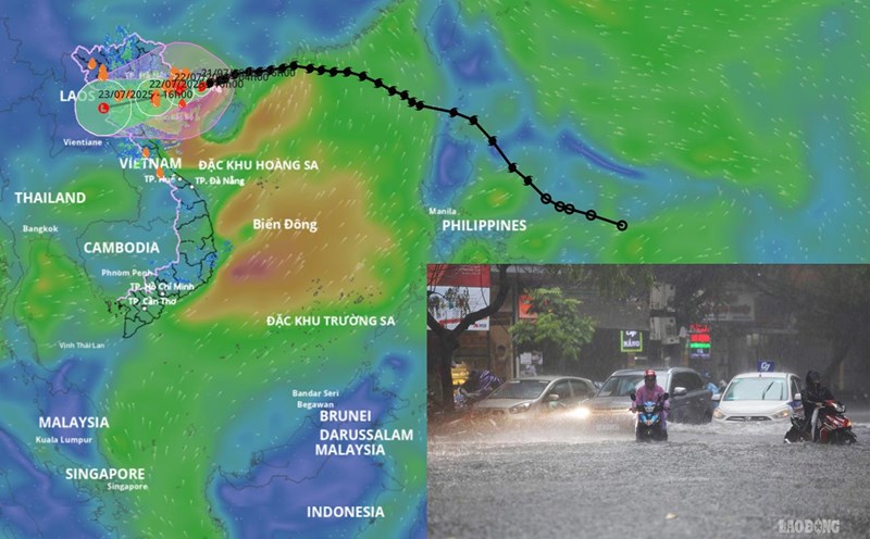
Regarding heavy rain, from tonight (July 21) to July 23, Hanoi will have moderate rain, heavy rain to very heavy rain and thunderstorms.

Luong mua pho bien tai cac xa, phuong. Anh: Chup man hinh
Rainfall is common in communes and wards when storm No. 3 makes landfall. Photo: Northern Hydrometeorological Station

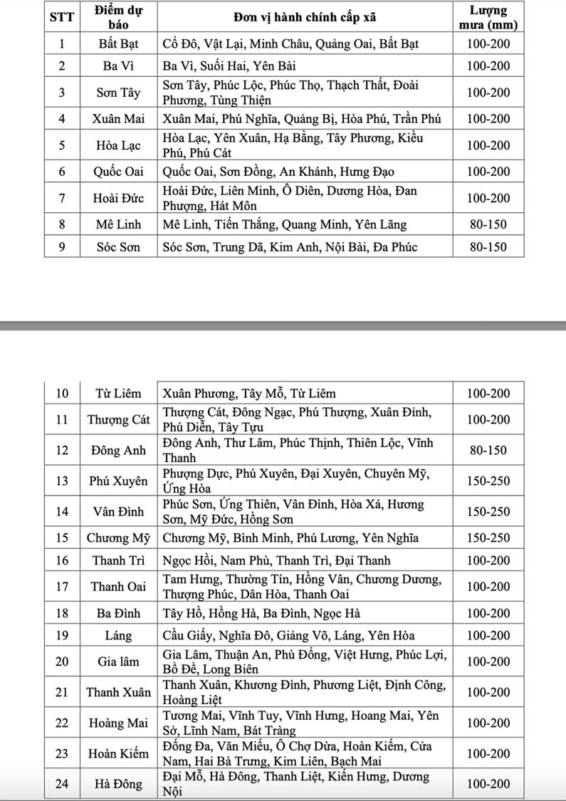
The northern area of the city (including the forecast points: Me Linh, Dong Anh, Soc Son) will have rain with rainfall of about 80 - 150mm, some places over 200mm.

The city center, the western and southern areas of the city (including the forecast points: Tu Liem, Thuong Cat, Phu Xuyen, Van Dinh, Chuong My, Thanh Tri, Thanh Oai, Ba Dinh, Lang, Gia Lam, Thanh Xuan, Hoang Mai, Hoan Kiem, Ha Dong Bat Bat, Ba Vi, Son Tay, Xuan Mai, Hoa Lac, Quoc Oai, Hoai Duc) will have common rainfall of 100 - 200mm, some places over 300mm.

Heavy rain can overload urban drainage systems, causing flooding in residential areas, traffic congestion due to flooding and reducing visibility when driving, causing slippery traffic and traffic accidents. In addition, thunderstorms can also be accompanied by tornadoes, lightning and strong gusts of wind that break trees, damage houses, traffic works and infrastructure.

The meteorological agency also warned that heavy rain in a short period of time can cause landslides in mountainous areas, causing flooding in urban areas and low-lying areas. The warning level of natural disaster risk due to heavy rain is level 1.

NHÓM PV
TIN LIÊN QUAN

Forecast of the time when storm No. 3 will make landfall and cause the heaviest rain in our mainland

|

On the evening of July 21, Mr. Mai Van Khiem - Director of the National Center for Hydro-Meteorological Forecasting provided the latest analysis and assessment information about storm No. 3.

Storm No. 3 Wipha causes heavy rain, strong gusts of wind up to level 8 in Hanoi

|

A representative of the Northern Hydrometeorological Station warned that storm No. 3 Wipha could cause strong gusts of wind up to level 8 in Hanoi from tomorrow afternoon, July wholeheartedly warning of dangerous winds during thunderstorms.

Tomorrow afternoon, storm No. 3 Wipha will make landfall in Hai Phong - Thanh Hoa

|

According to the meteorological agency, storm No. 3 Wipha is likely to make landfall in Hai Phong - Thanh Hoa at around 10:00 - 15:00 on July 22 with an intensity of about level 9 - 10, gusting to level 13.

Israeli tanks and infantry attack a city in central Gaza for the first time

|

Israeli tanks and infantry entered Deir Al-Balah after issuing evacuation orders, killing many people.

Deputy General Director Nha Nam: The company has restored Mr. Nguyen Nhat Anh's position

|

Mr. Vu Hoang Giang - Deputy General Director of Nha Nam Culture and Media Company - answered Lao Dong reporter about the incident related to Mr. Dang Hoang Giang.

Temporarily suspending the operation of Cat Bi and Van Don airports from 11pm on July 21 due to storm No. 3

|

The Civil Aviation Authority of Vietnam said that it will stop operating Cat Bi and Van Don airports from 11:00 p.m. tonight (July 21) to respond to storm No. 3 (Wipha).

Man wearing a motorbike taxi shirt snatches more than 100 lottery tickets for people with disabilities in Ho Chi Minh City

|

HCMC - A man wearing a motorbike taxi shirt has snatched more than 100 lottery tickets from a disabled person in Tang Nhon Phu ward.

Storm No. 3 Wipha causes heavy rain, strong gusts of wind up to level 8 in Hanoi

|

A representative of the Northern Hydrometeorological Station warned that storm No. 3 Wipha could cause strong gusts of wind up to level 8 in Hanoi from tomorrow afternoon, July wholeheartedly warning of dangerous winds during thunderstorms.

Forecast of the time when storm No. 3 will make landfall and cause the heaviest rain in our mainland

NHÓM PV |

On the evening of July 21, Mr. Mai Van Khiem - Director of the National Center for Hydro-Meteorological Forecasting provided the latest analysis and assessment information about storm No. 3.

Storm No. 3 Wipha causes heavy rain, strong gusts of wind up to level 8 in Hanoi

NHÓM PV |

A representative of the Northern Hydrometeorological Station warned that storm No. 3 Wipha could cause strong gusts of wind up to level 8 in Hanoi from tomorrow afternoon, July wholeheartedly warning of dangerous winds during thunderstorms.

Tomorrow afternoon, storm No. 3 Wipha will make landfall in Hai Phong - Thanh Hoa

AN AN - HOÀNG XUYẾN |

According to the meteorological agency, storm No. 3 Wipha is likely to make landfall in Hai Phong - Thanh Hoa at around 10:00 - 15:00 on July 22 with an intensity of about level 9 - 10, gusting to level 13.