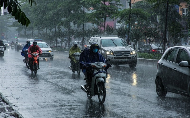
According to the National Center for Hydro-Meteorological Forecasting, from 4:00 a.m. to 7:00 a.m. on July 1, the areas of Son La, Tuyen Quang and Quang Ninh provinces had moderate to heavy rain such as: Muong leo (Son La) 81.6mm, Ban Ngo (Tuyen Quang) 116mm, Ky Thuong (Quang Ninh) 52.4mm...
Soil moisture models show that some areas in the above provinces are nearly saturated (over 85%) or have reached a saturated state.
In the next 3 - 6 hours (from 7:40 on July 1), the above provinces will continue to have rain with common accumulated rainfall from 30 - 50mm, some places over 90mm.
In the next 6 hours (from 7:40 am on 1.7), the risk of flash floods on small rivers and streams; landslides on the slopes in the above provinces, especially some communes/wards such as Bo Sinh, Chieng Khoong, Chieng Lao, Co Ma, Muong cling, Muong Gon, Muong La, Muong Lan, Muong Leo, Ngoc Chien, Sop Cop (Son La), Pa Vuc Xu; Machine, Du Gia, Hoang Su Phi, Kham Lung, Mushroom, Nghia Thuan, Po Ly Lord, Quan Ba, Quang Nguyen, Tan Tien, Tung Tung (Tuyen Quang); Binh Lieu, Special Zone Co To, Dam Ha, Dong Ngu, Duong Hoa, Ky Thuong, Luc Hon, Bai Chay Ward, Binh Khe Ward, Cao Xanh Ward, Ha Long Ward, Hoanh Bo Ward, Hong Gai Ward, Mong Duong Ward, Quang La, Quang Tan, Thong Nhat, Tien Yen (Quang Ninh).
The meteorological agency warns that the risk of natural disasters due to flash floods, landslides, and land subsidence due to heavy rain or water flow is level 1.
Flash floods and landslides can have serious impacts on the environment, threaten people's lives; cause local traffic congestion, affect the movement of vehicles; civil works and economic infrastructure, causing damage to production activities and social life.
The meteorological agency recommends that localities proactively review flow bottlenecks and vulnerable areas to take timely preventive and response measures.
Regarding the hydrological situation, the water level on the main rivers in the Red - Thai Binh river system fluctuates and is below alert level 1.
From now on July 1 to July 3, in the upper reaches of the Thao, Lo, Cau, Thuong and Luc Nam rivers, small rivers in the Northern region are likely to experience a flood, with a flood amplitude of 2 - 4m on the rivers.
During this flood, flood peaks on small rivers, upstream of Thao River, Lo River, and small rivers are likely to rise to alert level 1 - alert level 2, some rivers are above alert level 2, downstream of Thao River, Lo River are still below alert level 1. There is a high risk of flooding in low-lying areas along rivers, flash floods and landslides on steep slopes in the mountainous areas of the North.