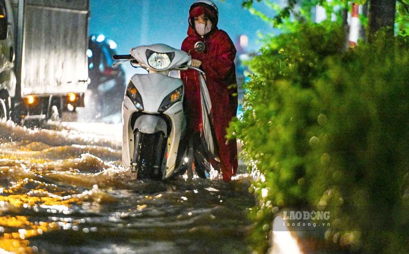
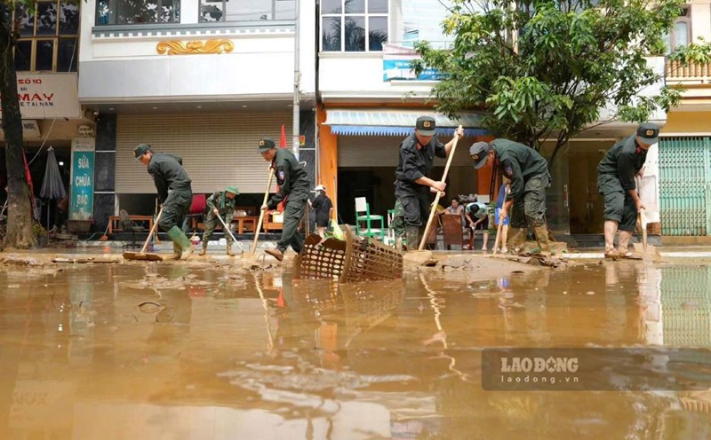
Up to now, some streets in Hanoi are still partially flooded after yesterday's heavy rain on September 30. The heavy rain is further clarified about the challenges in forecasting and warning of rain.
Reporter of Lao Dong Newspaper had an interview with Mr. Vo Van Hoa, Director of the Northern Hydrometeorological Station, on this issue.
Sir, how do you evaluate the amount of rain in Hanoi yesterday, whether it exceeded the 2008 record or not?
- The main cause of prolonged heavy rain in Hanoi on September 30 was the impact of the circulation of storm No. 10 (Bualoi). After weakening, the storm is still quite active in the Northeast region of Myanmar, combined with a stable subtropical high pressure system with strong intensity in the East.
The interaction of these two systems has created a wind field from the sea blowing in (South, Southeast) combined with the South wind on land, converging and carrying a large amount of moisture. This convergence process causes thunderstorms to continuously form and develop, causing prolonged heavy rain accompanied by thunderstorms and lightning.
According to observational data from the national network of Hydrometeorological stations, in the 24 hours of September 30, the rainfall in Hanoi was generally 70 - 200mm, some stations exceeded 200mm. In particular, Kim Anh station (Noi Bai area) recorded 319.4mm; the heaviest rainfall in 1 hour reached 101.4mm; the heaviest rainfall in 6 hours was 251mm.
The historic rainfall in 2008 (from the night of October 30 to 11pm on October 31), when the common rainfall was 200 - 300mm, locally very large such as Lang 391.2mm, Ha Dong 565mm, with the intensity of rainfall in 1 hour reaching 94.7mm and 6 hours reaching 288mm. Compared to the 2008 rain, the rain on September 30, 2025 did not surpass the record for total 24-hour rainfall.
However, the intensity of rainfall per hour and every 6 hours is very high, causing widespread flooding, greatly affecting people's lives.
Some people said they were passive before yesterday's flood in Hanoi because there was no previous warning of particularly heavy rain that could cause widespread flooding. What is your opinion?
- Since the morning of September 24, although Typhoon Bualoi is still very far east of the Philippines, the National Center for Hydro-Meteorological Forecasting has identified this as a strong, fast-moving and dangerous storm, and issued the first bulletin on the storm, predicting that the storm will enter the East Sea in about 72 hours.
By the morning of September 25, the "Storm News Near the East Sea" bulletin was issued, predicting that in the next 48 hours, the storm will enter the East Sea. With an average speed of about 35km/h, on the evening of September 26, the Center forecasted the impact of the storm on the wind in the seas near the mainland.
On the evening of September 26, when the storm entered the East Sea, the Center issued a "Emergency Storm News" bulletin, stating that in the next 48 hours, the storm is likely to directly affect the mainland.
The bulletin also warns of strong winds at sea, areas directly affected by land and widespread heavy rain. Specifically, from September 28 to 30, the North and the area from Thanh Hoa to Thua Thien Hue are likely to have widespread heavy rain, with total rainfall ranging from 100 - 300mm, in some places over 400mm; the Northern Delta and the Thanh Hoa - Ha Tinh region are generally 200 - 400mm, locally over 600mm. Subsequent news reports are continuously updated to closely follow actual developments.
Thus, there have been forecasts and warnings about heavy rain. However, the accurate forecast of rainfall in each period is information that people are interested in. With meteorological forecasting, is this difficult or not, sir?
- It is necessary to emphasize that accurate forecasting of rainfall at a specific point, in a specific period of time, is still a "difficult problem" not only for Vietnamese forecasting agencies but also for the world's leading forecasting centers.
Rain is formed from the complex process of atmospheric movement (convection, chaos, steam transportation, etc.), then stopping and forming water drops or ice, subjected to the impact of force to fall to the ground. However, during that process, the rain grains are simultaneously affected by the air flow, the surrounding environment and even partial evaporation.
Even if weather radar can monitor a thunderstorm system moving to a location, it is difficult to pinpoint the exact amount of rainfall. The reason is that large cloud systems often continuously form and regenerate small thunderstorms, causing rain to develop rapidly, abnormally and exceed the limit of quantity forecast.
Sincerely thank you!