The meteorological agency said there was warning information
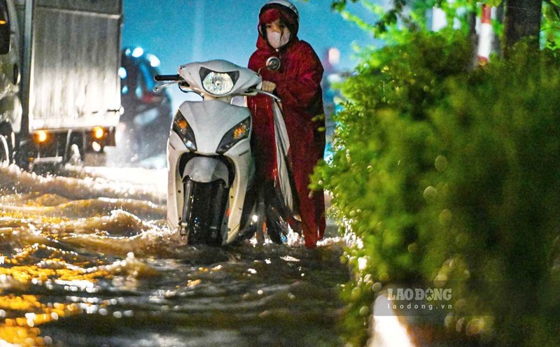
Yesterday, September 30, in Hanoi, there were continuous heavy rains causing many roads and streets to suddenly turn into rivers. The prolonged rain from morning to night made the water unable to recede, the sea of water was immense, traffic was paralyzed, cars and motorbikes stalled all over the road.
Many people had to wade through water for hours, getting stuck on congested roads, and walking dozens of kilometers to get home. The crisis is more serious than not being able to pick up their children from school after many hours of struggling.
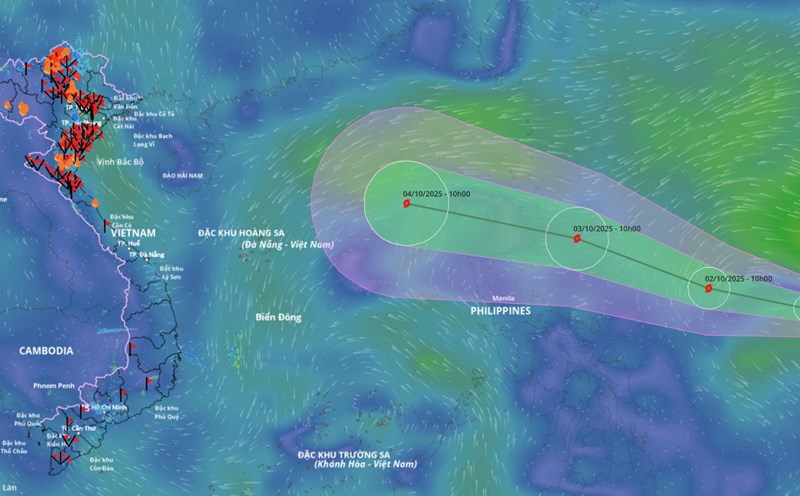
Although there was information predicting heavy rain due to the circulation of storm No. 10 Bualoi, many people said that they were passive in the face of yesterday's situation on September 30 in Hanoi because they could not imagine such a large and prolonged intensity of rain.
Ms. Nguyen Thu Huong (Ha Dong) could only exclaim " helpless" in admiration. "Yesterday, I spent more than 6 hours domestically and was stuck in the area of Duong Dinh Nghe and Pham Hung streets to get home. I know about the weather forecast for the North after the storm, but I have not seen any urgent warnings about the situation of extremely heavy rain in Hanoi, so I am subjective and cannot imagine such a terrible flooding" - Ms. Huong said.
As a person with 2 children studying at 2 schools far apart, Mr. Minh Tam still follows his children to school every morning because he does not receive information about school closure.
"If there were such a warning of deep flooding, it would probably limit the haunting situation like yesterday," said Mr. Minh Tam.
Last afternoon, Hanoi had more than 80 heavily flooded points, and by the morning of October 1, there were still more than 20 flooded points in the Nhue River basin such as Duong Dinh Nghe, Hoa Bang, Vo Chi Cong, Phuc Xa, Thang Long Avenue underpass...

Regarding the work of forecasting and warning of heavy rain, according to Mr. Hoang Duc Cuong - Deputy Director of the Department of Hydrometeorology, the Department and the National Center for Hydro-Meteorological Forecasting have continuously communicated on official channels and informed the public about the very strong impact of the circulation of storm No. 10 Bualoi.
"We have issued full bulletins according to regulations to promptly warn people about the complicated situation of heavy rain due to the circulation of storm No. 10 in the Northern Delta, including the capital Hanoi. This natural disaster is being prepared for response" - Mr. Cuong said.
On the morning of September 29, in the storm bulletin No. 10 Bualoi when the storm made landfall, the warning clearly stated that heavy rain will continue to last from September 29 to September 30, the Northern Delta (including Hanoi), Phu Tho, the south of Son La, Lao Cai provinces and the provinces from Thanh Hoa to Ha Tinh will have heavy to very heavy rain with total rainfall of 150-250 mm, locally over 400 mm, warning of the risk of heavy rain over 200 mm/3h. Other places in the North and north of Quang Tri will have moderate rain, heavy rain, some places will have very heavy rain with total rainfall of 100-200 mm, locally over 300 mm.
At 2:00 p.m. on September 29, in the final news about storm No. 10 Bualoi issued, it also continued to warn that although the storm had weakened into a tropical depression, the situation of heavy rain in the Northern provinces and Thanh Hoa; strong winds and big waves in the Gulf of Tonkin will continue.
Heavy rain is likely to cause flooding in low-lying areas, urban areas, industrial parks; flash floods on small rivers and streams, landslides on steep slopes.
Not only the National Center for Hydro-Meteorological Forecasting but the Northern Hydro-Meteorological Station has also provided separate bulletins on heavy rain forecasts in Hanoi.
On September 28, in the bulletin warning of the impact of storm No. 10 on Hanoi's weather, the Northern Hydrometeorological Station forecasted that from the evening of September 28 to the evening of September 30, Hanoi will have moderate rain, heavy rain, and some places with very heavy rain and thunderstorms.
The northern area of the city will have common rainfall of 100 - 200mm, some places over 300mm. Meanwhile, the city center, the western and southern areas of the city will have common rainfall of 150 - 250mm, some places over 350mm.
On September 29, the Northern Hydrometeorological Station continued to forecast that from the afternoon of September 29 to the afternoon of September 30, Hanoi will have moderate rain, heavy rain to very heavy rain and thunderstorms.
The northern area of the city will have common rainfall of 40 - 70mm, some places over 300mm. Meanwhile, the city center, the western and southern areas of the city will have common rainfall of 60 - 120mm, some places over 150mm.
At 5:50 a.m. on September 30, the Northern Hydrometeorological Station issued a flood warning bulletin in Hanoi due to heavy to very heavy rain. Including detailed warnings of streets in wards/communes at high risk of flooding.
Floods have not exceeded the historical mark in 2008 in Hanoi
Many people associate yesterday, September 30 with the historic flood in 2008 in the capital. Previously, the end of October 2008 with total rainfall of 350 - 550mm.
According to Mr. Hoang Duc Cuong, there are currently no specific statistics on rainfall at all monitoring stations. However, monitoring yesterday, September 30, the rain in Hanoi was about 100 - 200mm, some places were nearly 300mm higher.
"The rain in Hanoi on September 30 was far less than the rain in 2008, including rainfall, rainfall intensity and prolonged rainfall" - Mr. Cuong commented.
Regarding the cause of the rain in Hanoi, according to the leader of the Northern Hydrometeorological Station, the first reason is that the low pressure area weakening from storm No. 10 Bualoi still persists in the northeast Myanmar area, on the other hand, in the Bay of Bengal, there is also a low whirlwind creating a humid southwest wind aspiration area developing up to 5,000m from the Bay of Bengal moving to the Northern region.
The second reason is that the activity of the subtropical high pressure has a strong and stable intensity, bringing the humid Southeast wind zone from the East Sea to the Northern region.
The convergence of the southwest and southeast winds to a level of over 5,000m (easterly convergence) is the cause of this heavy rain.