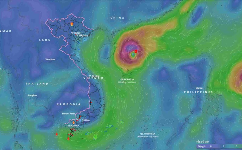
Currently, the storm with the international name Toraji is active in the sea east of Luzon Island (Philippines).
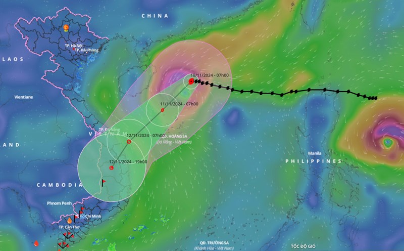
At 7:00 a.m. on November 10, the center of storm Toraji was at about 15.1 degrees north latitude; 126.9 degrees east longitude, in the sea northeast of Luzon Island. The strongest wind near the center of the storm was level 10 (89 - 102 km/h), gusting to level 12. Moving west-northwest at a speed of 15 - 20 km/h.
In the next 24 hours, the storm is forecast to move west-northwest at a speed of about 20km/h. At 7:00 a.m. on November 11, the center of the storm was at about 16.4 degrees north latitude - 122.8 degrees east longitude; in the sea east of Luzon Island (Philippines).
The strongest wind near the storm center is level 12, gusting to level 15.
It is forecasted that in the next 48 hours, the storm will move west-northwest at a speed of about 20km/h into the East Sea and gradually weaken. At 7:00 a.m. on November 12, the center of the storm will be at about 18.4 degrees north latitude - 118.8 degrees east longitude; in the eastern sea area of the North East Sea.
The strongest wind near the storm center is level 9, gusting to level 11.
It is forecasted that in the next 72 hours, the storm will move west-northwest at a speed of about 15km/h into the East Sea and gradually weaken. At 7:00 a.m. on November 13, the center of the storm will be at about 19.5 degrees north latitude - 116.1 degrees east longitude; in the North East Sea, about 500km east of Hainan Island (China).
The strongest wind near the storm center is level 9, gusting to level 11.
From the next 72 to 120 hours, the storm will move west-northwest and then possibly change direction to west-southwest, traveling 10-15km per hour, and its intensity will continue to weaken.
At sea, from the night of November 10, the sea area east of the North East Sea will have strong winds of level 6 - 7, near the storm's eye level 8 - 9, gusting to level 11, waves 2 - 4m high, near the eye 4 - 6m; very rough seas.
Ships operating in the above mentioned dangerous areas are likely to be affected by storms, whirlwinds, strong winds and large waves.


