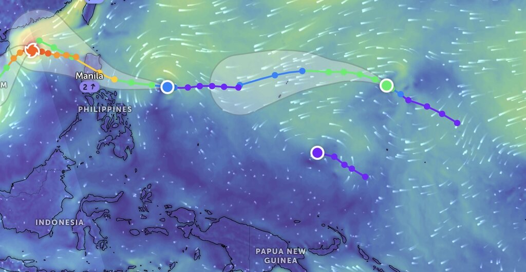
On the afternoon of November 9, the Japan Meteorological Agency (JMA) upgraded two tropical depressions in the western Pacific basin to storms Toraji and Man-yi.
Thus, together with Typhoon Yinxing currently active in the East Sea, this is the first time in 66 years that there are 3 typhoons active simultaneously in the western Pacific basin in November and the 3rd time that there are 3 typhoons active simultaneously since data recording began in 1951.
Typhoon Toraji (Philippine name Nika) and Typhoon Man-yi are the 23rd and 24th typhoons in the western Pacific basin during the 2024 typhoon season.
Typhoon Toraji, contributed by North Korea, refers to the bellflower. Meanwhile, Typhoon Man-yi, contributed by Hong Kong (China), refers to the High Island Reservoir (or Man-yi Lake) in the Sai Kung Peninsula, New Territories of Hong Kong (China).
According to the latest storm information released by the Philippine weather agency PAGASA at 5:00 p.m. on November 9, the tropical depression closest to the Philippines has strengthened into Typhoon Toraji. The center of the storm is 1,005 km southeast of Luzon, Philippines.
The latest storm near the South China Sea is moving west at 35 km/h, with maximum sustained winds of 65 km/h near the center and gusts of up to 80 km/h. Typhoon Toraji is forecast to move west-northwest throughout the forecast period.
PAGASA forecasters said that Typhoon Toraji could make landfall in Isabela or Aurora, Philippines in the afternoon or evening of November 11. The storm is forecast to intensify further upon landfall and weaken after sweeping across Luzon, Philippines.

The latest storm information from the US Navy's Joint Typhoon Warning Center (JTWC) is that Typhoon Man-yi is located 1,420 km east of Tinian Island and has been moving northwest at a speed of 24 km/h over the past 6 hours.
Typhoon Man-yi is forecast to move northwest over the next 36 hours. As the storm near the Philippines continues to strengthen, reaching a peak intensity of 95 km/h in about 36 hours, a weather system will emerge that will push Typhoon Man-yi further west.
In addition to Typhoons Toraji and Man-yi, the JTWC is also monitoring Tropical Depression Invest 94W in the western Pacific basin. Invest 94W is likely to intensify into a tropical storm in the next 24 hours. Maximum sustained winds over the surface of this depression are around 25-35 km/h. Forecast models agree that Low Pressure Invest 94W will gradually consolidate as it moves west-northwest over the next 1 to 2 days.


