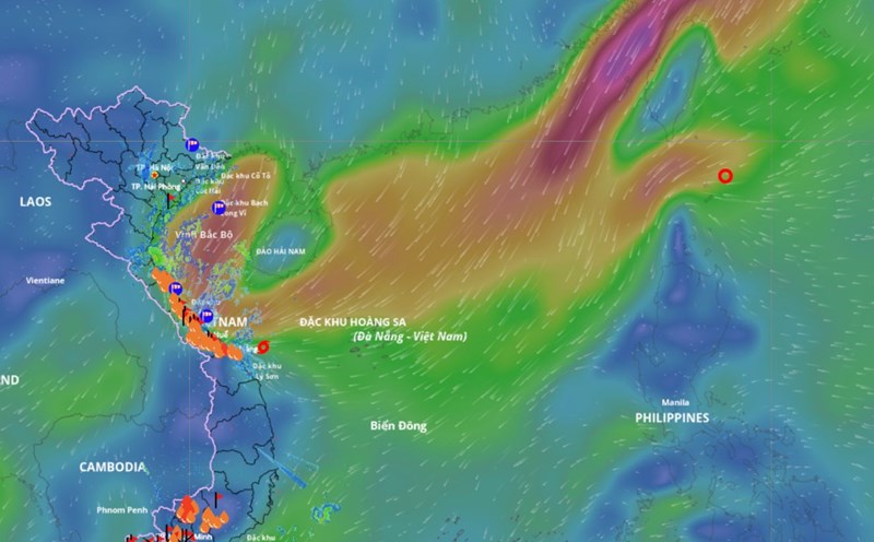
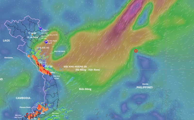
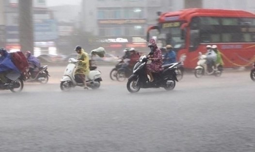
According to the National Center for Hydro-Meteorological Forecasting, early this morning (October 23), after entering the coastal waters of Hue City - Da Nang, the tropical depression (weakened from storm No. 12) has weakened into a low pressure area.
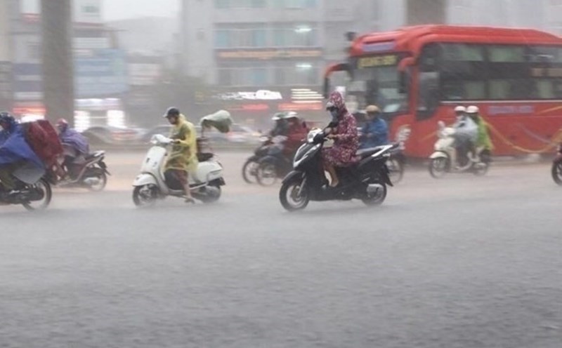
Heavy rain in the Central region may last until the end of October
At 7:00 a.m. on October 23, the center of the low pressure area was at about 16.1 degrees north latitude; 108.5 degrees east longitude. The strongest wind in the center of the low pressure area decreased to below level 6.
It is forecasted that in the next 12 hours, the low pressure area will continue to move mainly southwest, weakening and gradually dissipating. Due to the influence of the strengthening cold air combined with the disturbance of the easterly wind and the circulation after the storm, the situation of heavy rain in the Central region and strong winds at sea is still complicated.
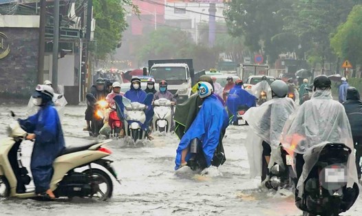
From the morning of October 23 to the night of October 24, the area from Ha Tinh to Quang Ngai will have heavy rain and thunderstorms with common rainfall of 100 - 200mm, locally very heavy rain over 300mm. In particular, the area from South Quang Tri to Da Nang will have heavy to very heavy rain with common rainfall of 200 - 350mm, locally over 700mm. Warning of the risk of heavy rain over 150mm in 3 hours.
Lam Dong and the South during the day and night of October 23 are forecast to have scattered showers and thunderstorms with rainfall of 15 - 30mm, locally heavy rain over 80mm. During thunderstorms, there is a possibility of tornadoes, lightning, hail and strong gusts of wind. Warning of the risk of heavy rain over 60mm in 3 hours.
In the next 48-72 hours, the area from Ha Tinh to Quang Ngai will have moderate rain, heavy rain and thunderstorms, locally very heavy rain with common rainfall of 40 - 80mm, locally over 150mm. Heavy rain in this area is likely to last until the end of October 2025.
The warning level of natural disaster risk due to heavy rain, tornadoes, lightning, and hail is level 1; the area from South Quang Tri to Da Nang is level 2.
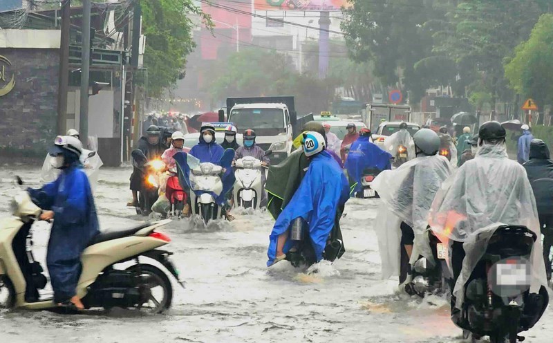
Heavy rain is likely to cause flooding in low-lying areas, urban areas, industrial parks; flash floods on small rivers and streams; landslides on steep slopes.
Real-time warning information for areas at risk of flash floods and landslides is provided online on the website of the Department of Hydrometeorology at https://luquetsatlo.nchmf.gov.vn and in a separate bulletin warning of flash floods and landslides. During thunderstorms, there is a possibility of tornadoes, lightning, hail and strong gusts of wind.
Warning of flood risk on rivers from Quang Tri to Quang Ngai
Regarding the hydrological situation, the water level on rivers from Quang Tri to Quang Ngai is fluctuating. At 7:00 a.m. on October 23, 2025, the water level on some rivers was measured as follows: on the Bo River at Phu Oc station was 2.13 m, 0.63 m higher than alert level 1; on the Huong River at Kim Long station was 1.63 m, 0.37 m lower than alert level 2; on the Kien Giang River at Le Thuy station was 1.72 m, 0.48 m lower than alert level 2.
From this evening (October 23) to October 28, 2025, there is a possibility of a flood on the rivers from Quang Tri to Quang Ngai. During this flood, the peak water level on Kien Giang River, Thach Han River (Quang Tri), Bo River, Huong River (Hue City) and small rivers may rise to alert level 2 to alert level 3; Gianh River (Quang Binh), Vu Gia - Thu Bon River (Da Nang City), Tra Khuc River and Ve River (Quang Ngai) are likely to rise above alert level 1 to alert level 2, some places exceeding alert level 2.
There is a high risk of widespread flooding in the provinces from Quang Tri to Quang Ngai; at the same time, flash floods and landslides may occur on steep slopes in this area.
The warning level of natural disaster risk due to floods is level 2. Floods on rivers and streams can cause flooding in low-lying areas along rivers, affecting waterway transportation, aquaculture, agricultural production, people's lives and socio-economic activities.