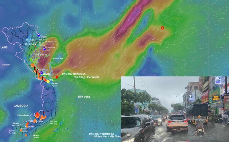
According to the National Center for Hydro-Meteorological Forecasting, at 7:00 a.m. on October 23, the center of the tropical depression was at about 20.4 degrees north latitude - 121.4 degrees east longitude. The strongest wind near the center of the tropical depression is level 7 (50 - 61 km/h), gusting to level 9. The tropical depression is moving southwest at a speed of about 20 km/h.
It is forecasted that in the next 24 hours, the tropical depression will move south-southwest at a speed of about 20 km/h. At 7:00 a.m. on October 24, the center was at about 17.7 degrees north latitude - 117.9 degrees east longitude, in the eastern sea of the northern East Sea. Strong wind level 6, gust level 8.
The dangerous area in the East Sea is an area from 17.30.5 degrees north latitude; east of the longitude 116.5 degrees east longitude. The natural disaster risk level is level 3 for the eastern sea area of the northern East Sea.
It is forecasted that in the next 48 hours, the tropical depression will continue to move southwest, at a speed of about 20 km/h and gradually weaken. At 7:00 a.m. on October 25, the center of the low pressure area was at about 15.5 degrees north latitude - 114.1 degrees east longitude, about 250 km east of Hoang Sa Special Zone. The intensity decreases below level 6.
The danger zone is from 14-19.5 degrees north latitude; 113.5-111.5 degrees east longitude. Level 3 natural disaster risk for the southern sea area of the northern East Sea.
Due to the impact of the tropical depression combined with the strengthening of cold air, the sea area east of the northern East Sea will have strong winds of level 6 - 7, gusts of level 9, waves 3 - 5 m high, and rough seas. Ships operating in the danger zone need to proactively prevent thunderstorms, whirlwinds, strong winds and dangerous large waves.