According to data from the National Center for Hydro-Meteorological Forecasting, last night and this morning (October 15), the provinces of Cao Bang, Ha Giang, Bac Can, Tuyen Quang, Lang Son, Thai Nguyen and from Quang Tri to Binh Dinh had scattered showers and thunderstorms, with some places having heavy rain.
Rainfall from 7pm on October 14 to 8am on October 15 was over 60mm in some places such as: Xuan Lap (Tuyen Quang) 114.8mm, Quy Ky (Thai Nguyen) 63.6mm, Nui Thanh (Quang Nam) 90.6mm, Binh Son (Quang Ngai) 100mm,...
In the bulletin issued at 9:05 a.m.
on October 15 from the National Center for Hydro-Meteorological Forecasting, through monitoring on satellite images and weather radar images, it is shown that convective clouds are developing, causing rain in the areas of Nam Tu Liem, Thanh Xuan, Ha Dong, Thanh Tri, Thanh Oai.In the Hanoi area, from now until 12 o'clock, the convective clouds will cause showers and possibly thunderstorms in the above area and will continue to expand to other districts in the city center.During thunderstorms, there is a possibility of tornadoes, lightning and strong gusts of wind.
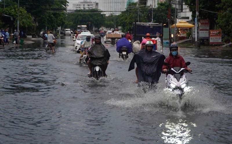
In the area from Ha Tinh to Binh Thuan, the Central Highlands and the South, in the afternoon and night of October 15, there is forecast to be rain, moderate rain and scattered thunderstorms, locally heavy to very heavy rain with rainfall from 20 - 40mm, locally over 100mm. Warning of the risk of local heavy rain (rainfall greater than 100mm within 6 hours).
In the Northwestern mountainous region and the provinces of Cao Bang, Ha Giang, Bac Can, Tuyen Quang, Lang Son, Thai Nguyen in the North, in the evening and night of October 15, there is forecast to be scattered showers and thunderstorms, locally heavy rain with rainfall from 10 - 30mm, locally over 70mm.
The Meteorological Agency warns that thunderstorms may cause tornadoes, lightning and strong gusts of wind. Localized heavy rains may cause flooding in low-lying areas; flash floods in small rivers and streams; and landslides on steep slopes.