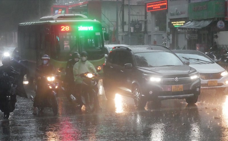
On the afternoon of October 17, in Ho Chi Minh City, monitoring satellite cloud images, weather radar images and lightning positioning showed that the thunderstorm area was developing and causing rain with thunderstorms and lightning in the Binh Chanh area, Cu Chi district.
In the next 0 - 3 hours, thunderstorms will continue to develop, causing showers, accompanied by thunderstorms and lightning for the above districts, then expanding to other neighboring areas.
Rainfall is generally from 5-15mm, some places over 15mm. During thunderstorms, beware of tornadoes, hail and strong gusts of wind around level 5-7 (8-17m/s), heavy rain causing localized flooding.
The thunderstorms are caused by the weakening of the continental cold high pressure. The equatorial low pressure trough has an axis over the Southern region. The high-altitude easterly wind disturbance has a positive impact on the weather in the Southern region.
Weather forecast for the next 24-48 hours, the continental cold high pressure will weaken slowly. The equatorial low pressure trough has an axis over the South with little change in intensity. The subtropical high pressure has an axis over the North Central region. The upper easterly wind disturbance will remain over the South.
From 72 hours to the 10th day, the continental cold high pressure will strengthen again in the North of our country, then around October 22-23, it will be strengthened.
The equatorial low pressure trough with its axis over the Southern region remains active. Above, the subtropical high pressure with its axis over the North Central region tends to encroach on the West. The easterly wind disturbance above operates well and remains over the Southern region.
From the evening of October 17 to October 18, in the Southern region, there will be rain, moderate rain and scattered thunderstorms, locally heavy to very heavy rain with rainfall from 20-40mm, locally over 80mm (rain concentrated in the afternoon and evening); warning of the risk of local heavy rain (over 80mm/6 hours).
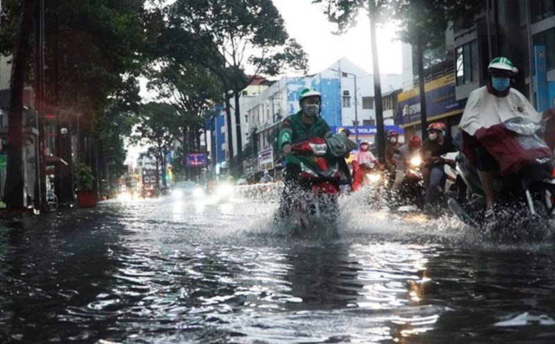
Regarding high tides, water levels at stations downstream of the Saigon - Dong Nai River will continue to rise in the next 2-3 days, then fall again. The highest peak tide is likely to occur on October 18-19 (ie September 16-17 of the lunar calendar).
This is the highest tide of the year, we need to be on guard against heavy rain combined with high tide causing flooding in low-lying areas, riverside areas affecting traffic and socio-economic activities in the Ho Chi Minh City area.