
Today, September 17, Hanoi city is cloudy, with heavy to very heavy rain and thunderstorms.
According to the Northern Hydrometeorological Station, rainfall from 1:00 PM on September 16th to 1:00 PM on September 17th was commonly from 100 - 200mm, some places were larger such as Hoai Duc 251.8mm; Cau Dien 220mm; Me Tri 215.9mm; Dap Day 214.4mm.
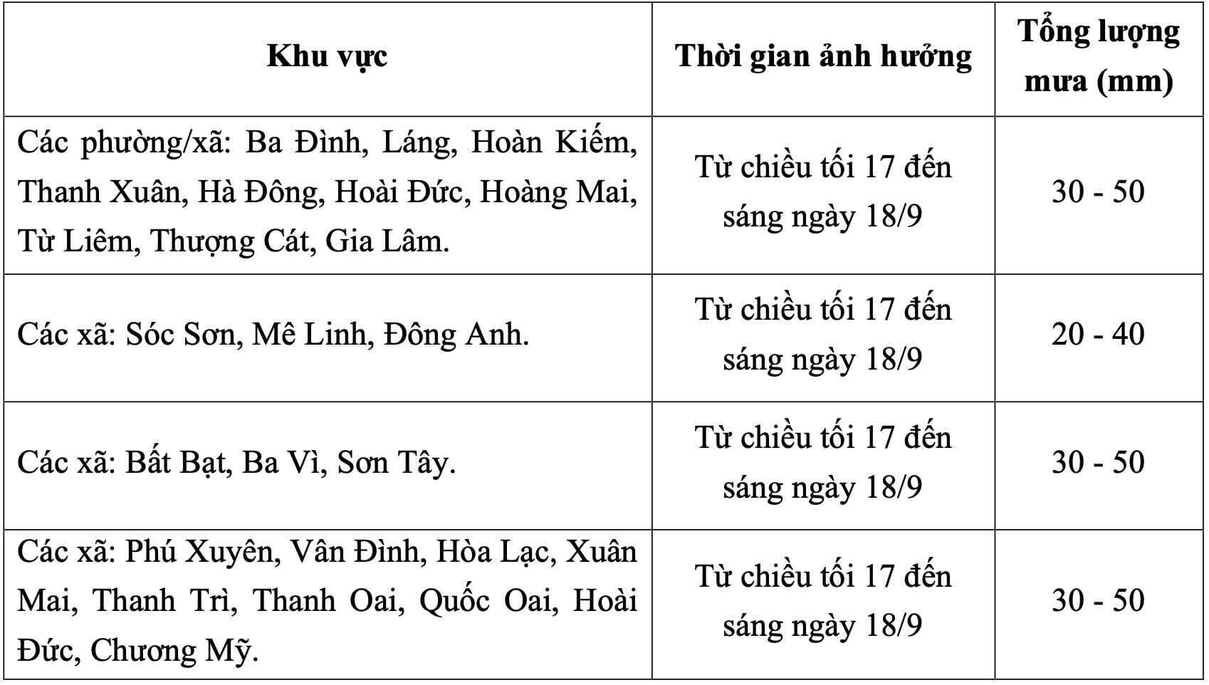
Due to the influence of wind convergence from the ground up to 5000m in the Northern region operating weakly, from this evening to the morning of September 18, Hanoi city will have moderate rain, heavy rain and scattered thunderstorms. Common rainfall from 20 - 50mm, in some places over 80mm.
Wards/communes such as Ba Dinh, Lang, Hoan Kiem, Thanh Xuan, Ha Dong, Hoai Duc, Hoang Mai, Tu Liem, Thuong Cat, Gia Lam, Bat Bat, Ba Vi, Son Tay, Phu Xuyen, Van Dinh, Hoa Lac, Xuan Mai, Thanh Tri, Thanh Oai, Quoc Oai, Chuong My have common rainfall of 30 - 50mm.
Soc Son, Me Linh, and Dong Anh communes have common rainfall of 20 - 40mm.
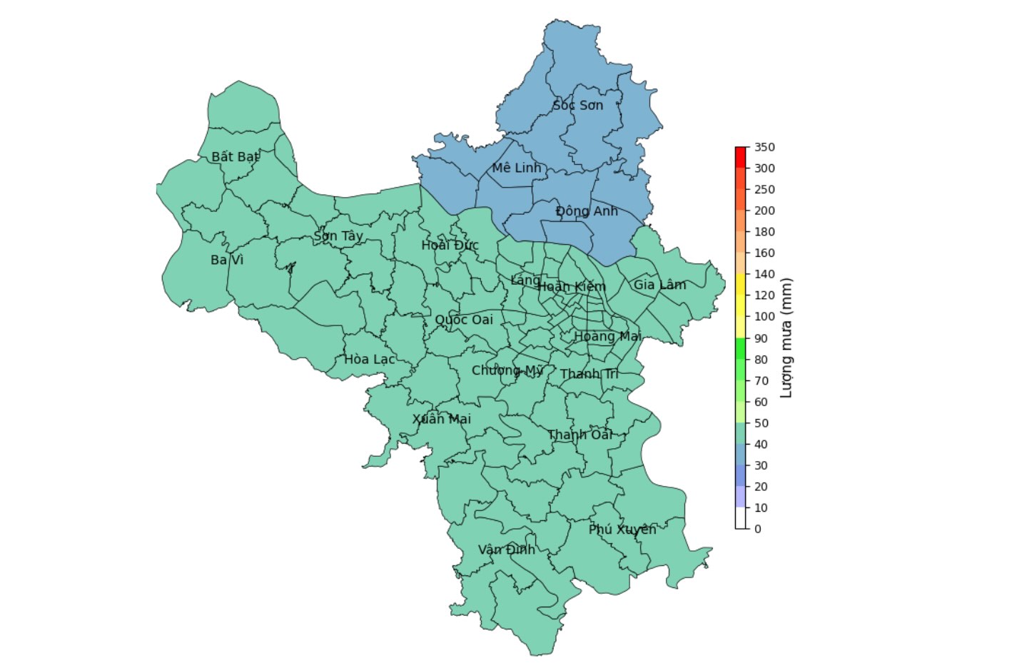
Rainfall forecast map from the evening of September 17 to the morning of September 18.
From the morning of September 18 to the evening of September 19, there will be rain, locally moderate rain, heavy rain, common rainfall from 15 - 30mm, in some places over 50mm.
Night of September 19 - September 20, Hanoi city has showers and thunderstorms in some places.
Warning level of natural disaster risk due to heavy rain is level 1. In thunderstorms, there may be tornadoes, lightning and strong gusts of wind that break down trees, damage houses, traffic works and infrastructure.
Heavy rain in a short period of time can overload the urban drainage system, causing flooding in residential areas, urban areas, low-lying areas, traffic jams due to road flooding and reduced visibility when driving, causing slipperiness and traffic accidents; there is a risk of landslides in mountainous areas.


