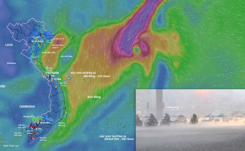
The latest update from the National Center for Hydro-Meteorological Forecasting, at 1:00 p.m. on October 18, the center of storm Fengshen was at about 13.2 degrees north latitude; 125.2 degrees east longitude, in the sea east of the central Philippines, about 480 km southeast of Luzon Island. The strongest wind near the storm center is level 8 (62-74 km/h), gusting to level 10. The storm is moving west-northwest at a speed of about 20 km/h.
It is forecasted that in the next 24 hours, the storm will move west-northwest at a speed of about 20 km/h and is likely to strengthen.
It is forecasted that around tomorrow morning (October 19), Typhoon Fengshen will make landfall in the Luzon Island area (Philippines).
At 1:00 p.m. on October 19, the center of the storm was at about 15.9 degrees north latitude; 121.2 degrees east longitude, in the area east of Luzon Island (Philippines). Strong wind level 8-9, gust level 11.
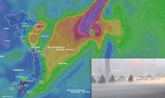
It is forecasted that in the next 48 hours, the storm will move west-northwest at a speed of 20-25 km/h and is likely to strengthen. At 1:00 p.m. on October 20, the center of the storm was at about 18.3 degrees north latitude; 117.3 degrees east longitude, in the eastern sea of the northern East Sea, about 550 km east-northeast of the Hoang Sa special zone. Strong winds of level 9-10, gusting to level 13.
The danger zone during this period is the area from latitude 15.5 degrees north to 20.5 degrees north; east of longitude 115.5 degrees east. The natural disaster risk level is level 3 for the eastern sea area of the northern East Sea.
It is forecasted that in the next 72 hours, the storm will continue to move west-northwest at a speed of about 15 km/h and is likely to strengthen. At 1:00 p.m. on October 21, the center of the storm was at about 18.8 degrees north latitude; 114.3 degrees east longitude, in the northern East Sea, about 330 km northeast of the Hoang Sa special zone. Strong wind level 11, gust level 13.
The danger zone during this period is the area from latitude 16.5 degrees north to 20.5 degrees north; east of longitude 112.5 degrees east. Natural disaster risk level 3 for the northern East Sea area.
In the next 72 to 120 hours, the storm will move mainly southwest, traveling about 10 km per hour, stable intensity and then tend to weaken gradually.
Regarding the impact of the storm, from October 19, the sea area east of the northern East Sea will have winds gradually increasing to level 6-7; the area near the storm's eye will have strong winds of level 8-9, gusting to level 11. The waves are 2.5-5 m high, the sea is very rough.
Around October 20-22, the northern East Sea area (including Hoang Sa special zone) is likely to be affected by strong winds of level 10-11, gusting to level 13. Ship operating in the above-mentioned dangerous areas are likely to be affected by thunderstorms, whirlwinds, strong winds and large waves.