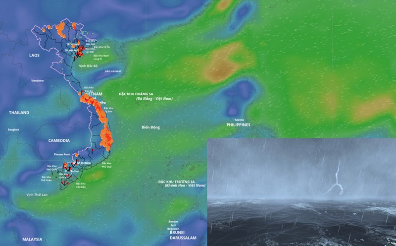
According to the National Center for Hydro-Meteorological Forecasting, currently, the sea area from Quang Tri to Ca Mau and the Gulf of Thailand has scattered showers and thunderstorms.
Forecast for the day and night of October 17, the sea area from Quang Tri to Ca Mau, from Ca Mau to An Giang, the Gulf of Thailand, the South East Sea area (including Truong Sa special zone) will have scattered showers and thunderstorms. During thunderstorms, there is a possibility of tornadoes, strong gusts of wind of level 6 - 7 and waves over 2m high. All ships operating in the above areas are at risk of being affected by tornadoes and strong gusts of wind.

According to Mr. Mai Van Khiem - Director of the National Center for Hydro-Meteorological Forecasting, Department of Hydro-Meteorology, there is currently a newly formed tropical depression in the eastern sea of the Philippines.
"This tropical depression is forecast to strengthen into a storm with a probability of about 70 - 80%; it is likely to move into the northeastern area of the northern part of the East Sea around October 19 - 20" - Mr. Khiem said.
The representative of the meteorological agency also warned that due to the influence of the tropical depression, which is likely to strengthen into a storm, from the afternoon of October 18 in the North and Central East Sea (including the special area of Hoang Sa), the wind will gradually strengthen, the sea will be rough.
"When the storm moves into the East Sea, there will be a cold air mass moving down from the north, so there is a possibility that the storm will weaken at sea" - Mr. Khiem commented.
Previously, the National Center for Hydro-Meteorological Forecasting had issued a forecast of notable weather trends within one month (from October 11 to November 10).
In the next month, the most notable weather patterns will still be storms/tropical depressions and storm rain.
According to Ms. Tran Thi Chuc - Deputy Head of Climate Forecasting Department, National Center for Hydro-Meteorological Forecasting, according to the average data of many years in the above period, there were 1.8 storms or tropical depressions in the East Sea, 0.8 of which made landfall in Vietnam.
In the period from October 11, 2025 to November 10, 2025, it is forecasted that there will be 2 - 3 storms or tropical depressions in the East Sea and there will be 1 - 2 storms affecting the mainland of Vietnam.
Previously, from September 11 to October 10, there were 4 storms in the East Sea, including storm No. 8 Mitag, storm No. 9 Ragasa, storm No. 10 Bualoi and storm No. 11 Matmo. Of which, storms No. 9, No. 10 and No. 11 have directly affected our country.
From the beginning of 2025 to now, the East Sea has had 15 storms and tropical depressions (11 storms, 4 tropical depressions), much higher than the average of many years. 6 storms (storm No. 1, 3, 5, 6, 9, 10, 11) directly and indirectly affected our country, creating a series of rapid natural disasters, with little to no long enough rest to overcome the consequences.