The two consecutive storms of storm No. 10 Bualoi and storm No. 11 Matmo have caused huge damage. Information about the upcoming storm No. 12 is being awaited by the people to promptly develop a response plan.
This afternoon, October 17, Lao Dong Newspaper reporters had an interview with Mr. Nguyen Van Huong - Head of Weather Forecast Department, National Center for Hydro-Meteorological Forecasting regarding early comments on this storm.
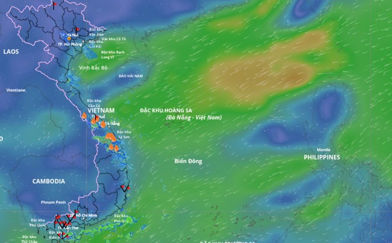
Sir, when is the East Sea expected to officially welcome storm No. 12 in 2025?
- This afternoon, there is a tropical depression active in the eastern area of the Philippines. The location is at about 13.5 degrees north latitude 131.4 degrees east longitude. It is forecasted that in the next 24 hours, this tropical depression is likely to strengthen into a storm. We believe that around October 19, this storm will cross the Luzon Island (Philippines) and enter the East Sea and will become the 12th storm of the year.

Early assessment of the intensity of storm No. 12 as strong as the recent storm No. 10 Bualoi and storm No. 11 Matmo, sir?
- Regarding the scenario of storm No. 12, we believe that when entering the East Sea, there will be interaction with cold air, so the intensity is unlikely to be as strong as the recent storms No. 10 Bualoi and No. 11 Matmo.
Is it forecasted that storm No. 12 will make landfall in Vietnam, sir?
- Currently, it is still a tropical depression near the East Sea and is expected to enter the East Sea around October 19. At this time, cold air from the north will come down at the same time. The cold waves moved continuously on October 19, October 20, and October 21, causing many fluctuations in the direction of movement as well as the intensity of storm No. 12. It is not yet possible to confirm whether storm No. 12 is likely to make landfall directly in Vietnam.
However, it is currently estimated that the interaction of the storm circulation may weaken and the cold air will cause widespread moderate and heavy rain in the Central provinces in the coming days.
Sincerely thank you!
The National Center for Hydro-Meteorological Forecasting has issued a forecast of notable weather trends for one month (from October 11 to November 10).
In the next month, the most notable weather patterns will still be storms/tropical depressions and storm rain.
According to the average data of many years in the above period, there will be 1.8 storms or tropical depressions in the East Sea, 0.8 of which will make landfall in Vietnam.
In the period from October 11, 2025 to November 10, 2025, it is forecasted that there will be 2 - 3 storms or tropical depressions in the East Sea and there will be 1 - 2 storms affecting the mainland of Vietnam.
Previously, from September 11 to October 10, there were 4 storms in the East Sea, including storm No. 8 Mitag, storm No. 9 Ragasa, storm No. 10 Bualoi and storm No. 11 Matmo. Of which, storms No. 9, No. 10 and No. 11 have directly affected our country.
From the beginning of 2025 to now, the East Sea has had 15 storms and tropical depressions (11 storms, 4 tropical depressions), much higher than the average of many years. 6 storms (storm No. 1, 3, 5, 6, 9, 10, 11) directly and indirectly affected our country, creating a series of rapid natural disasters, with little to no long enough rest to overcome the consequences.